 |
|
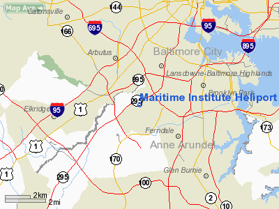
Maritime Institute Heliport |
Location & QuickFacts
| FAA Information Effective: | 2008-09-25 |
| Airport Identifier: | 2MD7 |
| Airport Status: | Operational |
| Longitude/Latitude: | 076-40-18.8860W/39-12-40.3860N
-76.671913/39.211218 (Estimated) |
| Elevation: | 170 ft / 51.82 m (Surveyed) |
| Land: | 0 acres |
| From nearest city: | 0 nautical miles SW of Linthicum Heights, MD |
| Location: | Anne Arundel County, MD |
| Magnetic Variation: | 10W (1985) |
Owner & Manager
| Ownership: | Privately owned |
| Owner: | Maritime Inst Of Technology |
| Address: | 5700 Hammonds Ferry Road
Linthicum Heights, MD 21090 |
| Phone number: | 410-859-5700 |
| Manager: | Capt Charles R Pillsbury |
| Address: | 5700 Hammonds Ferry Road
Linthicum Heights, MD 21090 |
| Phone number: | 410-859-5700 |
Airport Operations and Facilities
| Airport Use: | Private |
| Wind indicator: | Yes |
| Segmented Circle: | No |
| Control Tower: | No |
| Landing fee charge: | No |
| Sectional chart: | Washington |
| Region: | AEA - Eastern |
| Boundary ARTCC: | ZDC - Washington |
| Tie-in FSS: | DCA - Leesburg |
| FSS on Airport: | No |
| FSS Toll Free: | 1-800-WX-BRIEF |
Runway Information
Helipad H1
| Dimension: | 90 x 70 ft / 27.4 x 21.3 m |
| Surface: | ASPH, |
| |
Runway H1 |
Runway |
| Traffic Pattern: | Left | Left |
|
Radio Navigation Aids
| ID |
Type |
Name |
Ch |
Freq |
Var |
Dist |
| IUB | NDB | Institute | | 404.00 | 08W | 5.0 nm |
| FND | NDB | Ellicott | | 371.00 | 11W | 6.7 nm |
| BUH | NDB | Anne Arundel | | 260.00 | 10W | 8.7 nm |
| MTN | NDB | Martin | | 342.00 | 11W | 14.6 nm |
| GAI | NDB | Gaithersburg | | 385.00 | 09W | 23.1 nm |
| GTN | NDB | Georgetown | | 323.00 | 09W | 27.0 nm |
| VKX | NDB | Potomac | | 241.00 | 10W | 30.8 nm |
| DC | NDB | Oxonn | | 332.00 | 11W | 31.5 nm |
| APG | NDB | Aberdeen | | 349.00 | 11W | 32.7 nm |
| ESN | NDB | Easton | | 212.00 | 10W | 37.3 nm |
| EUD | NDB | York | | 254.00 | 11W | 43.7 nm |
| MTN | TACAN | Martin | 068X | | 11W | 14.1 nm |
| FDK | VOR | Frederick | | 109.00 | 08W | 34.9 nm |
| DCA | VOR/DME | Washington | 047X | 111.00 | 09W | 27.1 nm |
| PPM | VOR/DME | Phillips | 021X | 108.40 | 09W | 27.9 nm |
| BAL | VORTAC | Baltimore | 098X | 115.10 | 11W | 2.5 nm |
| EMI | VORTAC | Westminster | 126X | 117.90 | 08W | 22.2 nm |
| ADW | VORTAC | Andrews | 078X | 113.10 | 10W | 25.9 nm |
| OTT | VORTAC | Nottingham | 084X | 113.70 | 10W | 30.6 nm |
| AML | VORTAC | Armel | 082X | 113.50 | 08W | 40.6 nm |
| ADW | VOT | Andrews Afb | | 109.60 | | 27.2 nm |
| DCA | VOT | Washington National | | 109.40 | | 27.7 nm |
Remarks
- PROVIDED TREES N &S ARE REMOVED; LETTER OF AGREEMENT WITH BWI ATCT BEFORE STARTING OPERATIONS; 4 LIGHTING STANDARDS BE LOWERED; PARKING AREA TO BE LIGHTED; COORDINATE WITH FD FOR COVERAGE.
Images and information placed above are from
http://www.airport-data.com/airport/2MD7/
We thank them for the data!
| General Info
|
| Country |
United States
|
| State |
MARYLAND
|
| FAA ID |
2MD7
|
| Latitude |
39-12-40.386N
|
| Longitude |
076-40-18.886W
|
| Elevation |
170 feet
|
| Near City |
LINTHICUM HEIGHTS
|
We don't guarantee the information is fresh and accurate. The data may
be wrong or outdated.
For more up-to-date information please refer to other sources.
|
|


