 |
|
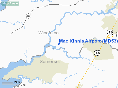
Location & QuickFacts
| FAA Information Effective: | 2008-09-25 |
| Airport Identifier: | MD53 |
| Airport Status: | Operational |
| Longitude/Latitude: | 075-44-21.7430W/38-17-19.4340N
-75.739373/38.288732 (Estimated) |
| Elevation: | 10 ft / 3.05 m (Estimated) |
| Land: | 20 acres |
| From nearest city: | 9 nautical miles SW of Salisbury, MD |
| Location: | Wicomico County, MD |
| Magnetic Variation: | 10W (1985) |
Owner & Manager
| Ownership: | Privately owned |
| Owner: | F.r. Mac Kinnis |
| Address: | 25357 Collins Wharf Rd
Eden, MD 21822 |
| Phone number: | 410-860-5019 |
| Manager: | F.r. Mac Kinnis |
| Address: | 25357 Collins Wharf Rd
Eden, MD 21822 |
| Phone number: | 410-860-5019 |
Airport Operations and Facilities
| Airport Use: | Private |
| Wind indicator: | Yes |
| Segmented Circle: | No |
| Control Tower: | No |
| Sectional chart: | Washington |
| Region: | AEA - Eastern |
| Boundary ARTCC: | ZDC - Washington |
| Tie-in FSS: | DCA - Leesburg |
| FSS on Airport: | No |
| FSS Toll Free: | 1-800-WX-BRIEF |
Runway Information
Runway 03/21
| Dimension: | 2400 x 100 ft / 731.5 x 30.5 m |
| Surface: | TURF, |
| |
Runway 03 |
Runway 21 |
| Traffic Pattern: | Left | Left |
|
Radio Navigation Aids
| ID |
Type |
Name |
Ch |
Freq |
Var |
Dist |
| CGE | NDB | Cambridge | | 355.00 | 10W | 20.4 nm |
| OX | NDB | Landy | | 407.00 | 12W | 25.9 nm |
| NHK | NDB | Patuxent | | 400.00 | 10W | 31.3 nm |
| ESN | NDB | Easton | | 212.00 | 10W | 34.7 nm |
| BDB | NDB | Accomack | | 336.00 | 11W | 43.3 nm |
| ATR | VOR/DME | Waterloo | 073X | 112.60 | 09W | 40.0 nm |
| SBY | VORTAC | Salisbury | 049X | 111.20 | 12W | 11.3 nm |
| SWL | VORTAC | Snow Hill | 071X | 112.40 | 08W | 19.1 nm |
| PXT | VORTAC | Patuxent | 123X | 117.60 | 10W | 31.2 nm |
Remarks
- OWNER DESIRES ARPT NOT BE CHARTED.
- PRVDD VFR ONLY.
Images and information placed above are from
http://www.airport-data.com/airport/MD53/
We thank them for the data!
| General Info
|
| Country |
United States
|
| State |
MARYLAND
|
| FAA ID |
MD53
|
| Latitude |
38-17-19.434N
|
| Longitude |
075-44-21.743W
|
| Elevation |
10 feet
|
| Near City |
SALISBURY
|
We don't guarantee the information is fresh and accurate. The data may
be wrong or outdated.
For more up-to-date information please refer to other sources.
|
|


