|
|
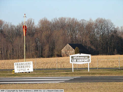
| Lee Airport |
| IATA: ANP – ICAO: KANP – FAA LID: ANP |
| Summary |
| Airport type |
Public |
| Owner |
Lee Airport Authority |
| Serves |
Annapolis, Maryland |
| Location |
Edgewater, Maryland |
| Elevation AMSL |
34 ft / 10 m |
| Coordinates |
38°56′34″N 076°34′06″W / 38.94278°N 76.56833°W / 38.94278; -76.56833 |
| Runways |
| Direction |
Length |
Surface |
| ft |
m |
| 12/30 |
2,500 |
762 |
Asphalt |
| Statistics (2009) |
| Aircraft operations |
31,638 |
| Based aircraft |
104 |
| Source: Federal Aviation Administration |
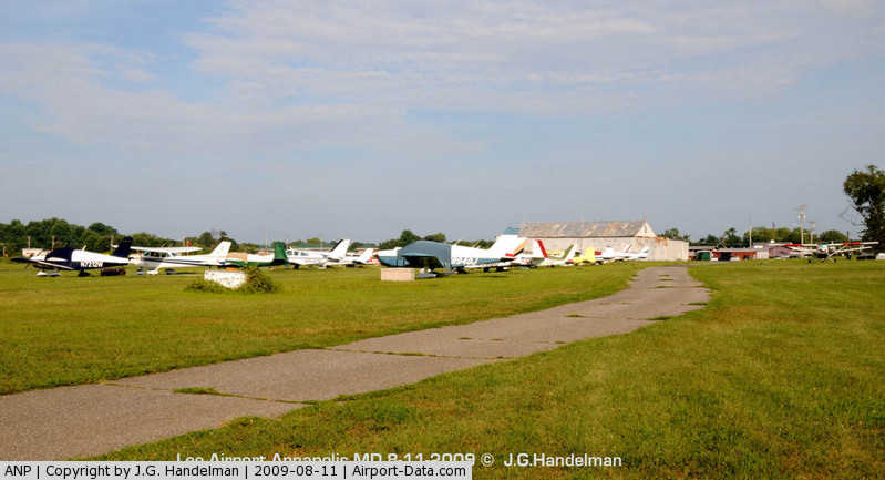
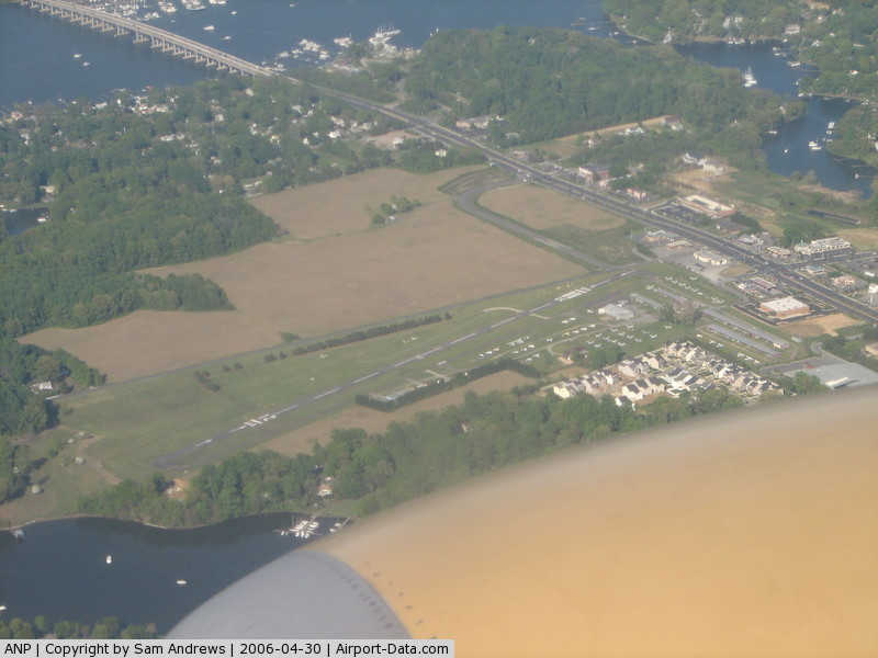
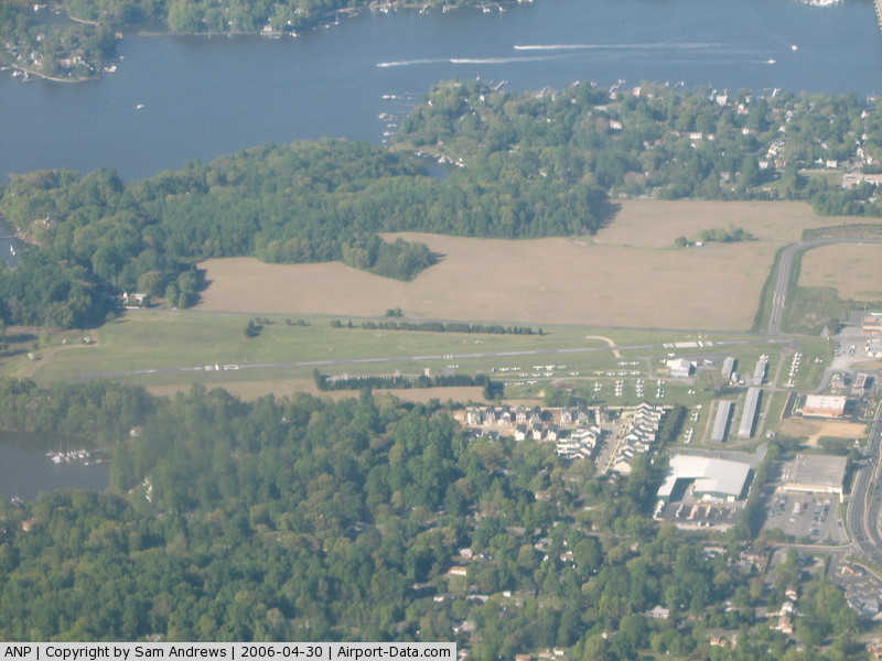
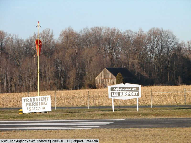
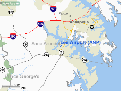
Lee Airport (IATA: ANP, ICAO: KANP, FAA LID: ANP) is a public use airport located in Anne Arundel County, Maryland, United States. The airport is five nautical miles (9 km) southwest of the central business district of Annapolis. It is privately owned by the Lee Airport Authority in Edgewater, Maryland.
Facilities and aircraft
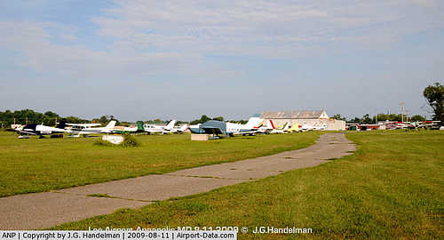
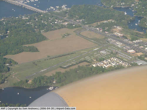
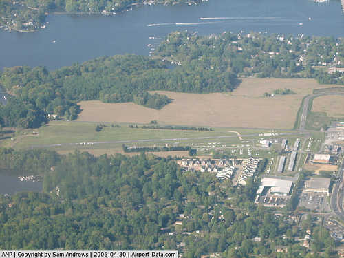
Lee Airport covers an area of 79 acres (32 ha) at an elevation of 34 feet (10 m) above mean sea level. It has one asphalt paved runway designated 12/30 which measures 2,500 by 48 feet (762 x 15 m).
For the 12-month period ending April 11, 2009, the airport had 31,638 aircraft operations, an average of 86 per day: 98% general aviation and 2% military. At that time there were 104 aircraft based at this airport: 96% single-engine, 3% multi-engine and 1% helicopter.
The above content comes from Wikipedia and is published under free licenses – click here to read more.
|
 |
(Click on the photo to enlarge) |
|
 |
(Click on the photo to enlarge) |
|
 |
(Click on the photo to enlarge) |
|
 |
(Click on the photo to enlarge) |
Location & QuickFacts
| FAA Information Effective: | 2008-09-25 |
| Airport Identifier: | ANP |
| Airport Status: | Operational |
| Longitude/Latitude: | 076-34-06.2370W/38-56-34.3600N
-76.568399/38.942878 (Estimated) |
| Elevation: | 34 ft / 10.36 m (Estimated) |
| Land: | 79 acres |
| From nearest city: | 5 nautical miles SW of Annapolis, MD |
| Location: | Anne Arundel County, MD |
| Magnetic Variation: | 10W (1985) |
Owner & Manager
| Ownership: | Privately owned |
| Owner: | Lee Airport Authority Llc
CORPORATION ESTABLISHED BY MARY C. LEE |
| Address: | 141 Maryland Ave.
Edgewater, MD 21037 |
| Phone number: | 410-956-1280 |
| Manager: | Lee Runway Manager Llc |
| Address: | P.o. Box 789
Edgewater, MD 21037 |
| Phone number: | 410-956-1280 |
Airport Operations and Facilities
| Airport Use: | Open to public |
| Wind indicator: | Yes |
| Segmented Circle: | No |
| Control Tower: | No |
| Lighting Schedule: | DUSK-2200
ACTVT LIRL RWY 12/30 - CTAF 2200-0700. |
| Beacon Color: | Clear-Green (lighted land airport) |
| Landing fee charge: | Yes |
| Sectional chart: | Washington |
| Region: | AEA - Eastern |
| Traffic Pattern Alt: | 1000 ft |
| Boundary ARTCC: | ZDC - Washington |
| Tie-in FSS: | DCA - Leesburg |
| FSS on Airport: | No |
| FSS Toll Free: | 1-800-WX-BRIEF |
| NOTAMs Facility: | DCA (NOTAM-d service avaliable) |
Airport Communications
Airport Services
| Fuel available: | 100LL |
| Airframe Repair: | MAJOR |
| Power Plant Repair: | MAJOR |
Runway Information
Runway 12/30
| Dimension: | 2500 x 48 ft / 762.0 x 14.6 m |
| Surface: | ASPH, Fair Condition
MINOR PAVEMENT CRACKS FULL LENGTH. |
| Edge Lights: | Low |
| |
Runway 12 |
Runway 30 |
| Longitude: | 076-34-21.3250W | 076-33-51.1490W |
| Latitude: | 38-56-38.0750N | 38-56-30.6440N |
| Elevation: | 31.00 ft | 31.00 ft |
| Alignment: | 108 | 127 |
| Traffic Pattern: | Left | Left |
| Markings: | Basic, Fair Condition | Non-precision instrument, Fair Condition |
| Crossing Height: | 20.00 ft | 16.00 ft |
| Displaced threshold: | 476.00 ft | 321.00 ft |
| VASI: | system of panels on left side that may or may not be lighted | system of panels on right side that may or may not be lighted |
| Visual Glide Angle: | 5.75° | 4.25° |
| Obstruction: | 53 ft trees, 248.0 ft from runway, 95 ft right of centerline
APCH SLOPE 13:1 TO DSPLCD THLD.
+6' FENCE ACROSS APCH END MARKED | 15 ft bldg, 200.0 ft from runway, 175 ft left of centerline
RY 30 HAS +50 FT TREE, 562 FT NORTHWEST, 274 FT L, 17:1 TO DSPLCD THLD.
+6' FENCE ACROSS APCH END MKD. +26' TREES 135' OUT 55' RIGHT. |
|
Radio Navigation Aids
| ID |
Type |
Name |
Ch |
Freq |
Var |
Dist |
| BUH | NDB | Anne Arundel | | 260.00 | 10W | 12.3 nm |
| IUB | NDB | Institute | | 404.00 | 08W | 20.9 nm |
| VKX | NDB | Potomac | | 241.00 | 10W | 21.6 nm |
| FND | NDB | Ellicott | | 371.00 | 11W | 22.9 nm |
| MTN | NDB | Martin | | 342.00 | 11W | 23.2 nm |
| DC | NDB | Oxonn | | 332.00 | 11W | 23.9 nm |
| ESN | NDB | Easton | | 212.00 | 10W | 24.8 nm |
| GTN | NDB | Georgetown | | 323.00 | 09W | 26.0 nm |
| GAI | NDB | Gaithersburg | | 385.00 | 09W | 31.0 nm |
| CGE | NDB | Cambridge | | 355.00 | 10W | 35.0 nm |
| NHK | NDB | Patuxent | | 400.00 | 10W | 40.2 nm |
| APG | NDB | Aberdeen | | 349.00 | 11W | 41.6 nm |
| MTN | TACAN | Martin | 068X | | 11W | 24.4 nm |
| FDK | VOR | Frederick | | 109.00 | 08W | 47.0 nm |
| DCA | VOR/DME | Washington | 047X | 111.00 | 09W | 22.5 nm |
| PPM | VOR/DME | Phillips | 021X | 108.40 | 09W | 36.5 nm |
| BAL | VORTAC | Baltimore | 098X | 115.10 | 11W | 14.4 nm |
| ADW | VORTAC | Andrews | 078X | 113.10 | 10W | 16.1 nm |
| OTT | VORTAC | Nottingham | 084X | 113.70 | 10W | 16.5 nm |
| EMI | VORTAC | Westminster | 126X | 117.90 | 08W | 38.3 nm |
| PXT | VORTAC | Patuxent | 123X | 117.60 | 10W | 40.2 nm |
| AML | VORTAC | Armel | 082X | 113.50 | 08W | 42.0 nm |
| ADW | VOT | Andrews Afb | | 109.60 | | 17.3 nm |
| DCA | VOT | Washington National | | 109.40 | | 22.5 nm |
Remarks
- NO LANDING ON GRASS. LDG FEE AFTER ONE HOUR OR OVERNIGHT.
- TOUCH & GO OPNS PROHIBITED. VASI APCHS TO BE FLOWN.
- NO TAKE-OFFS AFTER 2200 DAILY.
- EXISTED PRIOR TO 1959.
Images and information placed above are from
http://www.airport-data.com/airport/ANP/
We thank them for the data!
| General Info
|
| Country |
United States
|
| State |
MARYLAND
|
| FAA ID |
ANP
|
| Latitude |
38-56-34.360N
|
| Longitude |
076-34-06.237W
|
| Elevation |
34 feet
|
| Near City |
ANNAPOLIS
|
We don't guarantee the information is fresh and accurate. The data may
be wrong or outdated.
For more up-to-date information please refer to other sources.
|
|