 |
|
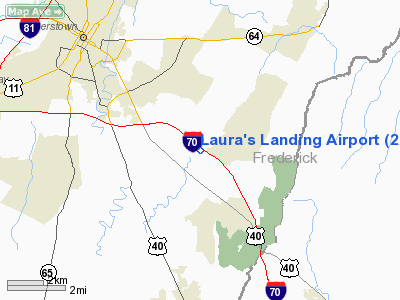
Location & QuickFacts
| FAA Information Effective: | 2008-09-25 |
| Airport Identifier: | 22MD |
| Airport Status: | Operational |
| Longitude/Latitude: | 077-38-42.0000W/39-35-13.0000N
-77.645000/39.586944 (Estimated) |
| Elevation: | 550 ft / 167.64 m (Estimated) |
| Land: | 50 acres |
| From nearest city: | 5 nautical miles E of Hagerstown, MD |
| Location: | Washington County, MD |
| Magnetic Variation: | 10W (2000) |
Owner & Manager
| Ownership: | Privately owned |
| Owner: | Neil A. Wright |
| Address: | 9779 Beaver Creek Church Rd.
Hagerstown, MD 21740 |
| Phone number: | 301-797-1337 |
| Manager: | Neil A. Wright |
| Address: | 9779 Beaver Creek Church Rd.
Hagerstown, MD 21740 |
| Phone number: | 301-797-1337 |
Airport Operations and Facilities
| Airport Use: | Private |
| Wind indicator: | Yes |
| Segmented Circle: | No |
| Control Tower: | No |
| Sectional chart: | Washington |
| Region: | AEA - Eastern |
| Boundary ARTCC: | ZDC - Washington |
| Tie-in FSS: | DCA - Leesburg |
| FSS Toll Free: | 1-800-WX-BRIEF |
Runway Information
Runway 13/31
| Dimension: | 1180 x 40 ft / 359.7 x 12.2 m |
| Surface: | TURF, |
| |
Runway 13 |
Runway 31 |
| Traffic Pattern: | Left | Left |
|
Radio Navigation Aids
| ID |
Type |
Name |
Ch |
Freq |
Var |
Dist |
| GAI | NDB | Gaithersburg | | 385.00 | 09W | 33.5 nm |
| TZ | NDB | Cogan | | 364.00 | 10W | 36.0 nm |
| GDX | NDB | Goodwin Lake | | 227.00 | 08W | 39.0 nm |
| EUD | NDB | York | | 254.00 | 11W | 40.7 nm |
| FND | NDB | Ellicott | | 371.00 | 11W | 44.1 nm |
| GTN | NDB | Georgetown | | 323.00 | 09W | 46.3 nm |
| HGR | VOR | Hagerstown | | 109.80 | 07W | 11.8 nm |
| FDK | VOR | Frederick | | 109.00 | 08W | 16.3 nm |
| MRB | VORTAC | Martinsburg | 058X | 112.10 | 07W | 15.3 nm |
| THS | VORTAC | St Thomas | 097X | 115.00 | 07W | 25.2 nm |
| EMI | VORTAC | Westminster | 126X | 117.90 | 08W | 31.4 nm |
| AML | VORTAC | Armel | 082X | 113.50 | 08W | 40.1 nm |
Remarks
- PRVDD VFR; A CLEAR 20:1 APCH PATH; AND OPERATE IN A MANNER TO MINIMIZE NOISE.
Images and information placed above are from
http://www.airport-data.com/airport/22MD/
We thank them for the data!
| General Info
|
| Country |
United States
|
| State |
MARYLAND
|
| FAA ID |
22MD
|
| Latitude |
39-35-13.000N
|
| Longitude |
077-38-42.000W
|
| Elevation |
550 feet
|
| Near City |
HAGERSTOWN
|
We don't guarantee the information is fresh and accurate. The data may
be wrong or outdated.
For more up-to-date information please refer to other sources.
|
|


