 |
|
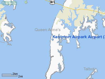
Location & QuickFacts
| FAA Information Effective: | 2008-09-25 |
| Airport Identifier: | 3W3 |
| Airport Status: | Operational |
| Longitude/Latitude: | 076-21-31.8000W/38-55-05.2000N
-76.358833/38.918111 (Estimated) |
| Elevation: | 10 ft / 3.05 m (Estimated) |
| Land: | 20 acres |
| From nearest city: | 5 nautical miles SW of Stevensville, MD |
| Location: | Queen Annes County, MD |
| Magnetic Variation: | 10W (1985) |
Owner & Manager
| Ownership: | Privately owned |
| Owner: | Kentmorr Airstrip Inc. |
| Address: | 120 Kentmorr Rd
Stevensville, MD 21666 |
| Phone number: | 410-643-1770 |
| Manager: | Mr. Jack Mccarthy |
| Address: | 114 Kentmorr Rd
Stevensville, MD 21666 |
| Phone number: | 410-643-1785 |
Airport Operations and Facilities
| Airport Use: | Open to public |
| Wind indicator: | Yes |
| Segmented Circle: | No |
| Control Tower: | No |
| Landing fee charge: | No |
| Sectional chart: | Washington |
| Region: | AEA - Eastern |
| Traffic Pattern Alt: | 990 ft |
| Boundary ARTCC: | ZDC - Washington |
| Tie-in FSS: | DCA - Leesburg |
| FSS on Airport: | No |
| FSS Toll Free: | 1-800-WX-BRIEF |
| NOTAMs Facility: | DCA (NOTAM-d service avaliable) |
Airport Communications
Airport Services
| Airframe Repair: | NONE |
| Power Plant Repair: | NONE |
| Bottled Oxygen: | NONE |
| Bulk Oxygen: | NONE |
Runway Information
Runway 10/28
| Dimension: | 2400 x 75 ft / 731.5 x 22.9 m |
| Surface: | TURF, Good Condition |
| |
Runway 10 |
Runway 28 |
| Longitude: | 076-21-47.0000W | 076-21-16.6300W |
| Latitude: | 38-55-05.2000N | 38-55-05.2000N |
| Traffic Pattern: | Left | Left |
| Displaced threshold: | 200.00 ft | 150.00 ft |
| Obstruction: | 40 ft tree, 93.0 ft from runway, 105 ft left of centerline, 2:1 slope to clear
RWY 10 APCH RATIO 7:1 TO DSPLCD THLD. | 35 ft pole, 100.0 ft from runway, 117 ft left of centerline, 2:1 slope to clear
APCH SLOPE 7:1 TO DSPLCD THLD. |
|
Radio Navigation Aids
| ID |
Type |
Name |
Ch |
Freq |
Var |
Dist |
| ESN | NDB | Easton | | 212.00 | 10W | 15.2 nm |
| BUH | NDB | Anne Arundel | | 260.00 | 10W | 21.2 nm |
| MTN | NDB | Martin | | 342.00 | 11W | 23.0 nm |
| IUB | NDB | Institute | | 404.00 | 08W | 25.4 nm |
| CGE | NDB | Cambridge | | 355.00 | 10W | 27.5 nm |
| FND | NDB | Ellicott | | 371.00 | 11W | 29.5 nm |
| VKX | NDB | Potomac | | 241.00 | 10W | 29.8 nm |
| DC | NDB | Oxonn | | 332.00 | 11W | 32.6 nm |
| GTN | NDB | Georgetown | | 323.00 | 09W | 35.8 nm |
| NHK | NDB | Patuxent | | 400.00 | 10W | 38.1 nm |
| APG | NDB | Aberdeen | | 349.00 | 11W | 38.9 nm |
| GAI | NDB | Gaithersburg | | 385.00 | 09W | 40.6 nm |
| MTN | TACAN | Martin | 068X | | 11W | 24.9 nm |
| DOV | TACAN | Dover | 037X | | 09W | 43.6 nm |
| DCA | VOR/DME | Washington | 047X | 111.00 | 09W | 31.9 nm |
| PPM | VOR/DME | Phillips | 021X | 108.40 | 09W | 34.1 nm |
| BAL | VORTAC | Baltimore | 098X | 115.10 | 11W | 20.7 nm |
| OTT | VORTAC | Nottingham | 084X | 113.70 | 10W | 22.1 nm |
| ADW | VORTAC | Andrews | 078X | 113.10 | 10W | 24.7 nm |
| PXT | VORTAC | Patuxent | 123X | 117.60 | 10W | 37.9 nm |
| ENO | VORTAC | Smyrna | 051X | 111.40 | 09W | 43.6 nm |
| EMI | VORTAC | Westminster | 126X | 117.90 | 08W | 45.1 nm |
| ADW | VOT | Andrews Afb | | 109.60 | | 25.6 nm |
| DCA | VOT | Washington National | | 109.40 | | 31.9 nm |
Remarks
- NO NIGHT OPNS.
- HELICOPTERS REQD TO USE STD TFC PAT.
- RY 10/28 MAY BE SOFT & WET.
- PREFERRED CALM WIND RWY 28; FOR NOISE ABATEMENT.
- PREFERRED 90 DEGREE CROSSWIND RWY 28; FOR NOISE ABATEMENT.
- UNLIMITED VEHICLE ACCESS TO ACFT MOVEMENT AREAS.
- NUMEROUS BIRDS ON & INVOF ARPT.
- TAXI & PARK NORTH SIDE OF RY.
- IN OPN PRIOR TO 1959
Images and information placed above are from
http://www.airport-data.com/airport/3W3/
We thank them for the data!
| General Info
|
| Country |
United States
|
| State |
MARYLAND
|
| FAA ID |
3W3
|
| Latitude |
38-55-05.409N
|
| Longitude |
076-21-28.838W
|
| Elevation |
10 feet
|
| Near City |
STEVENSVILLE
|
We don't guarantee the information is fresh and accurate. The data may
be wrong or outdated.
For more up-to-date information please refer to other sources.
|
|


