 |
|
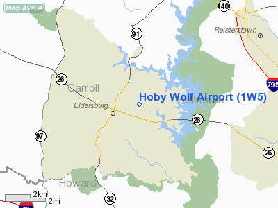
Location & QuickFacts
| FAA Information Effective: | 2008-09-25 |
| Airport Identifier: | 1W5 |
| Airport Status: | Operational |
| Longitude/Latitude: | 076-55-39.2000W/39-24-28.6000N
-76.927556/39.407944 (Estimated) |
| Elevation: | 600 ft / 182.88 m (Estimated) |
| Land: | 70 acres |
| From nearest city: | 1 nautical miles E of Eldersburg, MD |
| Location: | Carroll County, MD |
| Magnetic Variation: | 10W (1985) |
Owner & Manager
| Ownership: | Privately owned |
| Owner: | Hoby Wolf |
| Address: | 6122 Oklahoma Rd
Sykesville, MD 21784 |
| Phone number: | 410-795-3241 |
| Manager: | Dan Wolf |
| Address: | 319a Savannah Rd
Essex, MD 21221 |
| Phone number: | 410-952-1294 |
Airport Operations and Facilities
| Airport Use: | Open to public |
| Wind indicator: | Yes |
| Segmented Circle: | No |
| Control Tower: | No |
| Landing fee charge: | No |
| Sectional chart: | Washington |
| Region: | AEA - Eastern |
| Boundary ARTCC: | ZNY - New York |
| Tie-in FSS: | DCA - Leesburg |
| FSS on Airport: | No |
| FSS Toll Free: | 1-800-WX-BRIEF |
| NOTAMs Facility: | DCA (NOTAM-d service avaliable) |
Airport Communications
Airport Services
| Airframe Repair: | MINOR |
| Power Plant Repair: | MINOR |
Runway Information
Runway 02/20
| Dimension: | 2000 x 60 ft / 609.6 x 18.3 m |
| Surface: | TURF, Fair Condition
HAS UP & DOWN SLOPES WITH UNDULATIONS. |
| |
Runway 02 |
Runway 20 |
| Longitude: | 076-55-41.0800W | 076-55-37.3900W |
| Latitude: | 39-24-18.8600N | 39-24-38.4200N |
| Traffic Pattern: | Left | Left |
| Obstruction: | 87 ft trees | 38 ft trees, 0.0 ft from runway |
|
Radio Navigation Aids
| ID |
Type |
Name |
Ch |
Freq |
Var |
Dist |
| FND | NDB | Ellicott | | 371.00 | 11W | 10.1 nm |
| IUB | NDB | Institute | | 404.00 | 08W | 15.8 nm |
| GAI | NDB | Gaithersburg | | 385.00 | 09W | 18.1 nm |
| BUH | NDB | Anne Arundel | | 260.00 | 10W | 21.0 nm |
| MTN | NDB | Martin | | 342.00 | 11W | 26.3 nm |
| GTN | NDB | Georgetown | | 323.00 | 09W | 30.2 nm |
| EUD | NDB | York | | 254.00 | 11W | 30.9 nm |
| DC | NDB | Oxonn | | 332.00 | 11W | 38.9 nm |
| APG | NDB | Aberdeen | | 349.00 | 11W | 38.9 nm |
| VKX | NDB | Potomac | | 241.00 | 10W | 39.6 nm |
| MTN | TACAN | Martin | 068X | | 11W | 24.4 nm |
| FDK | VOR | Frederick | | 109.00 | 08W | 20.8 nm |
| HGR | VOR | Hagerstown | | 109.80 | 07W | 46.4 nm |
| DCA | VOR/DME | Washington | 047X | 111.00 | 09W | 33.4 nm |
| PPM | VOR/DME | Phillips | 021X | 108.40 | 09W | 35.3 nm |
| EMI | VORTAC | Westminster | 126X | 117.90 | 08W | 5.7 nm |
| BAL | VORTAC | Baltimore | 098X | 115.10 | 11W | 18.9 nm |
| ADW | VORTAC | Andrews | 078X | 113.10 | 10W | 36.2 nm |
| AML | VORTAC | Armel | 082X | 113.50 | 08W | 38.0 nm |
| MRB | VORTAC | Martinsburg | 058X | 112.10 | 07W | 42.8 nm |
| OTT | VORTAC | Nottingham | 084X | 113.70 | 10W | 43.1 nm |
| DCA | VOT | Washington National | | 109.40 | | 34.2 nm |
| ADW | VOT | Andrews Afb | | 109.60 | | 37.3 nm |
| MDT | VOT | Harrisburg International | | 110.00 | | 48.1 nm |
Remarks
- UNLIMITED VEHICLE ACCESS TO ACFT MOVEMENT AREAS
- BIRDS & WILDLIFE ON & INVOF ARPT.
- PRIVATE ROAD CROSSING RY 02 75 FT BYD THLD.
- UNLIMITED VEHICLE ACCESS TO ACFT MOVEMENT AREAS.
- RY 20 APCH SLOPE RATIO TO 250 FT. DSPLCD THLD IS 20:1.
- EXISTED PRIOR TO 1959.
Images and information placed above are from
http://www.airport-data.com/airport/1W5/
We thank them for the data!
| General Info
|
| Country |
United States
|
| State |
MARYLAND
|
| FAA ID |
1W5
|
| Latitude |
39-24-28.373N
|
| Longitude |
076-55-38.922W
|
| Elevation |
600 feet
|
| Near City |
ELDERSBURG
|
We don't guarantee the information is fresh and accurate. The data may
be wrong or outdated.
For more up-to-date information please refer to other sources.
|
|


