 |
|
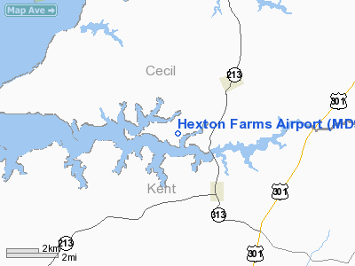
Location & QuickFacts
| FAA Information Effective: | 2008-09-25 |
| Airport Identifier: | MD93 |
| Airport Status: | Operational |
| Longitude/Latitude: | 075-54-23.7860W/39-22-30.4040N
-75.906607/39.375112 (Estimated) |
| Elevation: | 65 ft / 19.81 m (Estimated) |
| Land: | 0 acres |
| From nearest city: | 3 nautical miles SW of Cecilton, MD |
| Location: | Cecil County, MD |
| Magnetic Variation: | 11W (1985) |
Owner & Manager
| Ownership: | Privately owned |
| Owner: | Samuel F & Joanne J Dupont |
| Address: | Hexton Farms Po Box 384
Georgeton, MD 21930 |
| Phone number: | 410-275-2626 |
| Manager: | Samuel Dupont |
| Address: | Hexton Farms Po Box 384
Georgetown, MD 21930 |
| Phone number: | 410-275-2626 |
Airport Operations and Facilities
| Airport Use: | Private |
| Wind indicator: | Yes |
| Segmented Circle: | No |
| Control Tower: | No |
| Landing fee charge: | No |
| Sectional chart: | Washington |
| Region: | AEA - Eastern |
| Boundary ARTCC: | ZDC - Washington |
| Tie-in FSS: | DCA - Leesburg |
| FSS on Airport: | No |
| FSS Toll Free: | 1-800-WX-BRIEF |
Airport Services
| Airframe Repair: | NONE |
| Power Plant Repair: | NONE |
Runway Information
Runway 14/32
| Dimension: | 3800 x 100 ft / 1158.2 x 30.5 m |
| Surface: | TURF, |
| |
Runway 14 |
Runway 32 |
| Traffic Pattern: | Left | Left |
|
Radio Navigation Aids
| ID |
Type |
Name |
Ch |
Freq |
Var |
Dist |
| APG |
NDB |
Aberdeen |
|
349.00 |
11W |
13.4 nm |
| MTN |
NDB |
Martin |
|
342.00 |
11W |
22.5 nm |
| IUB |
NDB |
Institute |
|
404.00 |
08W |
33.8 nm |
| ESN |
NDB |
Easton |
|
212.00 |
10W |
35.1 nm |
| RNB |
NDB |
Rainbow |
|
363.00 |
11W |
35.9 nm |
| FND |
NDB |
Ellicott |
|
371.00 |
11W |
40.8 nm |
| BUH |
NDB |
Anne Arundel |
|
260.00 |
10W |
43.4 nm |
| MTN |
TACAN |
Martin |
068X |
|
11W |
23.6 nm |
| DOV |
TACAN |
Dover |
037X |
|
09W |
25.1 nm |
| PPM |
VOR/DME |
Phillips |
021X |
108.40 |
09W |
13.5 nm |
| ATR |
VOR/DME |
Waterloo |
073X |
112.60 |
09W |
47.0 nm |
| ENO |
VORTAC |
Smyrna |
051X |
111.40 |
09W |
20.1 nm |
| DQO |
VORTAC |
Dupont |
087X |
114.00 |
10W |
22.9 nm |
| OOD |
VORTAC |
Woodstown |
075X |
112.80 |
10W |
32.1 nm |
| MXE |
VORTAC |
Modena |
079X |
113.20 |
09W |
34.4 nm |
| BAL |
VORTAC |
Baltimore |
098X |
115.10 |
11W |
37.2 nm |
| VCN |
VORTAC |
Cedar Lake |
099X |
115.20 |
10W |
44.7 nm |
| LRP |
VORTAC |
Lancaster |
120X |
117.30 |
09W |
48.2 nm |
| PHL |
VOT |
Philadelphia Intl |
|
109.80 |
|
42.7 nm |
Remarks
Images and information placed above are from
http://www.airport-data.com/airport/MD93/
We thank them for the data!
| General Info
|
| Country |
United States
|
| State |
MARYLAND
|
| FAA ID |
MD93
|
| Latitude |
39-22-30.404N
|
| Longitude |
075-54-23.786W
|
| Elevation |
65 feet
|
| Near City |
CECILTON
|
We don't guarantee the information is fresh and accurate. The data may
be wrong or outdated.
For more up-to-date information please refer to other sources.
|
|


