 |
|
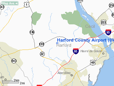
Location & QuickFacts
| FAA Information Effective: | 2008-09-25 |
| Airport Identifier: | 0W3 |
| Airport Status: | Operational |
| Longitude/Latitude: | 076-12-08.6500W/39-34-00.6160N
-76.202403/39.566838 (Estimated) |
| Elevation: | 409 ft / 124.66 m (Surveyed) |
| Land: | 59 acres |
| From nearest city: | 3 nautical miles E of Churchville, MD |
| Location: | Harford County, MD |
| Magnetic Variation: | 11W (1995) |
Owner & Manager
| Ownership: | Privately owned |
| Owner: | Harford Cty Arpt Owners Group Inc |
| Address: | Po Box 472, 3413 Mc Ommons Road
Churchville, MD 21028 |
| Phone number: | 410-679-7472 |
| Manager: | Kevin Hess |
| Address: | 3538 Aldino Rd
Churchville, MD 21028 |
| Phone number: | 410-836-2828 |
Airport Operations and Facilities
| Airport Use: | Open to public |
| Wind indicator: | Yes |
| Segmented Circle: | No |
| Control Tower: | No |
| Lighting Schedule: | DUSK-DAWN |
| Beacon Color: | Clear-Green (lighted land airport) |
| Landing fee charge: | No |
| Sectional chart: | Washington |
| Region: | AEA - Eastern |
| Boundary ARTCC: | ZNY - New York |
| Responsible ARTCC: | ZDC - Washington |
| Tie-in FSS: | DCA - Leesburg |
| FSS on Airport: | No |
| FSS Toll Free: | 1-800-WX-BRIEF |
| NOTAMs Facility: | DCA (NOTAM-d service avaliable) |
Airport Communications
| CTAF: | 122.800 |
| Unicom: | 122.800 |
Airport Services
| Fuel available: | 100LL |
| Airframe Repair: | MAJOR |
| Power Plant Repair: | MAJOR |
| Bottled Oxygen: | NONE |
| Bulk Oxygen: | NONE |
Runway Information
Runway 01/19
| Dimension: | 2000 x 75 ft / 609.6 x 22.9 m |
| Surface: | TURF, Good Condition |
| |
Runway 01 |
Runway 19 |
| Longitude: | 076-12-10.5500W | 076-12-11.8870W |
| Latitude: | 39-33-50.4440N | 39-34-10.1830N |
| Alignment: | 127 | 127 |
| Traffic Pattern: | Left | Left |
| Obstruction: | 15 ft bldg, 300.0 ft from runway, 110 ft right of centerline, 20:1 slope to clear | 44 ft tree, 421.0 ft from runway, 74 ft left of centerline, 9:1 slope to clear
TREES AND BRUSH 92 FT LEFT AT THLD. |
|
Runway 10/28
| Dimension: | 2000 x 40 ft / 609.6 x 12.2 m |
| Surface: | ASPH, Good Condition |
| Edge Lights: | Non-standard lighting system
RWY 10/28 LIRL; NO DSPLCD THLD LGTS. |
| |
Runway 10 |
Runway 28 |
| Longitude: | 076-12-17.3370W | 076-11-51.8200W |
| Latitude: | 39-33-58.9370N | 39-33-58.1200N |
| Elevation: | 408.00 ft | 380.00 ft |
| Alignment: | 92 | 127 |
| Traffic Pattern: | Left | Left |
| Markings: | Non-precision instrument, Good Condition | Basic, Good Condition |
| Displaced threshold: | 0.00 ft | 100.00 ft |
| Runway End Identifier: | Yes | Yes |
| Obstruction: | 60 ft tree, 1265.0 ft from runway, 17:1 slope to clear | 42 ft trees, 600.0 ft from runway, 130 ft right of centerline, 9:1 slope to clear
APCH RATIO 16:1 TO DSPLCD THLD. |
|
Runway 14/32
| Dimension: | 1600 x 75 ft / 487.7 x 22.9 m |
| Surface: | TURF, Good Condition |
| |
Runway 14 |
Runway 32 |
| Longitude: | 076-12-18.2070W | 076-12-01.1730W |
| Latitude: | 39-34-08.1140N | 39-33-59.3860N |
| Alignment: | 124 | 127 |
| Traffic Pattern: | Left | Left |
| Obstruction: | 40 ft trees, 1500.0 ft from runway, 37:1 slope to clear | 34 ft trees, 400.0 ft from runway, 11:1 slope to clear |
|
Radio Navigation Aids
| ID |
Type |
Name |
Ch |
Freq |
Var |
Dist |
| APG | NDB | Aberdeen | | 349.00 | 11W | 4.8 nm |
| MTN | NDB | Martin | | 342.00 | 11W | 18.1 nm |
| IUB | NDB | Institute | | 404.00 | 08W | 25.9 nm |
| FND | NDB | Ellicott | | 371.00 | 11W | 31.5 nm |
| EUD | NDB | York | | 254.00 | 11W | 37.7 nm |
| BUH | NDB | Anne Arundel | | 260.00 | 10W | 38.9 nm |
| ESN | NDB | Easton | | 212.00 | 10W | 46.2 nm |
| MTN | TACAN | Martin | 068X | | 11W | 17.2 nm |
| DOV | TACAN | Dover | 037X | | 09W | 43.0 nm |
| PPM | VOR/DME | Phillips | 021X | 108.40 | 09W | 6.2 nm |
| DQO | VORTAC | Dupont | 087X | 114.00 | 10W | 28.4 nm |
| BAL | VORTAC | Baltimore | 098X | 115.10 | 11W | 31.9 nm |
| MXE | VORTAC | Modena | 079X | 113.20 | 09W | 32.4 nm |
| LRP | VORTAC | Lancaster | 120X | 117.30 | 09W | 33.5 nm |
| EMI | VORTAC | Westminster | 126X | 117.90 | 08W | 36.2 nm |
| ENO | VORTAC | Smyrna | 051X | 111.40 | 09W | 37.7 nm |
| OOD | VORTAC | Woodstown | 075X | 112.80 | 10W | 41.9 nm |
| PTW | VORTAC | Pottstown | 112X | 116.50 | 09W | 49.3 nm |
| MDT | VOT | Harrisburg International | | 110.00 | | 45.9 nm |
| PHL | VOT | Philadelphia Intl | | 109.80 | | 47.9 nm |
Remarks
- EXTENSIVE GLIDER OPNS ON TURF LDG AREA.
- BIRDS/WILDLIFE ON & INVOF ARPT.
- EXISTED PRIOR TO 1959.
Images and information placed above are from
http://www.airport-data.com/airport/0W3/
We thank them for the data!
| General Info
|
| Country |
United States
|
| State |
MARYLAND
|
| FAA ID |
0W3
|
| Latitude |
39-34-00.153N
|
| Longitude |
076-12-07.991W
|
| Elevation |
409 feet
|
| Near City |
CHURCHVILLE
|
We don't guarantee the information is fresh and accurate. The data may
be wrong or outdated.
For more up-to-date information please refer to other sources.
|
|


