 |
|
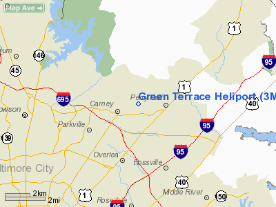
Location & QuickFacts
| FAA Information Effective: | 2008-09-25 |
| Airport Identifier: | 3MD7 |
| Airport Status: | Operational |
| Longitude/Latitude: | 076-30-17.8710W/39-24-09.3850N
-76.504964/39.402607 (Estimated) |
| Elevation: | 310 ft / 94.49 m (Estimated) |
| Land: | 3 acres |
| From nearest city: | 6 nautical miles NE of Baltimore, MD |
| Location: | Baltimore County, MD |
| Magnetic Variation: | 10W (1985) |
Owner & Manager
| Ownership: | Privately owned |
| Owner: | Josef J. Riedlbauer |
| Address: | 9804 Magledt Rd
Baltimore, MD 21234 |
| Phone number: | 410-661-3862 |
| Manager: | Josef J. Riedlbauer |
| Address: | 9804 Magledt Rd
Baltimore, MD 21234 |
| Phone number: | 410-661-3862 |
Airport Operations and Facilities
| Airport Use: | Private |
| Wind indicator: | Yes |
| Segmented Circle: | No |
| Control Tower: | No |
| Lighting Schedule: | DUSK-DAWN |
| Sectional chart: | Washington |
| Region: | AEA - Eastern |
| Boundary ARTCC: | ZNY - New York |
| Responsible ARTCC: | ZDC - Washington |
| Tie-in FSS: | DCA - Leesburg |
| FSS Toll Free: | 1-800-WX-BRIEF |
Airport Communications
Runway Information
Helipad H1
| Dimension: | 26 x 26 ft / 7.9 x 7.9 m |
| Surface: | CONC, |
| |
Runway H1 |
Runway |
| Traffic Pattern: | Left | Left |
|
Radio Navigation Aids
| ID |
Type |
Name |
Ch |
Freq |
Var |
Dist |
| MTN | NDB | Martin | | 342.00 | 11W | 8.5 nm |
| IUB | NDB | Institute | | 404.00 | 08W | 8.9 nm |
| FND | NDB | Ellicott | | 371.00 | 11W | 14.4 nm |
| APG | NDB | Aberdeen | | 349.00 | 11W | 20.1 nm |
| BUH | NDB | Anne Arundel | | 260.00 | 10W | 22.5 nm |
| GAI | NDB | Gaithersburg | | 385.00 | 09W | 33.8 nm |
| EUD | NDB | York | | 254.00 | 11W | 35.6 nm |
| GTN | NDB | Georgetown | | 323.00 | 09W | 40.5 nm |
| ESN | NDB | Easton | | 212.00 | 10W | 41.3 nm |
| VKX | NDB | Potomac | | 241.00 | 10W | 44.6 nm |
| DC | NDB | Oxonn | | 332.00 | 11W | 45.3 nm |
| MTN | TACAN | Martin | 068X | | 11W | 6.1 nm |
| FDK | VOR | Frederick | | 109.00 | 08W | 40.4 nm |
| PPM | VOR/DME | Phillips | 021X | 108.40 | 09W | 16.0 nm |
| DCA | VOR/DME | Washington | 047X | 111.00 | 09W | 41.0 nm |
| BAL | VORTAC | Baltimore | 098X | 115.10 | 11W | 15.7 nm |
| EMI | VORTAC | Westminster | 126X | 117.90 | 08W | 22.7 nm |
| ADW | VORTAC | Andrews | 078X | 113.10 | 10W | 39.6 nm |
| OTT | VORTAC | Nottingham | 084X | 113.70 | 10W | 43.3 nm |
| LRP | VORTAC | Lancaster | 120X | 117.30 | 09W | 44.2 nm |
| DQO | VORTAC | Dupont | 087X | 114.00 | 10W | 44.8 nm |
| ENO | VORTAC | Smyrna | 051X | 111.40 | 09W | 47.1 nm |
| MXE | VORTAC | Modena | 079X | 113.20 | 09W | 49.5 nm |
| ADW | VOT | Andrews Afb | | 109.60 | | 40.9 nm |
| DCA | VOT | Washington National | | 109.40 | | 41.6 nm |
| MDT | VOT | Harrisburg International | | 110.00 | | 49.3 nm |
Remarks
- PRVDD OPNS ARE TO/FROM THE NORTH.
Images and information placed above are from
http://www.airport-data.com/airport/3MD7/
We thank them for the data!
| General Info
|
| Country |
United States
|
| State |
MARYLAND
|
| FAA ID |
3MD7
|
| Latitude |
39-24-09.385N
|
| Longitude |
076-30-17.871W
|
| Elevation |
310 feet
|
| Near City |
BALTIMORE
|
We don't guarantee the information is fresh and accurate. The data may
be wrong or outdated.
For more up-to-date information please refer to other sources.
|
|


