 |
|
Location & QuickFacts
| FAA Information Effective: | 2008-09-25 |
| Airport Identifier: | 2MD8 |
| Airport Status: | Operational |
| Longitude/Latitude: | 079-26-29.1740W/39-20-00.3640N
-79.441437/39.333434 (Estimated) |
| Elevation: | 2500 ft / 762.00 m (Estimated) |
| Land: | 15 acres |
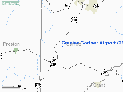
| From nearest city: | 5 nautical miles SW of Oakland, MD |
| Location: | Garrett County, MD |
| Magnetic Variation: | 08W (1985) |
Owner & Manager
| Ownership: | Privately owned |
| Owner: | Ralph & Mary Ellen Lichty |
| Address: | Route 2 Box 2625
Oakland, MD 21550 |
| Phone number: | 301-334-2866 |
| Manager: | J. D. Snyder |
| Address: | Route 1 Box 3020
Oakland, MD 21550 |
| Phone number: | 301-334-1023 |
Airport Operations and Facilities
| Airport Use: | Private |
| Wind indicator: | Yes |
| Segmented Circle: | No |
| Control Tower: | No |
| Landing fee charge: | No |
| Sectional chart: | Cincinnati |
| Region: | AEA - Eastern |
| Boundary ARTCC: | ZDC - Washington |
| Tie-in FSS: | EKN - Elkins |
| FSS on Airport: | No |
| FSS Toll Free: | 1-800-WX-BRIEF |
Airport Services
Runway Information
Runway 04/22
| Dimension: | 2034 x 50 ft / 620.0 x 15.2 m |
| Surface: | TURF, |
| |
Runway 04 |
Runway 22 |
| Traffic Pattern: | Left | Left |
|
Radio Navigation Aids
| ID |
Type |
Name |
Ch |
Freq |
Var |
Dist |
| RQY | NDB | Randolph County | | 284.00 | 07W | 32.8 nm |
| VV | NDB | Camor | | 299.00 | 08W | 35.9 nm |
| CBE | NDB | Cumberland | | 317.00 | 07W | 37.3 nm |
| ESL | VOR/DME | Kessel | 045X | 110.80 | 06W | 22.0 nm |
| GRV | VOR/DME | Grantsville | 070X | 112.30 | 06W | 25.6 nm |
| CKB | VOR/DME | Clarksburg | 073X | 112.60 | 04W | 38.7 nm |
| MGW | VORTAC | Morgantown | 053X | 111.60 | 05W | 23.6 nm |
| IHD | VORTAC | Indian Head | 019X | 108.20 | 06W | 38.7 nm |
| EKN | VORTAC | Elkins | 089X | 114.20 | 07W | 39.7 nm |
Remarks
Images and information placed above are from
http://www.airport-data.com/airport/2MD8/
We thank them for the data!
| General Info
|
| Country |
United States
|
| State |
MARYLAND
|
| FAA ID |
2MD8
|
| Latitude |
39-20-00.364N
|
| Longitude |
079-26-29.174W
|
| Elevation |
2500 feet
|
| Near City |
OAKLAND
|
We don't guarantee the information is fresh and accurate. The data may
be wrong or outdated.
For more up-to-date information please refer to other sources.
|
|


