 |
|
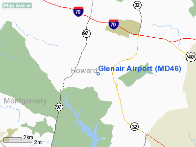
Location & QuickFacts
| FAA Information Effective: | 2008-09-25 |
| Airport Identifier: | MD46 |
| Airport Status: | Operational |
| Longitude/Latitude: | 077-00-18.9200W/39-16-10.3780N
-77.005256/39.269549 (Estimated) |
| Elevation: | 590 ft / 179.83 m (Estimated) |
| Land: | 45 acres |
| From nearest city: | 2 nautical miles NW of Dayton, MD |
| Location: | Howard County, MD |
| Magnetic Variation: | 10W (1985) |
Owner & Manager
| Ownership: | Privately owned |
| Owner: | Glenair Association |
| Address: | Ray Somerlock, President, 3681 Sharp Rd
Glenwood, MD 21738 |
| Phone number: | 410-442-1298 |
| Manager: | Enos C. Levy |
| Address: | 3689 Sharp Road
Glenwood, MD 21738 |
| Phone number: | 301-854-6684 |
Airport Operations and Facilities
| Airport Use: | Private |
| Wind indicator: | Yes |
| Segmented Circle: | No |
| Control Tower: | No |
| Lighting Schedule: | PHONE REQ
FOR RY LGTS CALL 301-854-6684 OR 301-442-1298. |
| Landing fee charge: | No |
| Sectional chart: | Washington |
| Region: | AEA - Eastern |
| Boundary ARTCC: | ZDC - Washington |
| Tie-in FSS: | DCA - Leesburg |
| FSS on Airport: | No |
| FSS Toll Free: | 1-800-WX-BRIEF |
Airport Services
| Airframe Repair: | NONE |
| Power Plant Repair: | NONE |
Runway Information
Runway 10/28
| Dimension: | 2200 x 50 ft / 670.6 x 15.2 m |
| Surface: | TURF, |
| Edge Lights: | Medium |
| |
Runway 10 |
Runway 28 |
| Traffic Pattern: | Right | Left |
| Obstruction: | 30 ft pline, 500.0 ft from runway | 20 ft trees, 500.0 ft from runway |
|
Radio Navigation Aids
| ID |
Type |
Name |
Ch |
Freq |
Var |
Dist |
| GAI | NDB | Gaithersburg | | 385.00 | 09W | 9.6 nm |
| FND | NDB | Ellicott | | 371.00 | 11W | 10.7 nm |
| BUH | NDB | Anne Arundel | | 260.00 | 10W | 16.0 nm |
| IUB | NDB | Institute | | 404.00 | 08W | 17.7 nm |
| GTN | NDB | Georgetown | | 323.00 | 09W | 21.2 nm |
| MTN | NDB | Martin | | 342.00 | 11W | 29.1 nm |
| DC | NDB | Oxonn | | 332.00 | 11W | 30.3 nm |
| VKX | NDB | Potomac | | 241.00 | 10W | 31.4 nm |
| EUD | NDB | York | | 254.00 | 11W | 39.5 nm |
| GDX | NDB | Goodwin Lake | | 227.00 | 08W | 42.9 nm |
| APG | NDB | Aberdeen | | 349.00 | 11W | 44.7 nm |
| MTN | TACAN | Martin | 068X | | 11W | 27.9 nm |
| FDK | VOR | Frederick | | 109.00 | 08W | 19.2 nm |
| HGR | VOR | Hagerstown | | 109.80 | 07W | 47.1 nm |
| DCA | VOR/DME | Washington | 047X | 111.00 | 09W | 24.7 nm |
| PPM | VOR/DME | Phillips | 021X | 108.40 | 09W | 40.5 nm |
| EMI | VORTAC | Westminster | 126X | 117.90 | 08W | 13.6 nm |
| BAL | VORTAC | Baltimore | 098X | 115.10 | 11W | 17.1 nm |
| ADW | VORTAC | Andrews | 078X | 113.10 | 10W | 28.5 nm |
| AML | VORTAC | Armel | 082X | 113.50 | 08W | 29.5 nm |
| OTT | VORTAC | Nottingham | 084X | 113.70 | 10W | 36.0 nm |
| MRB | VORTAC | Martinsburg | 058X | 112.10 | 07W | 39.8 nm |
| DCA | VOT | Washington National | | 109.40 | | 25.5 nm |
| ADW | VOT | Andrews Afb | | 109.60 | | 29.5 nm |
Remarks
- ADIZ FLIGHT PLAN REQUIRED FOR INGRESS/ EGRESS
- OPERATIONS FOR 12 MONTHS ENDING SEP 2006 GA LOCAL
Images and information placed above are from
http://www.airport-data.com/airport/MD46/
We thank them for the data!
| General Info
|
| Country |
United States
|
| State |
MARYLAND
|
| FAA ID |
MD46
|
| Latitude |
39-16-10.378N
|
| Longitude |
077-00-18.920W
|
| Elevation |
590 feet
|
| Near City |
DAYTON
|
We don't guarantee the information is fresh and accurate. The data may
be wrong or outdated.
For more up-to-date information please refer to other sources.
|
|


