 |
|
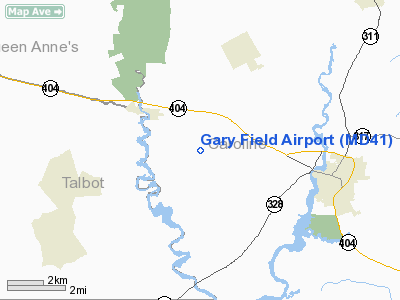
Location & QuickFacts
| FAA Information Effective: | 2008-09-25 |
| Airport Identifier: | MD41 |
| Airport Status: | Operational |
| Longitude/Latitude: | 075-54-38.0000W/38-53-54.0000N
-75.910556/38.898333 (Estimated) |
| Elevation: | 50 ft / 15.24 m (Estimated) |
| Land: | 4 acres |
| From nearest city: | 3 nautical miles W of Denton, MD |
| Location: | Caroline County, MD |
| Magnetic Variation: | 11W (1990) |
Owner & Manager
| Ownership: | Privately owned |
| Owner: | Douglas Gary |
| Address: | Rt 3 Box 154a
Denton, MD 21629 |
| Phone number: | 301-634-2432 |
| Manager: | Douglas Gary |
| Address: | Rte 3 Box 154a
Denton, MD 21629 |
| Phone number: | 301-634-2432 |
Airport Operations and Facilities
| Airport Use: | Private |
| Wind indicator: | Yes |
| Segmented Circle: | No |
| Control Tower: | No |
| Sectional chart: | Washington |
| Region: | AEA - Eastern |
| Boundary ARTCC: | ZDC - Washington |
| Tie-in FSS: | DCA - Leesburg |
| FSS Toll Free: | 1-800-WX-BRIEF |
Runway Information
Runway 10/28
| Dimension: | 1835 x 60 ft / 559.3 x 18.3 m |
| Surface: | TURF, |
| |
Runway 10 |
Runway 28 |
| Traffic Pattern: | Left | Left |
| Obstruction: | 60 ft trees | 25 ft pline, 30.0 ft from runway |
|
Radio Navigation Aids
| ID |
Type |
Name |
Ch |
Freq |
Var |
Dist |
| ESN | NDB | Easton | | 212.00 | 10W | 9.3 nm |
| CGE | NDB | Cambridge | | 355.00 | 10W | 22.4 nm |
| MTN | NDB | Martin | | 342.00 | 11W | 32.6 nm |
| APG | NDB | Aberdeen | | 349.00 | 11W | 39.3 nm |
| IUB | NDB | Institute | | 404.00 | 08W | 40.7 nm |
| BUH | NDB | Anne Arundel | | 260.00 | 10W | 41.2 nm |
| NHK | NDB | Patuxent | | 400.00 | 10W | 43.5 nm |
| OX | NDB | Landy | | 407.00 | 12W | 46.4 nm |
| FND | NDB | Ellicott | | 371.00 | 11W | 46.7 nm |
| RNB | NDB | Rainbow | | 363.00 | 11W | 47.8 nm |
| VKX | NDB | Potomac | | 241.00 | 10W | 49.8 nm |
| DOV | TACAN | Dover | 037X | | 09W | 25.0 nm |
| MTN | TACAN | Martin | 068X | | 11W | 35.0 nm |
| ATR | VOR/DME | Waterloo | 073X | 112.60 | 09W | 33.2 nm |
| PPM | VOR/DME | Phillips | 021X | 108.40 | 09W | 36.3 nm |
| ENO | VORTAC | Smyrna | 051X | 111.40 | 09W | 27.2 nm |
| SBY | VORTAC | Salisbury | 049X | 111.20 | 12W | 38.2 nm |
| BAL | VORTAC | Baltimore | 098X | 115.10 | 11W | 38.7 nm |
| OTT | VORTAC | Nottingham | 084X | 113.70 | 10W | 40.8 nm |
| PXT | VORTAC | Patuxent | 123X | 117.60 | 10W | 43.3 nm |
| ADW | VORTAC | Andrews | 078X | 113.10 | 10W | 45.1 nm |
| DQO | VORTAC | Dupont | 087X | 114.00 | 10W | 49.0 nm |
| ADW | VOT | Andrews Afb | | 109.60 | | 45.9 nm |
Remarks
- PRVDD 20:1 IS MAINTAINED TO EACH RY END; DALGT OPNS ONLY; IFR OPNS SHOULD NOT BE EMPLOYED. ACFT CHOULD BE LMTD TO SE, LESS THAN 3500 LBS MGW. PROPOSED ARPT IS INVOF CARMEAN PVT USE ARPT. OPERATORS OF BOTH ARPTS SHOULD BECOME FAMILIAR WITH CHK POINTS & TFC PATS AT EACH FACILITY.
Images and information placed above are from
http://www.airport-data.com/airport/MD41/
We thank them for the data!
| General Info
|
| Country |
United States
|
| State |
MARYLAND
|
| FAA ID |
MD41
|
| Latitude |
38-53-54.000N
|
| Longitude |
075-54-38.000W
|
| Elevation |
50 feet
|
| Near City |
DENTON
|
|


