 |
|
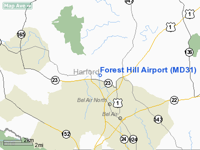
Location & QuickFacts
| FAA Information Effective: | 2008-09-25 |
| Airport Identifier: | MD31 |
| Airport Status: | Operational |
| Longitude/Latitude: | 076-22-28.8580W/39-34-48.3830N
-76.374683/39.580106 (Estimated) |
| Elevation: | 476 ft / 145.08 m (Surveyed) |
| Land: | 0 acres |
| From nearest city: | 1 nautical miles SE of Forest Hill, MD |
| Location: | Harford County, MD |
| Magnetic Variation: | 11W (2005) |
Owner & Manager
| Ownership: | Privately owned |
| Owner: | Forest Hill Industrial Arpk |
| Address: | 109 E Jarrettsville Rd
Forest Hill, MD 21050 |
| Phone number: | 410-879-1981 |
| Manager: | John Robert Martin Jr. |
| Address: | 109 E Jarrettsville Rd
Forest Hill, MD 21050 |
| Phone number: | 410-879-1981 |
Airport Operations and Facilities
| Airport Use: | Private |
| Wind indicator: | Yes |
| Segmented Circle: | No |
| Control Tower: | No |
| Lighting Schedule: | 2000-2300
ACTVT MIRL RY 13/31 AND TRIL RY 13 AND 31 - UNICOM. |
| Beacon Color: | Clear-Green (lighted land airport) |
| Landing fee charge: | Yes |
| Sectional chart: | Washington |
| Region: | AEA - Eastern |
| Boundary ARTCC: | ZNY - New York |
| Responsible ARTCC: | ZDC - Washington |
| Tie-in FSS: | DCA - Leesburg |
| FSS on Airport: | No |
| FSS Toll Free: | 1-800-WX-BRIEF |
Airport Communications
Airport Services
| Fuel available: | 100 100LL |
| Airframe Repair: | NONE |
| Power Plant Repair: | NONE |
Runway Information
Runway 13/31
| Dimension: | 3261 x 50 ft / 994.0 x 15.2 m |
| Surface: | ASPH, |
| Edge Lights: | Medium |
| |
Runway 13 |
Runway 31 |
| Longitude: | 076-22-44.6300W | 076-22-08.2700W |
| Latitude: | 39-34-53.7000N | 39-34-37.9800N |
| Elevation: | 478.00 ft | 497.00 ft |
| Traffic Pattern: | Right | Left |
| Displaced threshold: | 912.00 ft | 0.00 ft |
| VASI: | tri-color on left side | tri-color on left side |
|
Radio Navigation Aids
| ID |
Type |
Name |
Ch |
Freq |
Var |
Dist |
| APG | NDB | Aberdeen | | 349.00 | 11W | 12.7 nm |
| MTN | NDB | Martin | | 342.00 | 11W | 16.9 nm |
| IUB | NDB | Institute | | 404.00 | 08W | 21.1 nm |
| FND | NDB | Ellicott | | 371.00 | 11W | 25.7 nm |
| EUD | NDB | York | | 254.00 | 11W | 30.9 nm |
| BUH | NDB | Anne Arundel | | 260.00 | 10W | 34.8 nm |
| GAI | NDB | Gaithersburg | | 385.00 | 09W | 44.3 nm |
| ESN | NDB | Easton | | 212.00 | 10W | 48.7 nm |
| MTN | TACAN | Martin | 068X | | 11W | 15.1 nm |
| FDK | VOR | Frederick | | 109.00 | 08W | 47.5 nm |
| PPM | VOR/DME | Phillips | 021X | 108.40 | 09W | 11.6 nm |
| BAL | VORTAC | Baltimore | 098X | 115.10 | 11W | 28.0 nm |
| EMI | VORTAC | Westminster | 126X | 117.90 | 08W | 28.5 nm |
| LRP | VORTAC | Lancaster | 120X | 117.30 | 09W | 32.7 nm |
| DQO | VORTAC | Dupont | 087X | 114.00 | 10W | 36.0 nm |
| MXE | VORTAC | Modena | 079X | 113.20 | 09W | 38.4 nm |
| ENO | VORTAC | Smyrna | 051X | 111.40 | 09W | 45.0 nm |
| OOD | VORTAC | Woodstown | 075X | 112.80 | 10W | 49.7 nm |
| MDT | VOT | Harrisburg International | | 110.00 | | 41.2 nm |
Remarks
- USE STANDARD LEFTHAND PATTERN.
Images and information placed above are from
http://www.airport-data.com/airport/MD31/
We thank them for the data!
| General Info
|
| Country |
United States
|
| State |
MARYLAND
|
| FAA ID |
MD31
|
| Latitude |
39-34-48.383N
|
| Longitude |
076-22-28.858W
|
| Elevation |
476 feet
|
| Near City |
FOREST HILL
|
We don't guarantee the information is fresh and accurate. The data may
be wrong or outdated.
For more up-to-date information please refer to other sources.
|
|


