 |
|
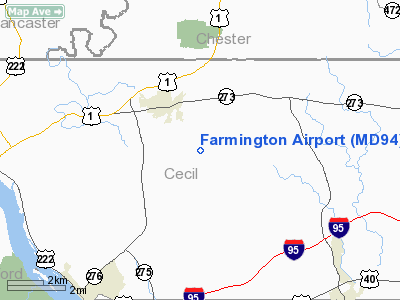
Location & QuickFacts
| FAA Information Effective: | 2008-09-25 |
| Airport Identifier: | MD94 |
| Airport Status: | Operational |
| Longitude/Latitude: | 076-02-12.8120W/39-40-35.3970N
-76.036892/39.676499 (Estimated) |
| Elevation: | 445 ft / 135.64 m (Surveyed) |
| Land: | 60 acres |
| From nearest city: | 0 nautical miles SW of Farmington, MD |
| Location: | Cecil County, MD |
| Magnetic Variation: | 11W (1985) |
Owner & Manager
| Ownership: | Privately owned |
| Owner: | Mary V Giffords Blevins |
| Address: | Rfd 1
Rising Sun, MD 21911 |
| Phone number: | 410-658-6911 |
| Manager: | Stanley Michalski |
| Address: | 50 Woodview Lane
Northeast, MD 21901 |
| Phone number: | 410-658-3947 |
Airport Operations and Facilities
| Airport Use: | Private |
| Wind indicator: | Yes |
| Segmented Circle: | Yes |
| Control Tower: | No |
| Landing fee charge: | No |
| Sectional chart: | Washington |
| Region: | AEA - Eastern |
| Boundary ARTCC: | ZNY - New York |
| Tie-in FSS: | DCA - Leesburg |
| FSS on Airport: | No |
| FSS Toll Free: | 1-800-WX-BRIEF |
Airport Services
| Airframe Repair: | MAJOR |
| Power Plant Repair: | MAJOR |
| Bottled Oxygen: | NONE |
| Bulk Oxygen: | NONE |
Runway Information
Runway 02/20
| Dimension: | 1600 x 75 ft / 487.7 x 22.9 m |
| Surface: | TURF, |
| |
Runway 02 |
Runway 20 |
| Traffic Pattern: | Left | Left |
| Runway End Identifier: | No | No |
| Touchdown Lights: | No | No |
|
Runway 10/28
| Dimension: | 1500 x 75 ft / 457.2 x 22.9 m |
| Surface: | TURF, |
| |
Runway 10 |
Runway 28 |
| Traffic Pattern: | Left | Left |
| Runway End Identifier: | No | No |
| Touchdown Lights: | No | No |
|
Radio Navigation Aids
| ID |
Type |
Name |
Ch |
Freq |
Var |
Dist |
| APG | NDB | Aberdeen | | 349.00 | 11W | 9.1 nm |
| MTN | NDB | Martin | | 342.00 | 11W | 27.7 nm |
| IUB | NDB | Institute | | 404.00 | 08W | 36.0 nm |
| EUD | NDB | York | | 254.00 | 11W | 41.5 nm |
| FND | NDB | Ellicott | | 371.00 | 11W | 41.5 nm |
| ING | NDB | Ambler | | 275.00 | 11W | 43.9 nm |
| RNB | NDB | Rainbow | | 363.00 | 11W | 44.6 nm |
| BUH | NDB | Anne Arundel | | 260.00 | 10W | 49.0 nm |
| MTN | TACAN | Martin | 068X | | 11W | 27.1 nm |
| DOV | TACAN | Dover | 037X | | 09W | 42.1 nm |
| PPM | VOR/DME | Phillips | 021X | 108.40 | 09W | 14.1 nm |
| DQO | VORTAC | Dupont | 087X | 114.00 | 10W | 19.9 nm |
| MXE | VORTAC | Modena | 079X | 113.20 | 09W | 22.3 nm |
| LRP | VORTAC | Lancaster | 120X | 117.30 | 09W | 29.1 nm |
| OOD | VORTAC | Woodstown | 075X | 112.80 | 10W | 34.0 nm |
| ENO | VORTAC | Smyrna | 051X | 111.40 | 09W | 36.0 nm |
| PTW | VORTAC | Pottstown | 112X | 116.50 | 09W | 39.5 nm |
| BAL | VORTAC | Baltimore | 098X | 115.10 | 11W | 42.0 nm |
| EMI | VORTAC | Westminster | 126X | 117.90 | 08W | 45.0 nm |
| PHL | VOT | Philadelphia Intl | | 109.80 | | 38.4 nm |
| MDT | VOT | Harrisburg International | | 110.00 | | 45.8 nm |
Remarks
Images and information placed above are from
http://www.airport-data.com/airport/MD94/
We thank them for the data!
| General Info
|
| Country |
United States
|
| State |
MARYLAND
|
| FAA ID |
MD94
|
| Latitude |
39-40-35.397N
|
| Longitude |
076-02-12.812W
|
| Elevation |
445 feet
|
| Near City |
FARMINGTON
|
We don't guarantee the information is fresh and accurate. The data may
be wrong or outdated.
For more up-to-date information please refer to other sources.
|
|


