 |
|
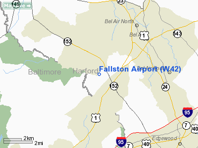
Location & QuickFacts
| FAA Information Effective: | 2008-09-25 |
| Airport Identifier: | W42 |
| Airport Status: | Operational |
| Longitude/Latitude: | 076-24-40.8000W/39-30-04.8000N
-76.411333/39.501333 (Estimated) |
| Elevation: | 460 ft / 140.21 m (Estimated) |
| Land: | 20 acres |
| From nearest city: | 1 nautical miles S of Fallston, MD |
| Location: | Harford County, MD |
| Magnetic Variation: | 10W (1985) |
Owner & Manager
| Ownership: | Privately owned |
| Owner: | Fred R. Mills |
| Address: | 711 Reckord Rd
Fallston, MD 21047 |
| Phone number: | 410-877-9889 |
| Manager: | Sharon Baxley |
| Address: | 711 Reckord Rd
Fallston, MD 21047 |
| Phone number: | 410-877-9889
ALTERNATE EMERGENCY PHONE (410) 808-3289 |
Airport Operations and Facilities
| Airport Use: | Open to public |
| Wind indicator: | Yes |
| Segmented Circle: | No |
| Control Tower: | No |
| Lighting Schedule: | PHONE REQ
NSTD LIRL AVAILABLE TO BASED AIRCRAFT W/PRIOR NOTICE. FOR NSTD LIRL RY 04/22 CTC AMGR 410-877-9889. |
| Landing fee charge: | No |
| Sectional chart: | Washington |
| Region: | AEA - Eastern |
| Boundary ARTCC: | ZNY - New York |
| Responsible ARTCC: | ZDC - Washington |
| Tie-in FSS: | DCA - Leesburg |
| FSS on Airport: | No |
| FSS Toll Free: | 1-800-WX-BRIEF |
| NOTAMs Facility: | DCA (NOTAM-d service avaliable) |
Airport Communications
Airport Services
| Fuel available: | 100LL |
| Airframe Repair: | NONE |
| Power Plant Repair: | NONE |
| Bottled Oxygen: | NONE |
| Bulk Oxygen: | NONE |
Runway Information
Runway 04/22
| Dimension: | 2200 x 50 ft / 670.6 x 15.2 m |
| Surface: | ASPH, Good Condition |
| Weight Limit: | Single wheel: 12000 lbs. |
| Edge Lights: | Non-standard lighting system
RY 04/22 NSTD LIRL; TWO THLD LGTS EACH SIDE & 300 FT EDGE LGT SPACING. |
| |
Runway 04 |
Runway 22 |
| Longitude: | 076-24-47.4400W | 076-24-34.1700W |
| Latitude: | 39-29-55.1800N | 39-30-14.3500N |
| Traffic Pattern: | Left | Left |
| Markings: | Basic, Good Condition | Basic, Good Condition |
| Obstruction: | 65 ft trees, 1314.0 ft from runway, 208 ft right of centerline, 17:1 slope to clear
RY 04 HAS +10 FT ROAD 45 FT FM THLD. | 50 ft tree, 1258.0 ft from runway, 66 ft left of centerline, 21:1 slope to clear
+15 FT ACCESS ROAD AT THR; +25 FT TREES & POLES 75 FT FM RY R OF APCH NMRS. |
|
Radio Navigation Aids
| ID |
Type |
Name |
Ch |
Freq |
Var |
Dist |
| MTN | NDB | Martin | | 342.00 | 11W | 12.2 nm |
| APG | NDB | Aberdeen | | 349.00 | 11W | 14.3 nm |
| IUB | NDB | Institute | | 404.00 | 08W | 16.3 nm |
| FND | NDB | Ellicott | | 371.00 | 11W | 21.3 nm |
| BUH | NDB | Anne Arundel | | 260.00 | 10W | 29.9 nm |
| EUD | NDB | York | | 254.00 | 11W | 33.1 nm |
| GAI | NDB | Gaithersburg | | 385.00 | 09W | 40.3 nm |
| ESN | NDB | Easton | | 212.00 | 10W | 44.8 nm |
| GTN | NDB | Georgetown | | 323.00 | 09W | 47.8 nm |
| MTN | TACAN | Martin | 068X | | 11W | 10.2 nm |
| DOV | TACAN | Dover | 037X | | 09W | 49.2 nm |
| FDK | VOR | Frederick | | 109.00 | 08W | 45.0 nm |
| PPM | VOR/DME | Phillips | 021X | 108.40 | 09W | 11.3 nm |
| DCA | VOR/DME | Washington | 047X | 111.00 | 09W | 48.3 nm |
| BAL | VORTAC | Baltimore | 098X | 115.10 | 11W | 23.0 nm |
| EMI | VORTAC | Westminster | 126X | 117.90 | 08W | 26.3 nm |
| LRP | VORTAC | Lancaster | 120X | 117.30 | 09W | 37.6 nm |
| DQO | VORTAC | Dupont | 087X | 114.00 | 10W | 38.7 nm |
| MXE | VORTAC | Modena | 079X | 113.20 | 09W | 42.4 nm |
| ENO | VORTAC | Smyrna | 051X | 111.40 | 09W | 44.7 nm |
| ADW | VORTAC | Andrews | 078X | 113.10 | 10W | 46.8 nm |
| MDT | VOT | Harrisburg International | | 110.00 | | 44.9 nm |
| ADW | VOT | Andrews Afb | | 109.60 | | 48.1 nm |
| DCA | VOT | Washington National | | 109.40 | | 49.0 nm |
Remarks
- ARPT CLSD DUSK-0900 DAILY.
- UNLIMITED VEHICLE ACCESS TO ACFT MOVEMENT AREAS.
- DEER & WILDLIFE ON & INVOF ARPT.
- EXISTED PRIOR TO 1959.
Images and information placed above are from
http://www.airport-data.com/airport/W42/
We thank them for the data!
| General Info
|
| Country |
United States
|
| State |
MARYLAND
|
| FAA ID |
W42
|
| Latitude |
39-30-05.386N
|
| Longitude |
076-24-39.863W
|
| Elevation |
460 feet
|
| Near City |
FALLSTON
|
We don't guarantee the information is fresh and accurate. The data may
be wrong or outdated.
For more up-to-date information please refer to other sources.
|
|


