 |
|
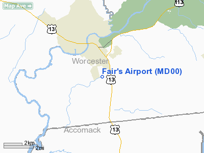
Location & QuickFacts
| FAA Information Effective: | 2008-09-25 |
| Airport Identifier: | MD00 |
| Airport Status: | Operational |
| Longitude/Latitude: | 075-33-11.7300W/38-02-46.4390N
-75.553258/38.046233 (Estimated) |
| Elevation: | 22 ft / 6.71 m (Estimated) |
| Land: | 104 acres |
| From nearest city: | 2 nautical miles S of Pocomoke City, MD |
| Location: | Worcester County, MD |
| Magnetic Variation: | 10W (1985) |
Owner & Manager
| Ownership: | Privately owned |
| Owner: | Freddie R. Fair, Sr. |
| Address: | 1521 Old Va Rd
Pocomoke, MD 21851 |
| Phone number: | 410-957-0264 |
| Manager: | Freddie R. Fair, Sr. |
| Address: | 1521 Old Va Rd
Pocomoke, MD 21851 |
| Phone number: | 410-957-0264 |
Airport Operations and Facilities
| Airport Use: | Private |
| Wind indicator: | Yes |
| Segmented Circle: | No |
| Control Tower: | No |
| Landing fee charge: | No |
| Sectional chart: | Washington |
| Region: | AEA - Eastern |
| Boundary ARTCC: | ZDC - Washington |
| Tie-in FSS: | DCA - Leesburg |
| FSS on Airport: | No |
| FSS Toll Free: | 1-800-WX-BRIEF |
Airport Services
Runway Information
Runway 07/25
| Dimension: | 1875 x 66 ft / 571.5 x 20.1 m |
| Surface: | TURF, Good Condition |
| |
Runway 07 |
Runway 25 |
| Traffic Pattern: | Right | Left |
| Obstruction: | 23 ft rr, 25.0 ft from runway, 1:1 slope to clear | 15 ft road, 15.0 ft from runway, 1:1 slope to clear |
|
Radio Navigation Aids
| ID |
Type |
Name |
Ch |
Freq |
Var |
Dist |
| OX | NDB | Landy | | 407.00 | 12W | 25.4 nm |
| BDB | NDB | Accomack | | 336.00 | 11W | 30.9 nm |
| CGE | NDB | Cambridge | | 355.00 | 10W | 37.2 nm |
| NHK | NDB | Patuxent | | 400.00 | 10W | 42.7 nm |
| ATR | VOR/DME | Waterloo | 073X | 112.60 | 09W | 48.6 nm |
| SWL | VORTAC | Snow Hill | 071X | 112.40 | 08W | 4.3 nm |
| SBY | VORTAC | Salisbury | 049X | 111.20 | 12W | 18.1 nm |
| PXT | VORTAC | Patuxent | 123X | 117.60 | 10W | 42.6 nm |
| CCV | VORTAC | Cape Charles | 059X | 112.20 | 10W | 47.0 nm |
Images and information placed above are from
http://www.airport-data.com/airport/MD00/
We thank them for the data!
| General Info
|
| Country |
United States
|
| State |
MARYLAND
|
| FAA ID |
MD00
|
| Latitude |
38-02-46.439N
|
| Longitude |
075-33-11.730W
|
| Elevation |
22 feet
|
| Near City |
POCOMOKE CITY
|
We don't guarantee the information is fresh and accurate. The data may
be wrong or outdated.
For more up-to-date information please refer to other sources.
|
|


