 |
|
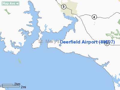
Location & QuickFacts
| FAA Information Effective: | 2008-09-25 |
| Airport Identifier: | 8MD7 |
| Airport Status: | Operational |
| Longitude/Latitude: | 076-39-35.0000W/38-14-19.0000N
-76.659722/38.238611 (Estimated) |
| Elevation: | 25 ft / 7.62 m () |
| Land: | 0 acres |
| From nearest city: | 3 nautical miles SW of Leonardtown, MD |
| Location: | St Marys County, MD |
| Magnetic Variation: | 11W (2000) |
Owner & Manager
| Ownership: | Privately owned |
| Owner: | John Junek |
| Address: | 20770 Sinclair Lane
Leonardtown, ME 20650 |
| Phone number: | 301-475-2988 |
| Manager: | John Junek |
| Address: | 20770 Sinclair Lane
Leonardtown, ME 20650 |
| Phone number: | 303-475-2988 |
Airport Operations and Facilities
| Airport Use: | Private |
| Wind indicator: | Yes |
| Segmented Circle: | No |
| Control Tower: | No |
| Sectional chart: | Washington |
| Region: | AEA - Eastern |
| Boundary ARTCC: | ZDC - Washington |
| Tie-in FSS: | DCA - Leesburg |
| FSS Toll Free: | 1-800-WX-BRIEF |
Runway Information
Runway 11/29
| Dimension: | 1000 x 80 ft / 304.8 x 24.4 m |
| Surface: | TURF, Good Condition |
| |
Runway 11 |
Runway 29 |
| Traffic Pattern: | Left | Left |
| Displaced threshold: | 300.00 ft | 0.00 ft |
| Obstruction: | 60 ft trees, 900.0 ft from runway | 60 ft trees |
|
Radio Navigation Aids
| ID |
Type |
Name |
Ch |
Freq |
Var |
Dist |
| NHK | NDB | Patuxent | | 400.00 | 10W | 12.4 nm |
| APH | NDB | A P Hill | | 396.00 | 10W | 32.7 nm |
| VKX | NDB | Potomac | | 241.00 | 10W | 33.7 nm |
| CGE | NDB | Cambridge | | 355.00 | 10W | 34.6 nm |
| DC | NDB | Oxonn | | 332.00 | 11W | 36.1 nm |
| EZF | NDB | Shannon | | 237.00 | 10W | 37.4 nm |
| ESN | NDB | Easton | | 212.00 | 10W | 43.9 nm |
| GTN | NDB | Georgetown | | 323.00 | 09W | 46.9 nm |
| LJK | NDB | Ashey | | 280.00 | 09W | 47.9 nm |
| DCA | VOR/DME | Washington | 047X | 111.00 | 09W | 41.3 nm |
| PXT | VORTAC | Patuxent | 123X | 117.60 | 10W | 12.6 nm |
| OTT | VORTAC | Nottingham | 084X | 113.70 | 10W | 28.4 nm |
| BRV | VORTAC | Brooke | 092X | 114.50 | 09W | 33.2 nm |
| ADW | VORTAC | Andrews | 078X | 113.10 | 10W | 35.5 nm |
| HCM | VORTAC | Harcum | 025X | 108.80 | 07W | 47.5 nm |
| ADW | VOT | Andrews Afb | | 109.60 | | 34.6 nm |
| DCA | VOT | Washington National | | 109.40 | | 40.5 nm |
Remarks
- SEE AIRSPACE LETTER DATED 4/13/2000 FOR CONDITIONS.
Images and information placed above are from
http://www.airport-data.com/airport/8MD7/
We thank them for the data!
| General Info
|
| Country |
United States
|
| State |
MARYLAND
|
| FAA ID |
8MD7
|
| Latitude |
38-14-19.000N
|
| Longitude |
076-39-35.000W
|
| Elevation |
25 feet
|
| Near City |
LEONARDTOWN
|
We don't guarantee the information is fresh and accurate. The data may
be wrong or outdated.
For more up-to-date information please refer to other sources.
|
|


