 |
|
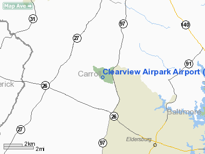
Clearview Airpark Airport |
Location & QuickFacts
| FAA Information Effective: | 2008-09-25 |
| Airport Identifier: | 2W2 |
| Airport Status: | Operational |
| Longitude/Latitude: | 077-01-02.8000W/39-28-01.3000N
-77.017444/39.467028 (Estimated) |
| Elevation: | 799 ft / 243.54 m (Surveyed) |
| Land: | 49 acres |
| From nearest city: | 7 nautical miles S of Westminster, MD |
| Location: | Carroll County, MD |
| Magnetic Variation: | 11W (2000) |
Owner & Manager
| Ownership: | Privately owned |
| Owner: | Clearview Airport Inc |
| Address: | 526 Oak Tree Rd
Westminster, MD 21157 |
| Phone number: | 410-795-1176 |
| Manager: | Thomas Chapman |
| Address: | 503 Oak Tree Rd
Westminster, MD 21157 |
| Phone number: | 410-795-1176 |
Airport Operations and Facilities
| Airport Use: | Open to public |
| Wind indicator: | Yes |
| Segmented Circle: | No |
| Control Tower: | No |
| Lighting Schedule: | RDO-CTL
ACTVT LIRL RY 14/32 & ROTG BCN - CTAF. |
| Beacon Color: | Clear-Green (lighted land airport) |
| Landing fee charge: | No |
| Sectional chart: | Washington |
| Region: | AEA - Eastern |
| Traffic Pattern Alt: | 1000 ft |
| Boundary ARTCC: | ZNY - New York |
| Responsible ARTCC: | ZDC - Washington |
| Tie-in FSS: | DCA - Leesburg |
| FSS on Airport: | No |
| FSS Toll Free: | 1-800-WX-BRIEF |
| NOTAMs Facility: | DCA (NOTAM-d service avaliable) |
Airport Communications
| CTAF: | 122.800 |
| Unicom: | 122.800 |
Airport Services
| Fuel available: | 100LL |
| Airframe Repair: | NONE |
| Power Plant Repair: | NONE |
| Bottled Oxygen: | NONE |
| Bulk Oxygen: | NONE |
Runway Information
Runway 14/32
| Dimension: | 1840 x 30 ft / 560.8 x 9.1 m |
| Surface: | ASPH, Good Condition |
| Edge Lights: | Non-standard lighting system
RY 14/32 NSTD LIRL, LGTS 20 FT FM EDGE OF RY. |
| |
Runway 14 |
Runway 32 |
| Longitude: | 077-01-12.4099W | 077-00-53.1009W |
| Latitude: | 39-28-06.4228N | 39-27-56.1083N |
| Elevation: | 760.00 ft | 799.00 ft |
| Alignment: | 125 | 127 |
| Traffic Pattern: | Left | Left |
| Markings: | Non-precision instrument, Good Condition | Non-precision instrument, Good Condition |
| Crossing Height: | 20.00 ft | 34.00 ft |
| Displaced threshold: | 0.00 ft | 278.00 ft |
| VASI: | system of panels on left side that may or may not be lighted | system of panels on left side that may or may not be lighted |
| Visual Glide Angle: | 4.00° | 7.00° |
| Obstruction: | 60 ft trees, 870.0 ft from runway, 138 ft left of centerline, 11:1 slope to clear
+50 FT TREES 125 FT L OF THLD. | 22 ft trees, 213.0 ft from runway, 128 ft left of centerline
RY 32 APCH RATIO 34:1 TO DSPLCD THLD.
PRIVATE DRIVEWAY AT THLD; +15 FT HOUSE 100 FT LEFT OF THLD. |
|
Radio Navigation Aids
| ID |
Type |
Name |
Ch |
Freq |
Var |
Dist |
| FND | NDB | Ellicott | | 371.00 | 11W | 15.5 nm |
| GAI | NDB | Gaithersburg | | 385.00 | 09W | 19.2 nm |
| IUB | NDB | Institute | | 404.00 | 08W | 21.2 nm |
| BUH | NDB | Anne Arundel | | 260.00 | 10W | 25.9 nm |
| EUD | NDB | York | | 254.00 | 11W | 28.0 nm |
| MTN | NDB | Martin | | 342.00 | 11W | 31.3 nm |
| GTN | NDB | Georgetown | | 323.00 | 09W | 32.7 nm |
| DC | NDB | Oxonn | | 332.00 | 11W | 42.1 nm |
| APG | NDB | Aberdeen | | 349.00 | 11W | 42.5 nm |
| VKX | NDB | Potomac | | 241.00 | 10W | 43.3 nm |
| GDX | NDB | Goodwin Lake | | 227.00 | 08W | 48.9 nm |
| MTN | TACAN | Martin | 068X | | 11W | 29.3 nm |
| FDK | VOR | Frederick | | 109.00 | 08W | 16.9 nm |
| HGR | VOR | Hagerstown | | 109.80 | 07W | 41.2 nm |
| DCA | VOR/DME | Washington | 047X | 111.00 | 09W | 36.5 nm |
| PPM | VOR/DME | Phillips | 021X | 108.40 | 09W | 39.3 nm |
| EMI | VORTAC | Westminster | 126X | 117.90 | 08W | 2.5 nm |
| BAL | VORTAC | Baltimore | 098X | 115.10 | 11W | 24.3 nm |
| AML | VORTAC | Armel | 082X | 113.50 | 08W | 38.2 nm |
| MRB | VORTAC | Martinsburg | 058X | 112.10 | 07W | 38.9 nm |
| ADW | VORTAC | Andrews | 078X | 113.10 | 10W | 40.3 nm |
| OTT | VORTAC | Nottingham | 084X | 113.70 | 10W | 47.5 nm |
| DCA | VOT | Washington National | | 109.40 | | 37.4 nm |
| ADW | VOT | Andrews Afb | | 109.60 | | 41.3 nm |
| MDT | VOT | Harrisburg International | | 110.00 | | 45.5 nm |
Remarks
- 60 FT DROP OFF 125 FT FM AER 14.
- ULTRALIGHT ACTIVITY ON & INVOF ARPT.
- UNLIMITED VEHICLE ACCESS TO ACFT MOVEMENT AREAS.
Images and information placed above are from
http://www.airport-data.com/airport/2W2/
We thank them for the data!
| General Info
|
| Country |
United States
|
| State |
MARYLAND
|
| FAA ID |
2W2
|
| Latitude |
39-28-01.300N
|
| Longitude |
077-01-02.800W
|
| Elevation |
799 feet
|
| Near City |
WESTMINSTER
|
We don't guarantee the information is fresh and accurate. The data may
be wrong or outdated.
For more up-to-date information please refer to other sources.
|
|


