 |
|
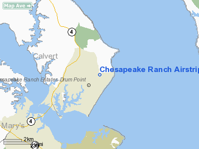
Chesapeake Ranch Airstrip Airport |
Location & QuickFacts
| FAA Information Effective: | 2008-09-25 |
| Airport Identifier: | MD50 |
| Airport Status: | Operational |
| Longitude/Latitude: | 076-24-18.8200W/38-21-40.4450N
-76.405228/38.361235 (Estimated) |
| Elevation: | 116 ft / 35.36 m (Surveyed) |
| Land: | 45 acres |
| From nearest city: | 4 nautical miles SE of Lusby, MD |
| Location: | Calvert County, MD |
| Magnetic Variation: | 10W (1985) |
Owner & Manager
| Ownership: | Privately owned |
| Owner: | Poacre Attn: John Eney |
| Address: | 395 Club House Dr
836 Whispering Pine Circle |
| Phone number: | 410-326-6431 |
| Manager: | John Eney |
| Address: | 12116 Doubletree Lane
Lusby, MD 20657 |
| Phone number: | 410-326-2864 |
Airport Operations and Facilities
| Airport Use: | Private |
| Wind indicator: | Yes |
| Segmented Circle: | Yes |
| Control Tower: | No |
| Lighting Schedule: | RDO-CTL
ACTVT LIRL RY 13/31 - 122.7; LIRL NOT AVBL AFTER 2200. |
| Landing fee charge: | No |
| Sectional chart: | Washington |
| Region: | AEA - Eastern |
| Boundary ARTCC: | ZDC - Washington |
| Tie-in FSS: | DCA - Leesburg |
| FSS on Airport: | No |
| FSS Toll Free: | 1-800-WX-BRIEF |
Airport Communications
Airport Services
| Airframe Repair: | NONE |
| Power Plant Repair: | NONE |
Runway Information
Runway 13/31
| Dimension: | 2500 x 50 ft / 762.0 x 15.2 m |
| Surface: | ASPH, |
| Edge Lights: | Low |
| |
Runway 13 |
Runway 31 |
| Traffic Pattern: | Left | Left |
| Obstruction: | 40 ft trees, 1000.0 ft from runway | |
|
Radio Navigation Aids
| ID |
Type |
Name |
Ch |
Freq |
Var |
Dist |
| NHK | NDB | Patuxent | | 400.00 | 10W | 4.5 nm |
| CGE | NDB | Cambridge | | 355.00 | 10W | 20.5 nm |
| ESN | NDB | Easton | | 212.00 | 10W | 31.0 nm |
| VKX | NDB | Potomac | | 241.00 | 10W | 34.8 nm |
| DC | NDB | Oxonn | | 332.00 | 11W | 38.0 nm |
| APH | NDB | A P Hill | | 396.00 | 10W | 46.4 nm |
| BUH | NDB | Anne Arundel | | 260.00 | 10W | 46.5 nm |
| GTN | NDB | Georgetown | | 323.00 | 09W | 48.0 nm |
| EZF | NDB | Shannon | | 237.00 | 10W | 49.6 nm |
| DCA | VOR/DME | Washington | 047X | 111.00 | 09W | 42.1 nm |
| PXT | VORTAC | Patuxent | 123X | 117.60 | 10W | 4.4 nm |
| OTT | VORTAC | Nottingham | 084X | 113.70 | 10W | 26.2 nm |
| ADW | VORTAC | Andrews | 078X | 113.10 | 10W | 34.5 nm |
| SBY | VORTAC | Salisbury | 049X | 111.20 | 12W | 42.2 nm |
| BRV | VORTAC | Brooke | 092X | 114.50 | 09W | 44.7 nm |
| SWL | VORTAC | Snow Hill | 071X | 112.40 | 08W | 48.1 nm |
| ADW | VOT | Andrews Afb | | 109.60 | | 34.0 nm |
| DCA | VOT | Washington National | | 109.40 | | 41.4 nm |
Remarks
- COMMERCIAL FLD FOR PVT USE OF CHESAPEAKE RANCH ESTATES MEMBERS & GUESTS ONLY.
- VFR ONLY
Images and information placed above are from
http://www.airport-data.com/airport/MD50/
We thank them for the data!
| General Info
|
| Country |
United States
|
| State |
MARYLAND
|
| FAA ID |
MD50
|
| Latitude |
38-21-40.445N
|
| Longitude |
076-24-18.820W
|
| Elevation |
116 feet
|
| Near City |
LUSBY
|
We don't guarantee the information is fresh and accurate. The data may
be wrong or outdated.
For more up-to-date information please refer to other sources.
|
|


