 |
|
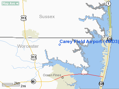
Location & QuickFacts
| FAA Information Effective: | 2008-09-25 |
| Airport Identifier: | 4MD3 |
| Airport Status: | Operational |
| Longitude/Latitude: | 075-09-34.0000W/38-26-23.0000N
-75.159444/38.439722 (Estimated) |
| Elevation: | 23 ft / 7.01 m (Estimated) |
| Land: | 6 acres |
| From nearest city: | 2 nautical miles E of Bishopville, MD |
| Location: | Worcester County, MD |
| Magnetic Variation: | 11W (1990) |
Owner & Manager
| Ownership: | Privately owned |
| Owner: | George Jarman |
| Address: | 11546 Mumford Rd.
Bishopville, MD 21813 |
| Phone number: | 410-352-5419 |
| Address: |
|
Airport Operations and Facilities
| Airport Use: | Private |
| Segmented Circle: | No |
| Control Tower: | No |
| Sectional chart: | Washington |
| Region: | AEA - Eastern |
| Boundary ARTCC: | ZDC - Washington |
| Tie-in FSS: | DCA - Leesburg |
| FSS on Airport: | No |
| FSS Toll Free: | 1-800-WX-BRIEF |
Runway Information
Runway 10/28
| Dimension: | 1775 x 40 ft / 541.0 x 12.2 m |
| Surface: | TURF, |
| |
Runway 10 |
Runway 28 |
| Traffic Pattern: | Left | Left |
| Displaced threshold: | 250.00 ft | 0.00 ft |
|
Radio Navigation Aids
| ID |
Type |
Name |
Ch |
Freq |
Var |
Dist |
| OX | NDB | Landy | | 407.00 | 12W | 5.0 nm |
| CGE | NDB | Cambridge | | 355.00 | 10W | 41.5 nm |
| ESN | NDB | Easton | | 212.00 | 10W | 48.0 nm |
| DOV | TACAN | Dover | 037X | | 09W | 44.1 nm |
| ATR | VOR/DME | Waterloo | 073X | 112.60 | 09W | 22.4 nm |
| SBY | VORTAC | Salisbury | 049X | 111.20 | 12W | 17.5 nm |
| SWL | VORTAC | Snow Hill | 071X | 112.40 | 08W | 27.1 nm |
| SIE | VORTAC | Sea Isle | 095X | 114.80 | 09W | 42.9 nm |
Remarks
- (E111-1) YOU COORDINATE OPNS WITH AT REP AT PATUXTENT RIVER NAS SINCE YOUR ARPT IS BELOW A MTR IR-716.
- PRVDD OPNS LMTD TO DALGT ONLY & NO IFR OPNS CONDUCTED; THR TO BOTH RY ENDS DSPLCD BY 250' TO PRVD A 20:1 APCH SFC; ACFT ARE LMTD TO 3500 LBS GWT OR LESS; YOU COORDINATE OPNS WITH WARRINGTON PRIVATE ARPT TO ASSURE EACH OPERATOR IS FAMILIAR WITH OPERATING PATTERNS & VISUAL CHECKPOINTS;
Images and information placed above are from
http://www.airport-data.com/airport/4MD3/
We thank them for the data!
| General Info
|
| Country |
United States
|
| State |
MARYLAND
|
| FAA ID |
4MD3
|
| Latitude |
38-26-23.000N
|
| Longitude |
075-09-34.000W
|
| Elevation |
23 feet
|
| Near City |
BISHOPVILLE
|
We don't guarantee the information is fresh and accurate. The data may
be wrong or outdated.
For more up-to-date information please refer to other sources.
|
|


