 |
|
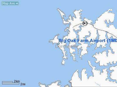
Location & QuickFacts
| FAA Information Effective: | 2008-09-25 |
| Airport Identifier: | 1MD1 |
| Airport Status: | Operational |
| Longitude/Latitude: | 076-17-10.8080W/38-34-08.4340N
-76.286336/38.569009 (Estimated) |
| Elevation: | 4 ft / 1.22 m (Estimated) |
| Land: | 3 acres |
| From nearest city: | 10 nautical miles W of Cambridge, MD |
| Location: | Dorchester County, MD |
| Magnetic Variation: | 10W (1985) |
Owner & Manager
| Ownership: | Privately owned |
| Owner: | Hugh B. Horning |
| Address: | 629 Hills Pt Cove Rd 3
Cambridge, MD 21613 |
| Phone number: | 410-228-7521 |
| Manager: | Hugh B. Horning |
| Address: | 629 Hills Pt Cove Rd 3
Cambridge, MD 21613 |
| Phone number: | 410-228-7521 |
Airport Operations and Facilities
| Airport Use: | Private |
| Wind indicator: | Yes |
| Segmented Circle: | No |
| Control Tower: | No |
| Landing fee charge: | No |
| Sectional chart: | Washington |
| Region: | AEA - Eastern |
| Boundary ARTCC: | ZDC - Washington |
| Tie-in FSS: | DCA - Leesburg |
| FSS on Airport: | No |
| FSS Toll Free: | 1-800-WX-BRIEF |
Runway Information
Runway E/W
| Dimension: | 1600 x 75 ft / 487.7 x 22.9 m |
| Surface: | TURF, |
| |
Runway E |
Runway W |
| Traffic Pattern: | Left | Left |
| Displaced threshold: | 200.00 ft
AND W DSPLCD THRS MARKED WITH THREE CONES EACH SIDE OF RWY. | 300.00 ft |
| Obstruction: | | 60 ft trees, 1000.0 ft from runway |
|
Radio Navigation Aids
| ID |
Type |
Name |
Ch |
Freq |
Var |
Dist |
| CGE | NDB | Cambridge | | 355.00 | 10W | 12.1 nm |
| ESN | NDB | Easton | | 212.00 | 10W | 17.5 nm |
| NHK | NDB | Patuxent | | 400.00 | 10W | 17.9 nm |
| VKX | NDB | Potomac | | 241.00 | 10W | 33.2 nm |
| DC | NDB | Oxonn | | 332.00 | 11W | 36.7 nm |
| BUH | NDB | Anne Arundel | | 260.00 | 10W | 38.1 nm |
| MTN | NDB | Martin | | 342.00 | 11W | 44.1 nm |
| GTN | NDB | Georgetown | | 323.00 | 09W | 44.9 nm |
| IUB | NDB | Institute | | 404.00 | 08W | 46.0 nm |
| FND | NDB | Ellicott | | 371.00 | 11W | 48.9 nm |
| MTN | TACAN | Martin | 068X | | 11W | 46.2 nm |
| DCA | VOR/DME | Washington | 047X | 111.00 | 09W | 39.3 nm |
| PXT | VORTAC | Patuxent | 123X | 117.60 | 10W | 17.7 nm |
| OTT | VORTAC | Nottingham | 084X | 113.70 | 10W | 23.0 nm |
| ADW | VORTAC | Andrews | 078X | 113.10 | 10W | 30.7 nm |
| SBY | VORTAC | Salisbury | 049X | 111.20 | 12W | 38.9 nm |
| BAL | VORTAC | Baltimore | 098X | 115.10 | 11W | 40.2 nm |
| SWL | VORTAC | Snow Hill | 071X | 112.40 | 08W | 49.5 nm |
| ADW | VOT | Andrews Afb | | 109.60 | | 30.8 nm |
| DCA | VOT | Washington National | | 109.40 | | 38.8 nm |
Remarks
- MILITARY JETS LOW FLYING IN AREA.
Images and information placed above are from
http://www.airport-data.com/airport/1MD1/
We thank them for the data!
| General Info
|
| Country |
United States
|
| State |
MARYLAND
|
| FAA ID |
1MD1
|
| Latitude |
38-34-08.434N
|
| Longitude |
076-17-10.808W
|
| Elevation |
4 feet
|
| Near City |
CAMBRIDGE
|
We don't guarantee the information is fresh and accurate. The data may
be wrong or outdated.
For more up-to-date information please refer to other sources.
|
|


