 |
|
Location & QuickFacts
| FAA Information Effective: | 2008-09-25 |
| Airport Identifier: | 1N5 |
| Airport Status: | Operational |
| Longitude/Latitude: | 075-37-00.7000W/38-24-45.6000N
-75.616861/38.412667 (Estimated) |
| Elevation: | 42 ft / 12.80 m (Surveyed) |
| Land: | 55 acres |
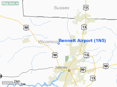
| From nearest city: | 4 nautical miles NW of Salisbury, MD |
| Location: | Wicomico County, MD |
| Magnetic Variation: | 10W (1985) |
Owner & Manager
| Ownership: | Privately owned |
| Owner: | Howard W. Bennett, Jr. |
| Address: | 28890 Naylor Mill Rd
Salisbury, MD 21801 |
| Phone number: | 410-742-9642 |
| Manager: | Howard W. Bennett, Jr. |
| Address: | 28890 Naylor Mill Rd
Salisbury, MD 21801 |
| Phone number: | 410-742-9642 |
Airport Operations and Facilities
| Airport Use: | Open to public |
| Wind indicator: | Yes |
| Segmented Circle: | No |
| Control Tower: | No |
| Lighting Schedule: | DUSK-2300
ACTVT LIRL RY 17/35 - CTAF. |
| Beacon Color: | Clear-Green (lighted land airport) |
| Landing fee charge: | No |
| Sectional chart: | Washington |
| Region: | AEA - Eastern |
| Boundary ARTCC: | ZDC - Washington |
| Tie-in FSS: | DCA - Leesburg |
| FSS on Airport: | No |
| FSS Toll Free: | 1-800-WX-BRIEF |
| NOTAMs Facility: | DCA (NOTAM-d service avaliable) |
Airport Communications
| CTAF: | 122.800 |
| Unicom: | 122.800 |
Airport Services
| Airframe Repair: | NONE |
| Power Plant Repair: | MINOR |
Runway Information
Runway 08/26
| Dimension: | 2270 x 95 ft / 691.9 x 29.0 m |
| Surface: | TURF, Good Condition |
| |
Runway 08 |
Runway 26 |
| Longitude: | 075-37-22.9800W | 075-36-57.3800W |
| Latitude: | 38-24-46.0800N | 38-24-55.9800N |
| Traffic Pattern: | Left | Left |
| Displaced threshold: | 400.00 ft | 300.00 ft |
| Obstruction: | 75 ft trees, 867.0 ft from runway, 11:1 slope to clear
APCH RATIO 20:1 TO DSPLCD THLD. | 64 ft trees, 0.0 ft from runway, 125 ft right of centerline
RWY 26 APCH RATIO 20:1 TO DSPLCD THLD, DISTANT TREES ARE CNTLG. OBSTN. |
|
Runway 17/35
| Dimension: | 3134 x 95 ft / 955.2 x 29.0 m |
| Surface: | TURF, Good Condition |
| Edge Lights: | Low |
| |
Runway 17 |
Runway 35 |
| Longitude: | 075-37-02.4300W | 075-36-45.2500W |
| Latitude: | 38-24-55.6200N | 38-24-27.7300N |
| Traffic Pattern: | Left | Left |
| Crossing Height: | 23.00 ft | 52.00 ft |
| Displaced threshold: | 237.00 ft | 741.00 ft |
| VASI: | system of panels on left side that may or may not be lighted | system of panels on right side that may or may not be lighted |
| Visual Glide Angle: | 4.00° | 5.00° |
| Obstruction: | 10 ft road
RWY 17 APCH RATIO 23:1 TO DSPLCD THLD. | 40 ft pline, 58.0 ft from runway, 1:1 slope to clear
RWY 35 APCH RATIO 19:1 TO DSPLCD THLD. |
|
Radio Navigation Aids
| ID |
Type |
Name |
Ch |
Freq |
Var |
Dist |
| OX | NDB | Landy | | 407.00 | 12W | 20.0 nm |
| CGE | NDB | Cambridge | | 355.00 | 10W | 20.9 nm |
| ESN | NDB | Easton | | 212.00 | 10W | 31.7 nm |
| NHK | NDB | Patuxent | | 400.00 | 10W | 37.8 nm |
| DOV | TACAN | Dover | 037X | | 09W | 43.8 nm |
| ATR | VOR/DME | Waterloo | 073X | 112.60 | 09W | 30.5 nm |
| SBY | VORTAC | Salisbury | 049X | 111.20 | 12W | 6.5 nm |
| SWL | VORTAC | Snow Hill | 071X | 112.40 | 08W | 22.6 nm |
| PXT | VORTAC | Patuxent | 123X | 117.60 | 10W | 37.7 nm |
| ENO | VORTAC | Smyrna | 051X | 111.40 | 09W | 49.5 nm |
Remarks
- ULTRALIGHT ACTIVITY ON & INVOF ARPT.
- +60 FT TREES MID-POINT BOTH SIDES RY 17/35.
- +375 FT LGTD ANTENNA 3200 FT L OF RY 35 THR, ON L DOWNWIND.
- BIRDS & WILDLIFE ON & INVOF ARPT.
- (52-17) FOUR 300' ANTENNAS-LGTD, 1/2 MILE FRM RWY, 500' L OF EXTD CNTRLN.
Images and information placed above are from
http://www.airport-data.com/airport/1N5/
We thank them for the data!
| General Info
|
| Country |
United States
|
| State |
MARYLAND
|
| FAA ID |
1N5
|
| Latitude |
38-24-45.421N
|
| Longitude |
075-36-36.732W
|
| Elevation |
42 feet
|
| Near City |
SALISBURY
|
We don't guarantee the information is fresh and accurate. The data may
be wrong or outdated.
For more up-to-date information please refer to other sources.
|
|


