 |
|
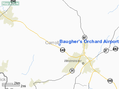
Baugher's Orchard Airport |
Location & QuickFacts
| FAA Information Effective: | 2008-09-25 |
| Airport Identifier: | 07MD |
| Airport Status: | Operational |
| Longitude/Latitude: | 077-03-07.0000W/39-36-30.0000N
-77.051944/39.608333 (Estimated) |
| Elevation: | 700 ft / 213.36 m () |
| Land: | 2 acres |
| From nearest city: | 4 nautical miles NW of Westminster, MD |
| Location: | Carroll County, MD |
| Magnetic Variation: | 11W (2000) |
Owner & Manager
| Ownership: | Privately owned |
| Owner: | Allan Baugher |
| Address: | 1236 Baugher Rd.
Westminster, MD 21158 |
| Phone number: | 410-848-3789 |
| Manager: | Dwight Baugher |
| Address: | 1614 Old Taweytown Rd
Westminster, MD 21158 |
| Phone number: | 410-848-3789 |
Airport Operations and Facilities
| Airport Use: | Private |
| Wind indicator: | Yes |
| Segmented Circle: | No |
| Control Tower: | No |
| Sectional chart: | Washington |
| Region: | AEA - Eastern |
| Boundary ARTCC: | ZNY - New York |
| Tie-in FSS: | DCA - Leesburg |
| FSS Toll Free: | 1-800-WX-BRIEF |
Runway Information
Runway 17/35
| Dimension: | 1000 x 70 ft / 304.8 x 21.3 m |
| Surface: | TURF, |
| |
Runway 17 |
Runway 35 |
| Traffic Pattern: | Right | Left |
|
Radio Navigation Aids
| ID |
Type |
Name |
Ch |
Freq |
Var |
Dist |
| EUD | NDB | York | | 254.00 | 11W | 20.4 nm |
| FND | NDB | Ellicott | | 371.00 | 11W | 23.1 nm |
| GAI | NDB | Gaithersburg | | 385.00 | 09W | 26.9 nm |
| IUB | NDB | Institute | | 404.00 | 08W | 27.7 nm |
| BUH | NDB | Anne Arundel | | 260.00 | 10W | 34.3 nm |
| MTN | NDB | Martin | | 342.00 | 11W | 36.3 nm |
| GTN | NDB | Georgetown | | 323.00 | 09W | 40.9 nm |
| APG | NDB | Aberdeen | | 349.00 | 11W | 44.0 nm |
| MTN | TACAN | Martin | 068X | | 11W | 34.1 nm |
| FDK | VOR | Frederick | | 109.00 | 08W | 19.1 nm |
| HGR | VOR | Hagerstown | | 109.80 | 07W | 37.6 nm |
| PPM | VOR/DME | Phillips | 021X | 108.40 | 09W | 41.7 nm |
| DCA | VOR/DME | Washington | 047X | 111.00 | 09W | 45.0 nm |
| EMI | VORTAC | Westminster | 126X | 117.90 | 08W | 7.6 nm |
| BAL | VORTAC | Baltimore | 098X | 115.10 | 11W | 31.9 nm |
| MRB | VORTAC | Martinsburg | 058X | 112.10 | 07W | 39.3 nm |
| HAR | VORTAC | Harrisburg | 072X | 112.50 | 10W | 41.7 nm |
| AML | VORTAC | Armel | 082X | 113.50 | 08W | 44.9 nm |
| THS | VORTAC | St Thomas | 097X | 115.00 | 07W | 45.9 nm |
| LRP | VORTAC | Lancaster | 120X | 117.30 | 09W | 46.7 nm |
| ADW | VORTAC | Andrews | 078X | 113.10 | 10W | 48.9 nm |
| MDT | VOT | Harrisburg International | | 110.00 | | 37.8 nm |
| DCA | VOT | Washington National | | 109.40 | | 45.9 nm |
| ADW | VOT | Andrews Afb | | 109.60 | | 49.9 nm |
Remarks
- PRVDD VFR ONLY, CLEAR 20:1 APCH/DEP PATH, CLEAR PRIMARY SFC 125 FT EACH SIDE RY CNTRLN, MINIMIZE NOISE OVER RESIDENCES.
Images and information placed above are from
http://www.airport-data.com/airport/07MD/
We thank them for the data!
| General Info
|
| Country |
United States
|
| State |
MARYLAND
|
| FAA ID |
07MD
|
| Latitude |
39-36-30.000N
|
| Longitude |
077-03-07.000W
|
| Elevation |
700 feet
|
| Near City |
WESTMINSTER
|
We don't guarantee the information is fresh and accurate. The data may
be wrong or outdated.
For more up-to-date information please refer to other sources.
|
|


