|
|
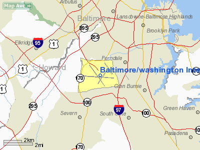
Baltimore/washington International Thurgood Marshal Airport |
| Baltimore/Washington International Thurgood Marshall Airport |
 |
 |
| Airline terminal |
| IATA: BWI – ICAO: KBWI – FAA LID: BWI
Location of BWI
|
| Summary |
| Airport type |
Public |
| Owner |
Maryland Aviation Administration |
| Serves |
Baltimore-Washington Metropolitan Area |
| Location |
Anne Arundel County, near Glen Burnie, Maryland |
| Hub for |
AirTran Airways |
| Elevation AMSL |
146 ft / 45 m |
| Coordinates |
39°10′31″N 076°40′06″W / 39.17528°N 76.66833°W / 39.17528; -76.66833 |
| Website |
www.bwiairport.com |
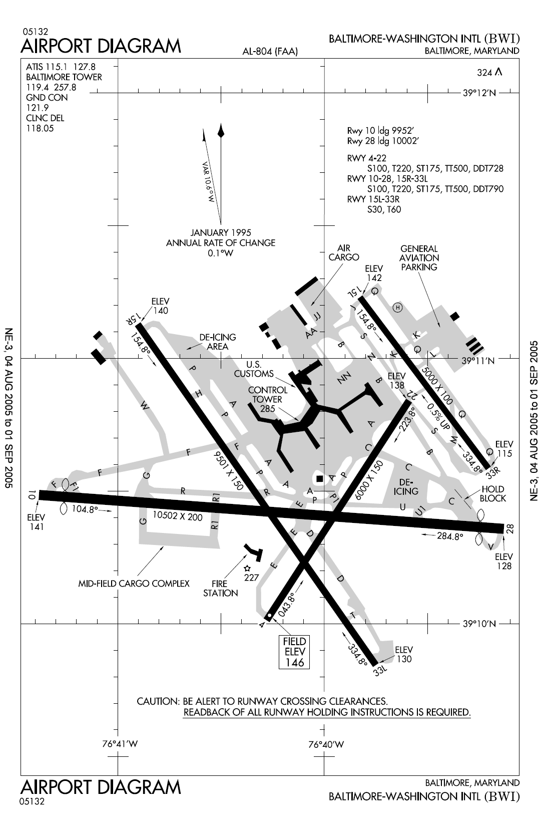
| Runways |
| Direction |
Length |
Surface |
| ft |
m |
| 4/22 |
6,000 |
1,829 |
Asphalt |
| 10/28 |
10,502 |
3,201 |
Asphalt |
| 15L/33R |
5,000 |
1,524 |
Asphalt |
| 15R/33L |
9,501 |
2,896 |
Asphalt |
| Helipads |
| Number |
Length |
Surface |
| ft |
m |
| H1 |
100 |
30 |
Asphalt |
| Statistics (2008) |
| Passengers |
20,488,881 |
| Aircraft operations |
277,662 |
| Based aircraft |
86 (2008) |
| Source: Federal Aviation Administration |
Baltimore/Washington International Thurgood Marshall Airport (IATA: BWI, ICAO: KBWI, FAA LID: BWI) is an international commercial airport serving the Baltimore-Washington Metropolitan Area in the United States. It is commonly called BWI, BWI Airport or BWI Marshall, BWI being an initialism for "Baltimore/Washington International" and the facility's IATA Airport Code. The airport is located in northern unincorporated Anne Arundel County, about 10 miles (16 km) south of Baltimore and 30 miles (48 km) northeast of Washington, D.C. It is adjacent to the Linthicum CDP. It is named after Thurgood Marshall, a Baltimore native and the first African American to serve on the Supreme Court of the United States. BWI is a secondary hub for AirTran Airways and a focus city for Southwest Airlines. 20.96 million passengers passed through BWI in 2009, up 2.78% from 2008's 20.49 million, making it the 24th busiest airport in North America. The airport was also ranked 47th in the world in total aircraft movements. In 2010 BWI was ranked as the best airport of its size (15-25 mil. passengers) in the world by the Airports Council International based on its 2009 Airport Service Quality survey. HistoryPlanning for a new airport on 3,200 acres (13 km²) to serve the Baltimore/Washington area began just after the end of World War II, and ground was broken in 1947. Located in Anne Arundel County, Maryland next to where Friendship Church was razed, Friendship International Airport was dedicated on June 24, 1950, by President Harry Truman. Regular commercial service started the following month. Jet service started in 1958-59 with the first Boeing 707s and Douglas DC-8s.
The State of Maryland, through the Maryland Department of Transportation (MDOT), purchased Friendship International Airport from the City of Baltimore for $36 million in 1972. Under MDOT, the Maryland State Aviation Administration took over airfield operations and grew from three employees to more than 200. Plans to upgrade, improve, and modernize all Maryland airport facilities were announced almost immediately by the Secretary of Transportation, Harry Hughes.
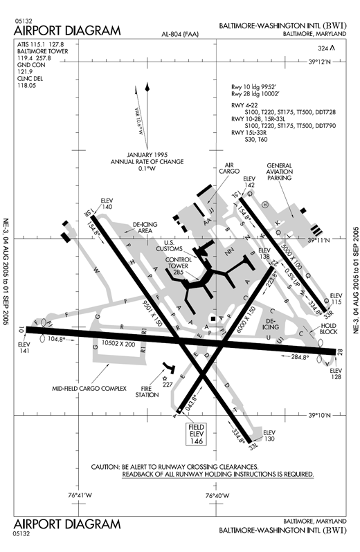 | |
Runway diagram for Baltimore-Washington Airport |
The airport was renamed Baltimore/Washington International Airport in 1973. However, the IATA code remained as "BAL" because "BWI" was already used by another airport until 1982 when it was changed to "BWI". The new name was part of an effort to attract passengers from the Washington-area travel market.
The first phase of BWI modernization was completed in 1974 at a cost of $30 million. Upgrades included improved instrument landing capabilities and runway systems, and construction of three new air cargo terminals, expanding the airport's freight capacity to 2.53 acres (10,200 m).
The passenger terminal renovation program was complete in 1979, the most dramatic work of the airport's modernization. The BWI terminal more than doubled in size to 14.58 acres (59,000 m); the number of gate positions increased from 20 to 27. The total cost of project was $70 million. To continue the work, the BWI Development Council was established to support initiatives for airport development.
The BWI Rail Station opened in 1980, providing a rail connection to passengers on the busy Northeast Corridor though Amtrak. BWI became the first airport in the U.S. to be served by a dedicated intercity rail station. In particular, the station provided relatively easy transit access to Washington, D.C., something Washington Dulles International Airport currently lacks. In the late 1990s, a new international terminal (Concourse E) was added, though Dulles continues to hold the lion's share of the region's international flights, and BWI has not attracted many long-haul international carriers. Air Jamaica and British Airways have had a presence at BWI for many years. AerLingus, Air Aruba, Air Greenland, El Al, Ghana Airways, Icelandair, KLM, and Mexicana previously flew to BWI. Military flights, operated by the U.S. Air Force's Air Mobility Command, continue to have a significant presence at BWI.
Beginning in the 1980s, and later for much of the 1990s, BWI was a major hub for Piedmont Airlines and successor US Airways, but that airline's financial difficulties in the wake of the dot-com bust, the September 11 attacks, and intense low fare competition forced it to significantly reduce its presence at the airport. The airport has been a major haven for low-cost flights in the Baltimore/Washington Metropolitan Area since Southwest Airlines' arrival in September 1993 and subsequent expansion in the early 2000s. Southwest is now the airport's largest carrier, accounting for 51.90% of passengers carried in 2008. In terms of daily departures BWI is now Southwest's 3rd most-served destination. Other major airlines with a significant presence at the airport are AirTran (13.98%), Delta Air Lines (7.12%), US Airways (6.48%) and United Airlines (5.74%).
To accommodate Southwest's extensive presence at the airport, in 2005 Concourses A and B were expanded, renovated, and integrated with one another to house all of that airline's operations there. This new facility opened on May 22, 2005. On October 1 of that year, the airport was renamed again, to Baltimore/Washington International Thurgood Marshall Airport, to honor the former US Supreme Court justice, who grew up in Baltimore.
The more recent renaming has not resulted in a change to the IATA and ICAO locater codes.
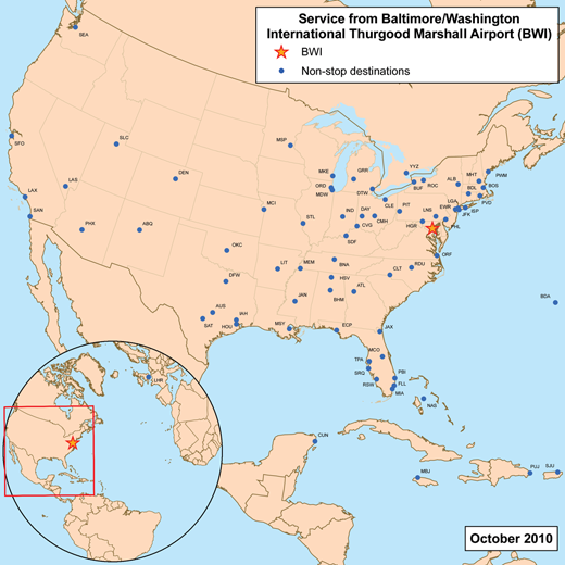 | |
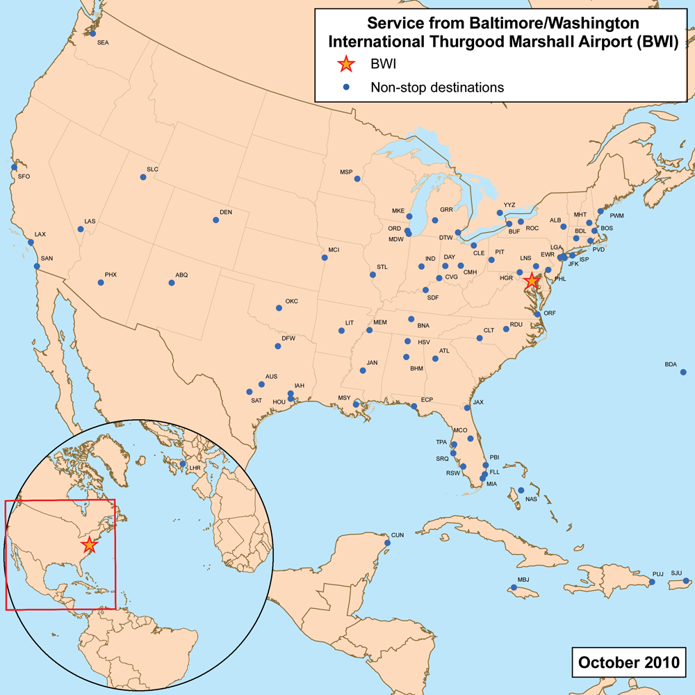
Destinations with direct service from BWI |
The airport has been a backdrop in numerous films, including The Silence of the Lambs, Goldfinger, Broadcast News, and Twelve Monkeys.
In late 2008, Health Magazine named BWI the second healthiest airport in the United States. In 2009 the airport had a six percent increase in air travelers due to the proliferation of discount flights. In a 2009 survey of airport service quality by Airports Council International, BWI was the world's top ranking airport in the 15-to-25-million-passenger category. BWI also ranked seventh, in medium sized airports, based on customer satisfaction conducted by J.D Power and Associates.
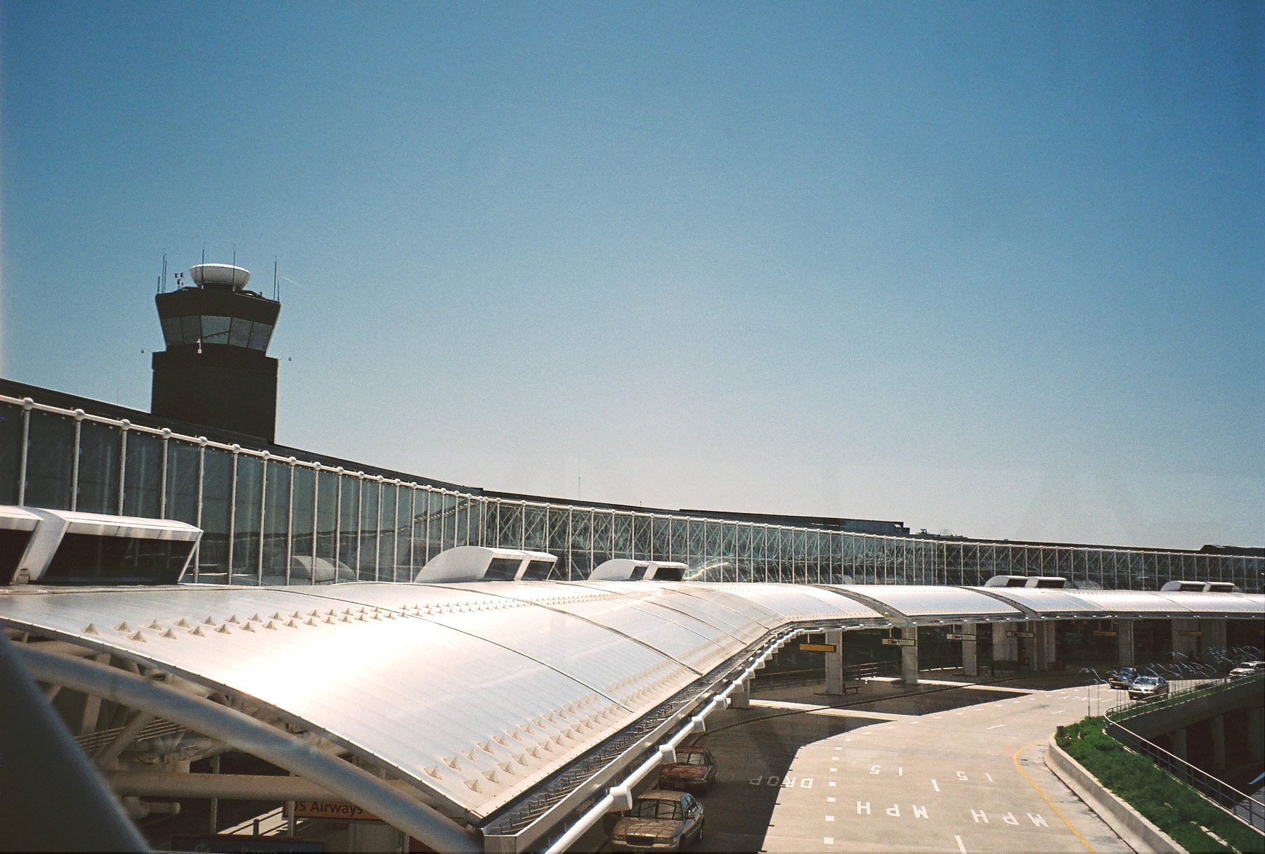
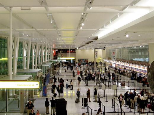
Terminals
Baltimore/Washington International Thurgood Marshall Airport has five concourses, though Concourses A and B were essentially merged into a single concourse in the renovations completed in 2005.
- Concourses A/B
-
- Note: Concourses A and B are both only used by Southwest Airlines.
- Concourse C
- Concourse D
-
- Note: All international arrivals from non pre-cleared destinations are handled at Concourse E.
- Concourse E
-
- Officially called the Governor William Donald Schaefer International Terminal.
- The Air Mobility Command also has a post in Concourse E flying active service troops out to worldwide destinations.
Airlines and destinations
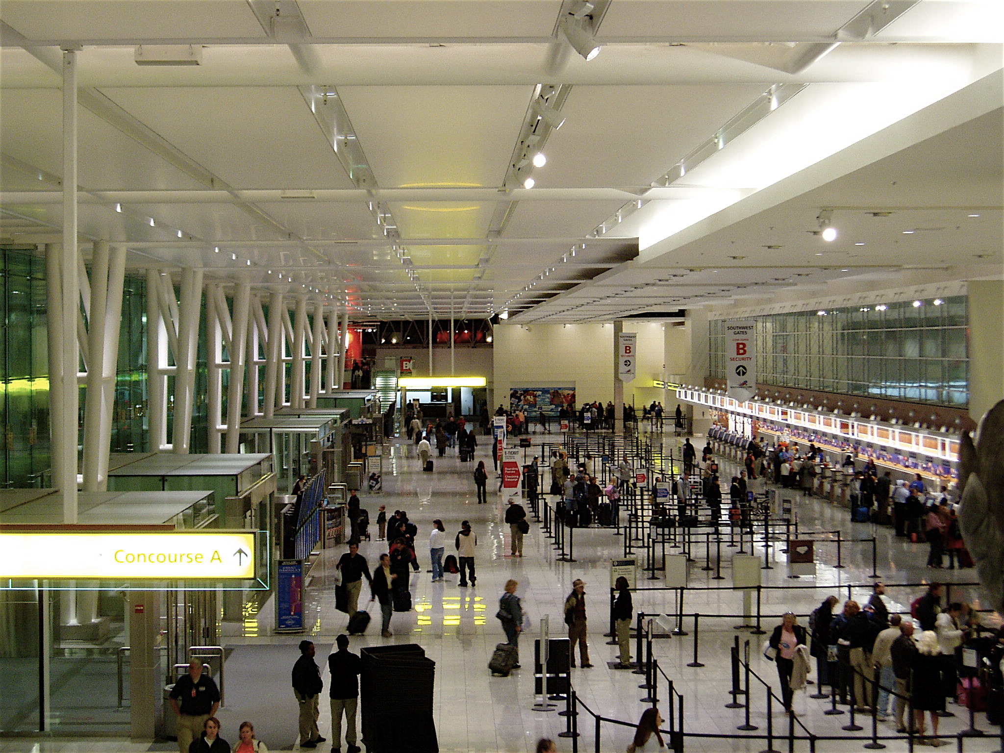
 | |
New Southwest Airlines ticket counter in the Concourse A-B expansion |
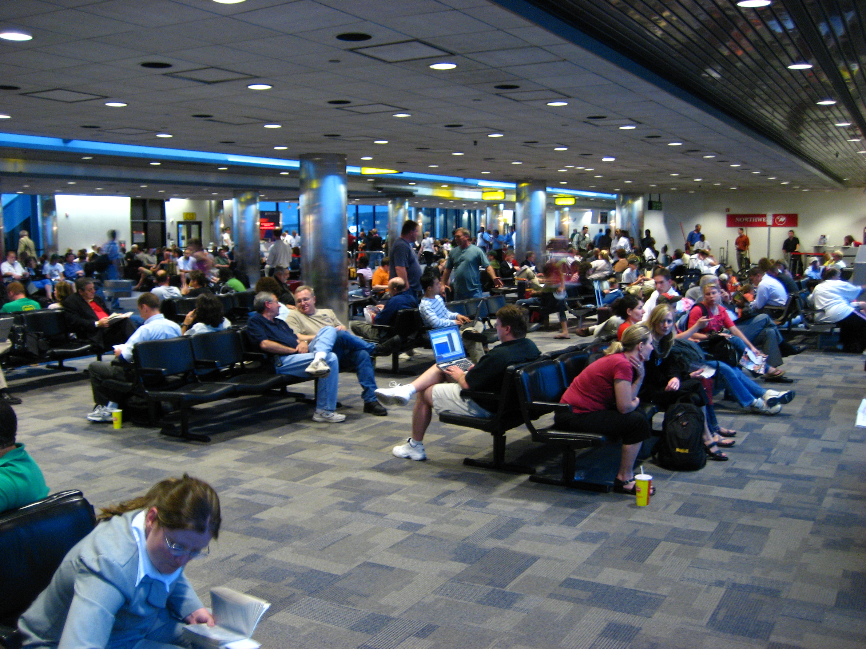
 | |
Passengers wait in Terminal C for a storm to pass |
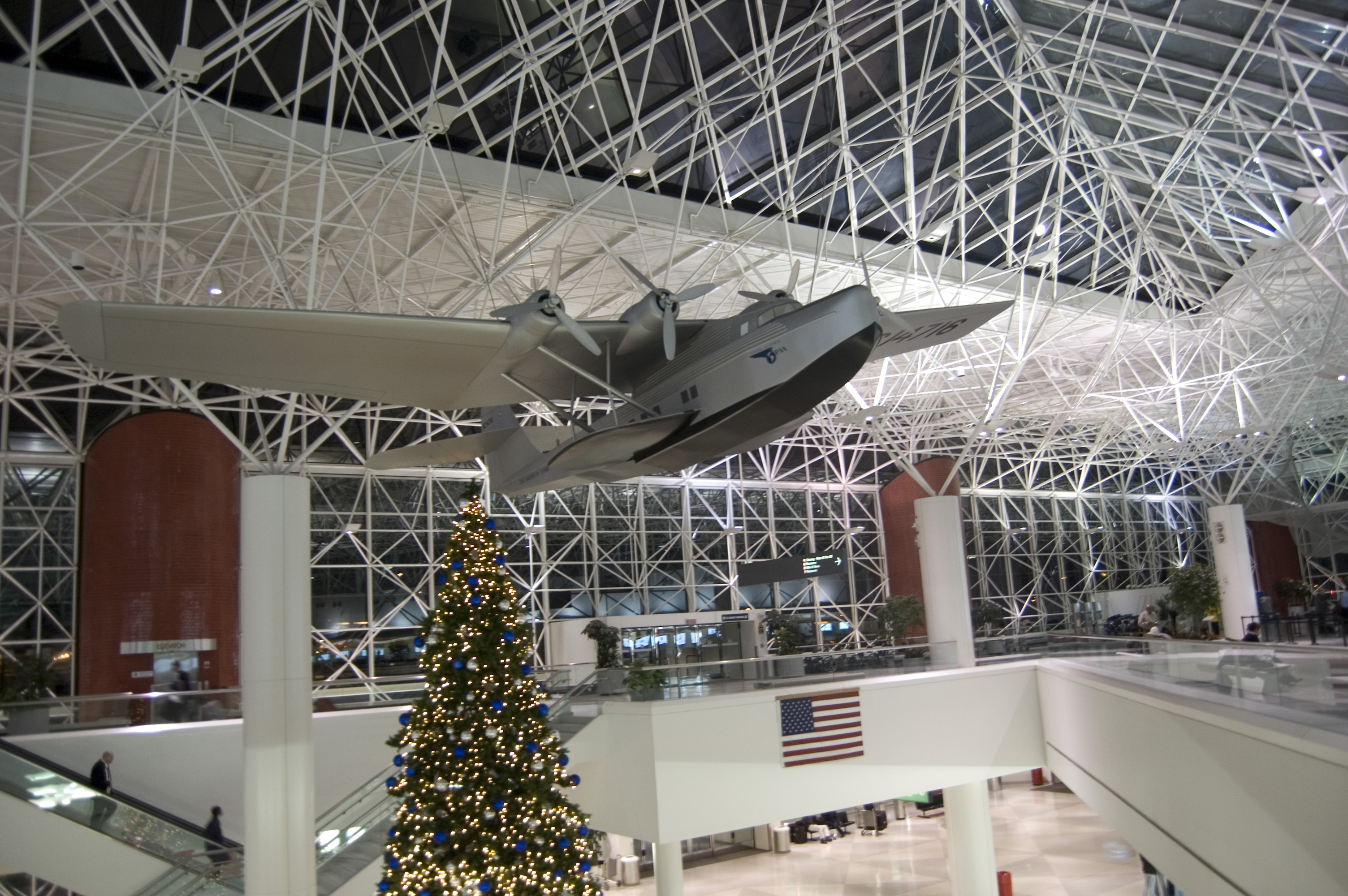
 | |
International terminal (Pier E) |
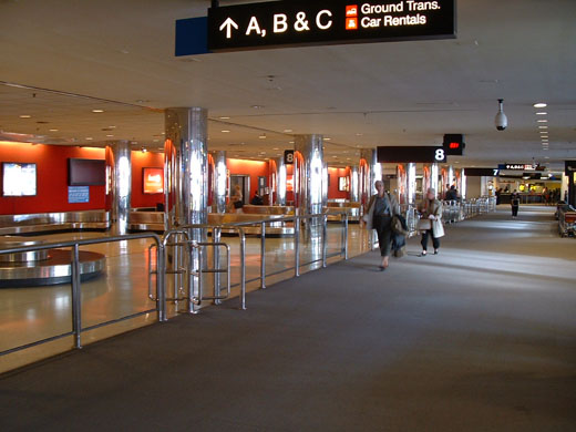 | |
Baggage claim area at the Baltimore/Washington International Airport. |
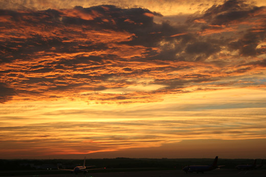 | |
View at sunset from Concourse A with Southwest 737s parked. Southwest operates at A and B. |
| Airlines |
Destinations |
Concourse |
| Air Canada Jazz |
Toronto-Pearson |
E |
| AirTran Airways |
Atlanta, Boston, Cancún, Charlotte, Dayton, Ft Lauderdale, Ft Myers, Grand Rapids, Huntsville, Indianapolis, Jacksonville, Los Angeles, Miami, Milwaukee, Montego Bay, Nassau, New Orleans, Orlando, Portland (ME), Rochester (NY), San Juan, Sarasota, Tampa
Seasonal: Dallas/Fort Worth, San Antonio, Seattle/Tacoma, West Palm Beach |
D
|
| American Airlines |
Dallas/Fort Worth, Miami, San Juan [ends April 4] |
C |
| American Eagle |
Chicago-O'Hare, New York-JFK |
C |
| British Airways |
London-Heathrow |
E |
| Cape Air |
Hagerstown, Lancaster |
D |
| Continental Airlines |
Houston-Intercontinental |
D |
| Continental Connection operated by Colgan Air |
Cleveland |
D |
| Continental Express operated by Chautauqua Airlines |
Cleveland [ends October 15] |
D |
| Continental Express operated by ExpressJet Airlines |
Cleveland, Newark |
D |
| Delta Air Lines |
Atlanta, Detroit, Memphis, Minneapolis/St. Paul, Salt Lake City |
C |
| Delta Connection operated by Comair |
Cincinnati/Northern Kentucky, Memphis, New York-JFK |
C |
| Delta Connection operated by Freedom Airlines |
Cincinnati/Northern Kentucky |
C |
| Delta Connection operated by Pinnacle Airlines |
Memphis, New York-JFK |
C |
| JetBlue Airways |
Boston |
C |
| Southwest Airlines |
Albany (NY), Albuquerque, Austin, Birmingham (AL), Boston, Buffalo, Chicago-Midway, Cleveland, Columbus (OH), Denver, Detroit, Ft Lauderdale, Ft Myers, Hartford, Houston-Hobby, Indianapolis, Jackson, Jacksonville, Kansas City, Las Vegas, Little Rock, Long Island/Islip, Los Angeles, Louisville, Manchester (NH), Milwaukee, Nashville, New Orleans, New York–LaGuardia, Norfolk, Oklahoma City, Orlando, Panama City (FL), Phoenix, Pittsburgh, Providence, Raleigh/Durham, St. Louis, Salt Lake City, San Antonio, San Diego, Tampa, West Palm Beach
Seasonal: Seattle/Tacoma |
A & B
|
| United Airlines |
Chicago-O'Hare, Denver, Los Angeles, San Francisco |
D |
| USA3000 Airlines (seasonal) |
Bermuda, Cancún, Punta Cana |
E |
| US Airways |
Charlotte, Philadelphia, Phoenix |
D |
| US Airways Express operated by Air Wisconsin |
New York-LaGuardia, Philadelphia |
D |
| US Airways Express operated by Chautauqua Airlines |
New York-LaGuardia, Philadelphia |
D |
| US Airways Express operated by Mesa Airlines |
Charlotte, Philadelphia |
D |
| US Airways Express operated by Piedmont Airlines |
New York-LaGuardia, Philadelphia |
D |
| US Airways Express operated by PSA Airlines |
Philadelphia |
D |
| US Airways Express operated by Republic Airlines |
Charlotte, Philadelphia |
D |
Other Services
- Locair operates flights to Beckley, West Virginia out of the Signature General Aviation Facility.
- Pet Airways serves Farmingdale, New York also out of the Signature General Aviation Facility.
Cargo Services
- Fedex Express
- UPS
- World Airways Cargo
Airline lounges
- British Airways operates a British Airways Chesapeake Club Lounge in Concourse E, near entrance to the concourse. This facility, while operated by British Airways, is a common-use facility available to passengers of all international concourse airlines.
- USO operates a lounge on the lower level of the Terminal between Concourses D and E for United States Military personnel and their families.
Operations
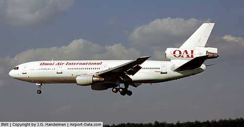
For the 12-month period ending December 31, 2008, the airport had 277,662 aircraft operations, an average of 761 per day: 90% air carrier, 10% general aviation and less than 1% military operations. There were 86 aircraft based at the airport: 58 single engine, 16 multi-engine, and 12 jets. With winds from the north or west, aircraft will generally land on runway 33L and depart on runway 28. When the winds are from the south or east, arrivals are on runway 10 and departures are on runway 15R. Use of the smaller parallel runway (33R/15L) is restricted to smaller propeller-driven aircraft and small corporate jets. Runway 4/22 is closed for landings and takeoffs however it is used for taxing and turnoffs. The largest planes that land at BWI are Boeing 757's, Mcdonell Douglas DC-10-30's, and British Airways' Boeing 767.
Ground transportation
BWI was ranked one of the "Top 10 Easiest U.S. Airports to Get to" by Aviation.com in 2007 and is one of a small number of airports with a light rail station in the main terminal.
Rail
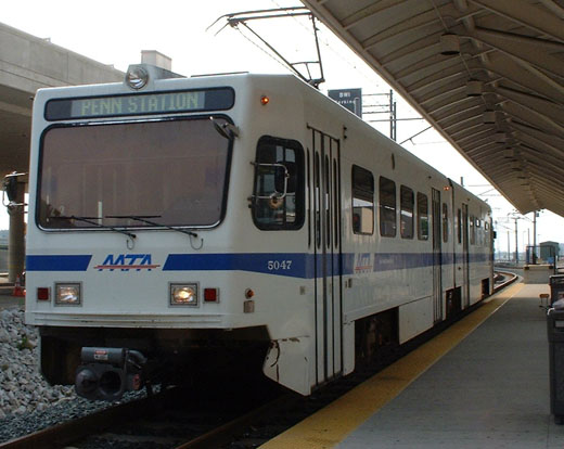 | |
Light rail train at BWI station |
BWI Rail Station is located about a mile from the airport terminal; a free shuttle bus connects the train station and airport terminals. The station is served by Amtrak Northeast Corridor trains and, on weekdays, by the MARC Penn Line. Travel time by train is about ten minutes to Baltimore's Penn Station and thirty-five minutes to Union Station in Washington, D.C. Trains depart at least once an hour seven days a week, with departure times during rush hours and business hours being significantly more frequent.
The Maryland Transit Administration's Light Rail line has a stop just outside the entrance to the airport's International Terminal. Passengers can take the Light Rail to a variety of destinations in Anne Arundel County, Baltimore City, and Baltimore County, and can transfer to the Metro Subway in Baltimore, or to either of MARC's Baltimore terminals. A ride downtown takes approximately 30 minutes. Trains run every 20 minutes during peak hours, and 30 minutes all other times.
Buses
Bus service between BWI and the Greenbelt station of the Washington Metro and MARC Camden Line is provided by WMATA's Metrobus on Route B30 every 40 minutes 6am-10pm weekdays and 9am-10pm on weekends.
The Maryland Transit Administration's Bus Route 17 serves BWI 24 hours a day, 7 days a week. During the hours when the Light Rail operates, buses operate to the Patapsco Light Rail Stop. When the Light Rail is not in service, buses operate to Downtown Baltimore.
Howard Transit's Silver route operates between BWI and The Mall in Columbia hourly at most times except overnight.
Annapolis Transit's Route C-60 operates between BWI and Annapolis.
Highway
BWI is located at the southeast terminus of Interstate 195, a spur route providing connections to the Baltimore-Washington Parkway and Interstate 95.
The above content comes from Wikipedia and is published under free licenses – click here to read more.
|
 |
(Click on the photo to enlarge) |
|
 |
(Click on the photo to enlarge) |
|
 |
(Click on the photo to enlarge) |
|
 |
(Click on the photo to enlarge) |
Location & QuickFacts
| FAA Information Effective: | 2008-09-25 |
| Airport Identifier: | BWI |
| Airport Status: | Operational |
| Longitude/Latitude: | 076-40-06.0000W/39-10-31.3000N
-76.668333/39.175361 (Estimated) |
| Elevation: | 146 ft / 44.50 m (Surveyed) |
| Land: | 3160 acres |
| From nearest city: | 9 nautical miles S of Baltimore, MD |
| Location: | Anne Arundel County, MD |
| Magnetic Variation: | 11W (2000) |
Owner & Manager
| Ownership: | Publicly owned |
| Owner: | State Of Maryland |
| Address: | Po Box 8766
Bwi Airport, MD 21240-0766 |
| Phone number: | 410-859-7100 |
| Manager: | John Stewart |
| Address: | Po Box 8766
Bwi Airport, MD 21240-0766 |
| Phone number: | 410-859-7018 |
Airport Operations and Facilities
| Airport Use: | Open to public |
| Wind indicator: | Yes |
| Segmented Circle: | No |
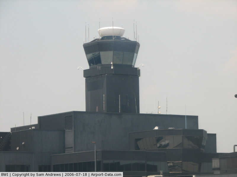
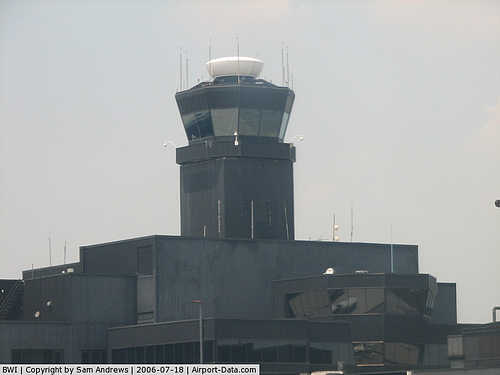
| Control Tower: | Yes |
| Lighting Schedule: | DUSK-DAWN |
| Beacon Color: | Clear-Green (lighted land airport) |
| Landing fee charge: | Yes |
| Sectional chart: | Washington |
| Region: | AEA - Eastern |
| Boundary ARTCC: | ZDC - Washington |
| Tie-in FSS: | DCA - Leesburg |
| FSS on Airport: | No |
| FSS Toll Free: | 1-800-WX-BRIEF |
| NOTAMs Facility: | BWI (NOTAM-d service avaliable) |
| Certification type/date: | I D S 05/1973 |
| Federal Agreements: | NGHY |
Airport Communications
Airport Services
| Fuel available: | 100LLA |
| Airframe Repair: | MAJOR |
| Power Plant Repair: | MAJOR |
| Bottled Oxygen: | HIGH/LOW |
| Bulk Oxygen: | HIGH/LOW |
Runway Information
Runway 04/22
| Dimension: | 6000 x 150 ft / 1828.8 x 45.7 m |
| Surface: | ASPH, Fair Condition |
| Surface Treatment: | Saw-cut or plastic Grooved |
| Weight Limit: | Single wheel: 100000 lbs.
Dual wheel: 220000 lbs.
Dual tandem wheel: 500000 lbs.
Dual dual tandem wheel: 728000 lbs. |
| Edge Lights: | High |
| |
Runway 04 |
Runway 22 |
| Longitude: | 076-40-16.9238W | 076-39-35.2074W |
| Latitude: | 39-10-00.7613N | 39-10-50.3846N |
| Elevation: | 146.00 ft | 138.00 ft |
| Alignment: | 33 | 127 |
| Traffic Pattern: | Left | Left |
| Markings: | Non-precision instrument, Good Condition | Non-precision instrument, Fair Condition |
| Crossing Height: | 49.00 ft | 47.00 ft |
| VASI: | 4-box on left side | 4-box on left side |
| Visual Glide Angle: | 3.00° | 3.00° |
| Runway End Identifier: | Yes | Yes |
| Obstruction: | 51 ft tree, 2190.0 ft from runway, 500 ft left of centerline, 39:1 slope to clear | 60 ft pole, 1920.0 ft from runway, 330 ft left of centerline, 28:1 slope to clear |
| Decleard distances: | Take off run available 6000.00 ft
Take off distance available 6000.00 ft
Actual stop distance available 6000.00 ft
Landing distance available 6000.00 ft
| Take off run available 6000.00 ft
Take off distance available 6000.00 ft
Actual stop distance available 6000.00 ft
Landing distance available 6000.00 ft
|
|
Runway 10/28
| Dimension: | 10502 x 200 ft / 3201.0 x 61.0 m |
| Surface: | ASPH, Fair Condition |
| Surface Treatment: | Saw-cut or plastic Grooved |
| Weight Limit: | Single wheel: 100000 lbs.
Dual wheel: 220000 lbs.
Dual tandem wheel: 500000 lbs.
Dual dual tandem wheel: 790000 lbs. |
| Edge Lights: | High |
| |
Runway 10 |
Runway 28 |
| Longitude: | 076-41-22.6260W | 076-39-09.6336W |
| Latitude: | 39-10-29.0898N | 39-10-21.4755N |
| Elevation: | 139.00 ft | 126.00 ft |
| Alignment: | 94 | 127 |
| ILS Type: | ILS
| ILS
|
| Traffic Pattern: | Left | Left |
| Markings: | Precision instrument, Good Condition | Precision instrument, Good Condition |
| Crossing Height: | 0.00 ft | 60.00 ft |
| Displaced threshold: | 550.00 ft | 500.00 ft |
| VASI: | | 4-box on left side |
| Visual Glide Angle: | 0.00° | 3.00° |
| RVR Equipment: | touchdown, midfield, rollout | touchdown, midfield, rollout |
| Approach lights: | ALSF2 | MALSR |
| Centerline Lights: | Yes | Yes |
| Touchdown Lights: | Yes | |
| Obstruction: | 43 ft tree, 1770.0 ft from runway, 400 ft right of centerline, 36:1 slope to clear
RY 10 APCH RATIO 50:1 TO DSPLCD THLD. | 28 ft tree, 1200.0 ft from runway, 420 ft right of centerline, 35:1 slope to clear
RY 28 APCH RATIO 50:1 TO DSPLCD THLD. |
| Decleard distances: | Take off run available 10502.00 ft
Take off distance available 11202.00 ft
Actual stop distance available 10502.00 ft
Landing distance available 9952.00 ft
| Take off run available 10502.00 ft
Take off distance available 10502.00 ft
Actual stop distance available 10502.00 ft
Landing distance available 10002.00 ft
|
|
Runway 15L/33R
| Dimension: | 5000 x 100 ft / 1524.0 x 30.5 m |
| Surface: | ASPH, Fair Condition |
| Surface Treatment: | Saw-cut or plastic Grooved |
| Weight Limit: | Single wheel: 30000 lbs.
Dual wheel: 60000 lbs. |
| Edge Lights: | High |
| |
Runway 15L |
Runway 33R |
| Longitude: | 076-39-48.7449W | 076-39-11.6303W |
| Latitude: | 39-11-14.5443N | 39-10-34.4482N |
| Elevation: | 142.00 ft | 114.00 ft |
| Alignment: | 127 | 127 |
| ILS Type: | ILS
| ILS
|
| Traffic Pattern: | Left | Left |
| Markings: | Precision instrument, Good Condition | Precision instrument, Good Condition |
| Crossing Height: | 47.00 ft | 56.00 ft |
| VASI: | 4-light PAPI on left side | 4-light PAPI on left side |
| Visual Glide Angle: | 3.00° | 3.00° |
| RVR Equipment: | touchdown | touchdown |
| Approach lights: | | MALSR |
| Runway End Identifier: | Yes | Yes |
| Obstruction: | 115 ft tree, 3220.0 ft from runway, 110 ft right of centerline, 26:1 slope to clear | 7 ft tree, 310.0 ft from runway, 400 ft right of centerline, 15:1 slope to clear |
| Decleard distances: | Take off run available 5000.00 ft
Take off distance available 5000.00 ft
Actual stop distance available 5000.00 ft
Landing distance available 5000.00 ft
| Take off run available 5000.00 ft
Take off distance available 5000.00 ft
Actual stop distance available 5000.00 ft
Landing distance available 5000.00 ft
|
|
Runway 15R/33L
| Dimension: | 9501 x 150 ft / 2895.9 x 45.7 m |
| Surface: | ASPH, Good Condition |
| Surface Treatment: | Saw-cut or plastic Grooved |
| Weight Limit: | Single wheel: 100000 lbs.
Dual wheel: 220000 lbs.
Dual tandem wheel: 500000 lbs.
Dual dual tandem wheel: 790000 lbs. |
| Edge Lights: | High |
| |
Runway 15R |
Runway 33L |
| Longitude: | 076-40-55.1421W | 076-39-44.5833W |
| Latitude: | 39-11-07.3179N | 39-09-51.1496N |
| Elevation: | 139.00 ft | 129.00 ft |
| Alignment: | 127 | 127 |
| ILS Type: | ILS
| ILS
|
| Traffic Pattern: | Left | Left |
| Markings: | Precision instrument, Good Condition | Precision instrument, Good Condition |
| Crossing Height: | 0.00 ft | 55.00 ft |
| VASI: | | 4-box on left side |
| Visual Glide Angle: | 0.00° | 3.00° |
| RVR Equipment: | touchdown, rollout | |
| Approach lights: | MALSR | MALSR
MALSR CTLD BUT NOT MONTRD BY ATCT. |
| Centerline Lights: | Yes | Yes |
| Touchdown Lights: | | Yes |
| Obstruction: | 1366 ft twr, 43418.0 ft from runway, 700 ft left of centerline, 31:1 slope to clear | 154 ft tower, 7450.0 ft from runway, 900 ft left of centerline, 47:1 slope to clear
RY 33L +2 FT ROAD 170 FT FROM RY END 500 FT LEFT.. |
| Decleard distances: | Take off run available 9501.00 ft
Take off distance available 9501.00 ft
Actual stop distance available 9501.00 ft
Landing distance available 9501.00 ft
| Take off run available 9501.00 ft
Take off distance available 9501.00 ft
Actual stop distance available 9501.00 ft
Landing distance available 9501.00 ft
|
|
Helipad H1
| Dimension: | 100 x 100 ft / 30.5 x 30.5 m |
| Surface: | ASPH, Fair Condition |
| |
Runway H1 |
Runway |
| Traffic Pattern: | Left | Left |
| Markings: | Basic, Good Condition | , |
|
Radio Navigation Aids
| ID |
Type |
Name |
Ch |
Freq |
Var |
Dist |
| BUH | NDB | Anne Arundel | | 260.00 | 10W | 7.0 nm |
| IUB | NDB | Institute | | 404.00 | 08W | 7.0 nm |
| FND | NDB | Ellicott | | 371.00 | 11W | 8.4 nm |
| MTN | NDB | Martin | | 342.00 | 11W | 15.4 nm |
| GAI | NDB | Gaithersburg | | 385.00 | 09W | 23.2 nm |
| GTN | NDB | Georgetown | | 323.00 | 09W | 25.9 nm |
| VKX | NDB | Potomac | | 241.00 | 10W | 28.9 nm |
| DC | NDB | Oxonn | | 332.00 | 11W | 29.8 nm |
| APG | NDB | Aberdeen | | 349.00 | 11W | 33.9 nm |
| ESN | NDB | Easton | | 212.00 | 10W | 35.8 nm |
| EUD | NDB | York | | 254.00 | 11W | 45.8 nm |
| CGE | NDB | Cambridge | | 355.00 | 10W | 48.5 nm |
| MTN | TACAN | Martin | 068X | | 11W | 15.2 nm |
| FDK | VOR | Frederick | | 109.00 | 08W | 35.8 nm |
| DCA | VOR/DME | Washington | 047X | 111.00 | 09W | 25.6 nm |
| PPM | VOR/DME | Phillips | 021X | 108.40 | 09W | 29.0 nm |
| BAL | VORTAC | Baltimore | 098X | 115.10 | 11W | 0.4 nm |
| ADW | VORTAC | Andrews | 078X | 113.10 | 10W | 24.0 nm |
| EMI | VORTAC | Westminster | 126X | 117.90 | 08W | 24.0 nm |
| OTT | VORTAC | Nottingham | 084X | 113.70 | 10W | 28.4 nm |
| AML | VORTAC | Armel | 082X | 113.50 | 08W | 40.0 nm |
| ADW | VOT | Andrews Afb | | 109.60 | | 25.3 nm |
| DCA | VOT | Washington National | | 109.40 | | 26.2 nm |
Remarks
- ACFT PARKED AT GATE PSNS D-15; 16; ENCROACH RY 04/22 7:1 (FAR 77) TO HEIGHT OF 58'.
- NOISE ABATEMENT PROCEDURES IN EFFECT - RESTRICTION FOR RY 15L/33R EXCEPT FOR EMERGENCIES OR MERCY FLIGHTS CTC AMGR FOR INFORMATION.
- MAJOR CONSTRUCTION ON ARPT DLY; ACFT MOVEMENT & PARKING AREAS SUBJECT TO SHORT NOTICE CHANGE/CLOSURE. FOR CURRENT INFORMATION PHONE BWI OPNS CENTER 410-859-7018.
- CLEARWAY 500 FT BY 1000 F (152 BY 204 METERS END OF RY 10.
- ACFT ON VISUAL APCHS EXPECT TO MAINTAIN 3000 FT UNTIL 10 DME FROM BWI; DEPARTURE ACFT SHOULD EXPECT TURNS BASED ON BALTIMORE DME.
- TAXIING PROHIBITED BTN GATE C16 & ADJ BLDG STRUCTURE SW OF PIER C.
- RY 15R DEICE PAD, POSITION # 1, 2 & 3 ARE RSTD TO ACFT WITH A WINGSPAN OF 135 FT OR LESS, POSITION #4 IS RSTD TO ACFT WITH A WINGSPAN OF 156 FT OR LESS & POSITION #5 IS RSTD TO ACFT WITH 214 FT OR LESS.
- TWY "S", SOUTH OF RY 22, RESTRICTED TO AIRCRAFT 60000 LBS. & LESS
- GENERAL AVIATION ACFT CTC UNICOM PRIOR TO ARRIVING AT GENERAL AVIATION RAMP FOR SECURITY PURPOSES.
- PRACTICE LNDG & APCH BY TURBO-PWRD ACFT PROHIBITED 2200-0600; PRACTICE LNDG & TKOF BY B-747 ACFT PROHIBITED RY 15R/33L.
- RYS 04/22, 10/28, 15L/33R: PAVEMENT CONDITION IS FAIR WITH NUMEROUS CRACKS ON ALL SURFACES.
- TWY "A" RESTRICTED TO ACFT WITH WINGSPAN OF 171 FT OR LESS. DESIGN GROUP IV.
- TAXILANES A-1 AND H, RESTRICTED TO GROUP III ACFT WITH MAX WINGSPAN OF 118 FEET.
- RY 15R ALT DE-ICE PAD IS RSTD TO GROUP III ACFT WITH A MAX WINGSPAN OF 118 FT.
- CONCOURSE A - ALTERNATE DEICING AREA IS RESTRICTED TO B737-800 SIZE AIRCRAFT WITH WINGLETS OR SMALLER ON SPOTS 6, 7A, AND 8A. B737-700 SIZE AIRCRAFT WITH WINGLETS OR SMALLER ARE RESTRICTED TO SPOTS 7B AND 8B.
- RY 28 DE-ICE PAD LANE 1 RSTD TO ACFT WITH WINGSPAN 171 FT OR LESS, LANE 2 RSTD TO ACFT WITH WINGSPAN 135 FT OR LESS, LANE 3 IS USED BY LARGE ACFT MAX WINGSPAN 215 FT AND WHEN IN USE- LANES 2 AND 4 ARE UNAVBL. LANES 4, 5 AND 6 ARE RSTD TO ACFT WINGSPAN 135 FT OR LESS.
- CONT MOWING OPERATIONS ADJ ALL RYS & TXYS - APR THRU NOV.
- NO APRON PARKING FOR UNSKED ACR.
- NOISE ABATEMENT PROCEDURES IN EFFECT,CTC ARPT MANAGEMENT FOR DETAILS AT 410-859-7018.
- RY 04/22 CLSD MULTI-ENG ACFT 2200-0700. RY 04/22 CLSD JET ACFT TKOFS. RY 22 CLSD LNDG JET ACFT. RY 04/22 RESTRICTIONS APPLY EXCEPT FOR EXCESSIVE CROSSWINDS; EMERGENCIES; OR NON-AVAILABILITY OF OTHER RYS.
- DEER & BIRDS OCNLLY ON & INVOF ARPT.
- DISTRACTING LGTS (GOLF DRIVING RANGE) RIGHT SIDE EXTDD CNTRLN RY 33L FROM AER TO 1/4 MI FINAL.
Images and information placed above are from
http://www.airport-data.com/airport/BWI/
We thank them for the data!
| General Info
|
| Country |
United States
|
| State |
MARYLAND
|
| FAA ID |
BWI
|
| Latitude |
39-10-31.300N
|
| Longitude |
076-40-06.000W
|
| Elevation |
146 feet
|
| Near City |
BALTIMORE
|
We don't guarantee the information is fresh and accurate. The data may
be wrong or outdated.
For more up-to-date information please refer to other sources.
|
|