 |
|
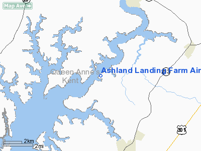
Ashland Landing Farm Airport |
Location & QuickFacts
| FAA Information Effective: | 2008-09-25 |
| Airport Identifier: | MD21 |
| Airport Status: | Operational |
| Longitude/Latitude: | 076-05-47.0000W/39-07-05.0000N
-76.096389/39.118056 (Estimated) |
| Elevation: | 10 ft / 3.05 m (Estimated) |
| Land: | 234 acres |
| From nearest city: | 5 nautical miles N of Centreville, MD |
| Location: | Queen Annes County, MD |
| Magnetic Variation: | 11W (1990) |
Owner & Manager
| Ownership: | Privately owned |
| Owner: | Jacob A Antwerpen |
| Address: | 425 Lands End Rd
Centreville, MD 21617 |
| Phone number: | 410-788-6600 |
| Manager: | Jacob A Antwerpen |
| Address: | 425 Lands End Rd
Centreville, MD 21617 |
| Phone number: | 410-788-6600 |
Airport Operations and Facilities
| Airport Use: | Private |
| Wind indicator: | Yes |
| Segmented Circle: | No |
| Control Tower: | No |
| Sectional chart: | Washington |
| Region: | AEA - Eastern |
| Boundary ARTCC: | ZDC - Washington |
| Tie-in FSS: | DCA - Leesburg |
| FSS on Airport: | No |
| FSS Toll Free: | 1-800-WX-BRIEF |
Runway Information
Runway 14/32
| Dimension: | 2250 x 50 ft / 685.8 x 15.2 m |
| Surface: | TURF, |
| |
Runway 14 |
Runway 32 |
| Traffic Pattern: | Left | Left |
|
Radio Navigation Aids
| ID |
Type |
Name |
Ch |
Freq |
Var |
Dist |
| MTN | NDB | Martin | | 342.00 | 11W | 17.1 nm |
| ESN | NDB | Easton | | 212.00 | 10W | 18.9 nm |
| APG | NDB | Aberdeen | | 349.00 | 11W | 25.1 nm |
| IUB | NDB | Institute | | 404.00 | 08W | 26.6 nm |
| BUH | NDB | Anne Arundel | | 260.00 | 10W | 31.0 nm |
| FND | NDB | Ellicott | | 371.00 | 11W | 33.3 nm |
| CGE | NDB | Cambridge | | 355.00 | 10W | 35.0 nm |
| VKX | NDB | Potomac | | 241.00 | 10W | 45.9 nm |
| RNB | NDB | Rainbow | | 363.00 | 11W | 48.2 nm |
| DC | NDB | Oxonn | | 332.00 | 11W | 48.4 nm |
| GTN | NDB | Georgetown | | 323.00 | 09W | 49.3 nm |
| GAI | NDB | Gaithersburg | | 385.00 | 09W | 50.0 nm |
| MTN | TACAN | Martin | 068X | | 11W | 19.5 nm |
| DOV | TACAN | Dover | 037X | | 09W | 29.3 nm |
| PPM | VOR/DME | Phillips | 021X | 108.40 | 09W | 21.2 nm |
| ATR | VOR/DME | Waterloo | 073X | 112.60 | 09W | 45.3 nm |
| DCA | VOR/DME | Washington | 047X | 111.00 | 09W | 46.6 nm |
| BAL | VORTAC | Baltimore | 098X | 115.10 | 11W | 26.5 nm |
| ENO | VORTAC | Smyrna | 051X | 111.40 | 09W | 27.9 nm |
| OTT | VORTAC | Nottingham | 084X | 113.70 | 10W | 39.2 nm |
| ADW | VORTAC | Andrews | 078X | 113.10 | 10W | 40.5 nm |
| DQO | VORTAC | Dupont | 087X | 114.00 | 10W | 40.6 nm |
| EMI | VORTAC | Westminster | 126X | 117.90 | 08W | 46.9 nm |
| OOD | VORTAC | Woodstown | 075X | 112.80 | 10W | 48.3 nm |
| ADW | VOT | Andrews Afb | | 109.60 | | 41.7 nm |
| DCA | VOT | Washington National | | 109.40 | | 46.8 nm |
Remarks
- SEE AIRSPACE DETERMINATION LTR DATED 13 APRIL 1995.
Images and information placed above are from
http://www.airport-data.com/airport/MD21/
We thank them for the data!
| General Info
|
| Country |
United States
|
| State |
MARYLAND
|
| FAA ID |
MD21
|
| Latitude |
39-07-05.000N
|
| Longitude |
076-05-47.000W
|
| Elevation |
10 feet
|
| Near City |
CENTREVILLE
|
We don't guarantee the information is fresh and accurate. The data may
be wrong or outdated.
For more up-to-date information please refer to other sources.
|
|


