 |
|
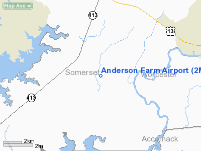
Location & QuickFacts
| FAA Information Effective: | 2008-09-25 |
| Airport Identifier: | 2MD0 |
| Airport Status: | Operational |
| Longitude/Latitude: | 075-42-12.7440W/38-02-55.4430N
-75.703540/38.048734 (Estimated) |
| Elevation: | 8 ft / 2.44 m (Estimated) |
| Land: | 3 acres |
| From nearest city: | 3 nautical miles E of Marion, MD |
| Location: | Somerset County, MD |
| Magnetic Variation: | 11W (1990) |
Owner & Manager
| Ownership: | Privately owned |
| Owner: | John C. Anderson, Iii |
| Address: | 30309 Rehobeth Rd
Marion, MD 21838 |
| Phone number: | 410-957-3154 |
| Manager: | John C. Anderson, Iii |
| Address: | 30309 Rehobeth Rd
Marion, MD 21838 |
| Phone number: | 410-957-3154 |
Airport Operations and Facilities
| Airport Use: | Private |
| Wind indicator: | Yes |
| Segmented Circle: | No |
| Control Tower: | No |
| Lighting Schedule: | PHONE REQ
FOR ARPT BCN CALL 410-957-3154. |
| Beacon Color: | Clear-Green (lighted land airport) |
| Sectional chart: | Washington |
| Region: | AEA - Eastern |
| Boundary ARTCC: | ZDC - Washington |
| Tie-in FSS: | DCA - Leesburg |
| FSS on Airport: | No |
| FSS Toll Free: | 1-800-WX-BRIEF |
Runway Information
Runway 07/25
| Dimension: | 2150 x 40 ft / 655.3 x 12.2 m |
| Surface: | TURF, |
| |
Runway 07 |
Runway 25 |
| Traffic Pattern: | Left | Left |
|
Radio Navigation Aids
| ID |
Type |
Name |
Ch |
Freq |
Var |
Dist |
| BDB | NDB | Accomack | | 336.00 | 11W | 29.1 nm |
| OX | NDB | Landy | | 407.00 | 12W | 30.4 nm |
| CGE | NDB | Cambridge | | 355.00 | 10W | 33.2 nm |
| NHK | NDB | Patuxent | | 400.00 | 10W | 36.0 nm |
| ESN | NDB | Easton | | 212.00 | 10W | 48.6 nm |
| SWL | VORTAC | Snow Hill | 071X | 112.40 | 08W | 11.4 nm |
| SBY | VORTAC | Salisbury | 049X | 111.20 | 12W | 20.0 nm |
| PXT | VORTAC | Patuxent | 123X | 117.60 | 10W | 35.9 nm |
| CCV | VORTAC | Cape Charles | 059X | 112.20 | 10W | 44.4 nm |
Remarks
- ADDITIONAL E111 RMKS - PRIMARY SURFACE KEPT CLEAR OF ALL OBSTRUCTIONS; PROVIDE 20:1 APCH SURFACE; LARGEST ACFT RECOMMENDED FOR OPERATION IS SEL WITH MAX GROSS WT OF 3500 LBS.
- PRVDD VFR DALGT ONLY; PRIVATE USE; COORDINATE WITH ARPT MGR AT CRISFIELD ARPT; WE WOULD ADVISE YOU THAT SITE FOR YOUR ARPT IS IN AIRSPACE WHICH CONTAINS MILITARY ACTIVITIES WHICH ARE NOT COMPATIBLE WITH THOSE NOT PARTICIPATING IN THESE ACTIVITIES;
Images and information placed above are from
http://www.airport-data.com/airport/2MD0/
We thank them for the data!
| General Info
|
| Country |
United States
|
| State |
MARYLAND
|
| FAA ID |
2MD0
|
| Latitude |
38-02-55.443N
|
| Longitude |
075-42-12.744W
|
| Elevation |
8 feet
|
| Near City |
MARION
|
We don't guarantee the information is fresh and accurate. The data may
be wrong or outdated.
For more up-to-date information please refer to other sources.
|
|


