 |
|
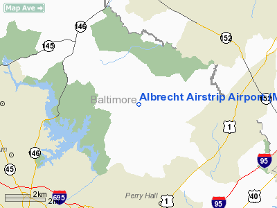
Albrecht Airstrip Airport |
Owner & Manager
| Ownership: | Privately owned |
| Owner: | Matilda Albrecht |
| Address: | 5130 Long Green Road
Glen Arm, MD 21057 |
| Phone number: | 410-592-8770 |
| Manager: | Matilda Albrecht |
| Address: | 5130 Long Green Road
Glen Arm, MD 21057 |
| Phone number: | 410-592-8770 |
Airport Operations and Facilities
| Airport Use: | Private |
| Wind indicator: | Yes |
| Segmented Circle: | No |
| Control Tower: | No |
| Landing fee charge: | No |
| Sectional chart: | Washington |
| Region: | AEA - Eastern |
| Boundary ARTCC: | ZNY - New York |
| Responsible ARTCC: | ZDC - Washington |
| Tie-in FSS: | DCA - Leesburg |
| FSS on Airport: | No |
| FSS Toll Free: | 1-800-WX-BRIEF |
Airport Services
| Airframe Repair: | NONE |
| Power Plant Repair: | NONE |
Runway Information
Runway 13/31
| Dimension: | 2100 x 60 ft / 640.1 x 18.3 m |
| Surface: | TURF, |
| |
Runway 13 |
Runway 31 |
| Traffic Pattern: | Left | Left |
|
Radio Navigation Aids
| ID |
Type |
Name |
Ch |
Freq |
Var |
Dist |
| MTN | NDB | Martin | | 342.00 | 11W | 11.8 nm |
| IUB | NDB | Institute | | 404.00 | 08W | 12.6 nm |
| FND | NDB | Ellicott | | 371.00 | 11W | 17.0 nm |
| APG | NDB | Aberdeen | | 349.00 | 11W | 18.6 nm |
| BUH | NDB | Anne Arundel | | 260.00 | 10W | 26.3 nm |
| EUD | NDB | York | | 254.00 | 11W | 32.0 nm |
| GAI | NDB | Gaithersburg | | 385.00 | 09W | 35.9 nm |
| GTN | NDB | Georgetown | | 323.00 | 09W | 43.7 nm |
| ESN | NDB | Easton | | 212.00 | 10W | 44.9 nm |
| VKX | NDB | Potomac | | 241.00 | 10W | 48.5 nm |
| DC | NDB | Oxonn | | 332.00 | 11W | 49.1 nm |
| MTN | TACAN | Martin | 068X | | 11W | 9.5 nm |
| FDK | VOR | Frederick | | 109.00 | 08W | 40.8 nm |
| PPM | VOR/DME | Phillips | 021X | 108.40 | 09W | 15.3 nm |
| DCA | VOR/DME | Washington | 047X | 111.00 | 09W | 44.6 nm |
| BAL | VORTAC | Baltimore | 098X | 115.10 | 11W | 19.7 nm |
| EMI | VORTAC | Westminster | 126X | 117.90 | 08W | 22.2 nm |
| LRP | VORTAC | Lancaster | 120X | 117.30 | 09W | 40.0 nm |
| DQO | VORTAC | Dupont | 087X | 114.00 | 10W | 43.2 nm |
| ADW | VORTAC | Andrews | 078X | 113.10 | 10W | 43.5 nm |
| MXE | VORTAC | Modena | 079X | 113.20 | 09W | 46.8 nm |
| OTT | VORTAC | Nottingham | 084X | 113.70 | 10W | 47.5 nm |
| ENO | VORTAC | Smyrna | 051X | 111.40 | 09W | 48.0 nm |
| ADW | VOT | Andrews Afb | | 109.60 | | 44.8 nm |
| MDT | VOT | Harrisburg International | | 110.00 | | 45.2 nm |
| DCA | VOT | Washington National | | 109.40 | | 45.2 nm |
Images and information placed above are from
http://www.airport-data.com/airport/MD48/
We thank them for the data!
| General Info
|
| Country |
United States
|
| State |
MARYLAND
|
| FAA ID |
MD48
|
| Latitude |
39-28-24.384N
|
| Longitude |
076-30-00.874W
|
| Elevation |
325 feet
|
| Near City |
LONG GREEN
|
We don't guarantee the information is fresh and accurate. The data may
be wrong or outdated.
For more up-to-date information please refer to other sources.
|
|


