 |
|
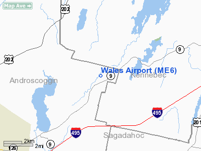
Location & QuickFacts
| FAA Information Effective: | 2008-09-25 |
| Airport Identifier: | ME6 |
| Airport Status: | Operational |
| Longitude/Latitude: | 070-01-08.2000W/44-10-28.3000N
-70.018944/44.174528 (Estimated) |
| Elevation: | 210 ft / 64.01 m (Estimated) |
| Land: | 500 acres |
| From nearest city: | 2 nautical miles SS of Wales, ME |
| Location: | Androscoggin County, ME |
| Magnetic Variation: | 17W (1995) |
Owner & Manager
| Ownership: | Privately owned |
| Owner: | Thomas P. O'connell |
| Address: | 222 Ridge Road
Wales, ME 04259 |
| Phone number: | 207-933-4725 |
| Manager: | Thomas P. Connell |
| Address: | 222 Ridge Road
Wales, ME 04259 |
| Phone number: | 207-933-4725
ALTERNATE PHONE: 207-754-1372 (CELL) |
Airport Operations and Facilities
| Airport Use: | Open to public |
| Wind indicator: | Yes |
| Segmented Circle: | No |
| Control Tower: | No |
| Region: | ANE - New England |
| Boundary ARTCC: | ZBW - Boston |
| Tie-in FSS: | BGR - Bangor |
| FSS Toll Free: | 1-800-WX-BRIEF |
| NOTAMs Facility: | BGR |
Airport Communications
Runway Information
Runway 04/22
| Dimension: | 2100 x 80 ft / 640.1 x 24.4 m |
| Surface: | TURF, Good Condition
SOFT IN SPRING; CALL PRIOR TO LNDG 207-933-4725. |
| |
Runway 04 |
Runway 22 |
| Traffic Pattern: | Left | Left |
| Obstruction: | 11 ft gnd, 80.0 ft from runway, 7:1 slope to clear | 35 ft tree, 123.0 ft from runway, 71 ft left of centerline, 3:1 slope to clear |
|
Radio Navigation Aids
| ID |
Type |
Name |
Ch |
Freq |
Var |
Dist |
| SZO | FAN MARKER | Grinn | | | 17W | 39.5 nm |
| PH | MARINE NDB | Portland Lhb-p | | 301.00 | 17W | 39.0 nm |
| ISS | NDB | Wiscasset | | 407.00 | 18W | 20.0 nm |
| RL | NDB | Bracy | | 399.00 | 18W | 21.1 nm |
| SZO | NDB | Sebago | | 227.00 | 17W | 36.8 nm |
| SUH | NDB | Sprucehead | | 356.00 | 18W | 40.1 nm |
| BUP | NDB | Burnham | | 348.00 | 18W | 42.3 nm |
| BST | NDB | Belfast | | 278.00 | 18W | 45.6 nm |
| NHZ | TACAN | Brunswick | 099X | | 17W | 18.6 nm |
| AUG | VOR/DME | Augusta | 051X | 111.40 | 18W | 13.0 nm |
| PWM | VOT | Portland Intl Jetport | | 111.00 | | 34.5 nm |
Remarks
- 1,239 FT MSL TWR, 7,000 FT SE & 968 FT MSL TWR 9,600 FT SSE OF ARPT.
- TWR 9,500 S.
- ARPT CLSD NOV-MAY; EXCEPT FOR SKIING.
- ALL OPNS DAYLIGHT VFR ONLY & USERS ARE NOTIFIED OF THIS CONDITION.
Images and information placed above are from
http://www.airport-data.com/airport/ME6/
We thank them for the data!
| General Info
|
| Country |
United States
|
| State |
MAINE
|
| FAA ID |
ME6
|
| Latitude |
44-10-28.300N
|
| Longitude |
070-01-08.200W
|
| Elevation |
210 feet
|
| Near City |
WALES
|
We don't guarantee the information is fresh and accurate. The data may
be wrong or outdated.
For more up-to-date information please refer to other sources.
|
|


