 |
|
Location & QuickFacts
| FAA Information Effective: | 2008-09-25 |
| Airport Identifier: | 1ME1 |
| Airport Status: | Operational |
| Longitude/Latitude: | 069-00-33.1000W/44-24-38.3000N
-69.009194/44.410639 (Estimated) |
| Elevation: | 180 ft / 54.86 m (Estimated) |
| Land: | 0 acres |
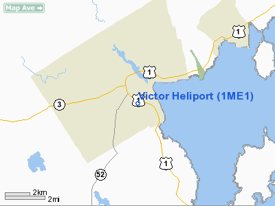
| From nearest city: | 1 nautical miles E of Belfast, ME |
| Location: | Waldo County, ME |
| Magnetic Variation: | 18W (1995) |
Owner & Manager
| Ownership: | Privately owned |
| Owner: | Coastal Helicopters Inc |
| Address: | 26 Airport Road
Belfast, ME 04915 |
| Phone number: | 207-338-3755
OR 338-3755. |
| Manager: | Benjamin L. Magro |
| Address: | 141 Peabody Road
Appleton, ME 04862 |
| Phone number: | 207-785-4521
MAGRO PAGER: 207-471-6600 |
Airport Operations and Facilities
| Airport Use: | Private |
| Wind indicator: | Yes |
| Segmented Circle: | No |
| Control Tower: | No |
| Sectional chart: | Montreal |
| Region: | ANE - New England |
| Boundary ARTCC: | ZBW - Boston |
| Tie-in FSS: | BGR - Bangor |
| FSS Toll Free: | 1-800-WX-BRIEF |
Runway Information
Helipad H1
| Dimension: | 70 x 70 ft / 21.3 x 21.3 m |
| Surface: | ASPH, |
| |
Runway H1 |
Runway |
| Traffic Pattern: | Left | Left |
|
Radio Navigation Aids
| ID |
Type |
Name |
Ch |
Freq |
Var |
Dist |
| SUH | NDB | Sprucehead | | 356.00 | 18W | 22.1 nm |
| BUP | NDB | Burnham | | 348.00 | 18W | 22.8 nm |
| BH | NDB | Surry | | 330.00 | 19W | 31.1 nm |
| RL | NDB | Bracy | | 399.00 | 18W | 31.3 nm |
| ISS | NDB | Wiscasset | | 407.00 | 18W | 37.4 nm |
| OLD | NDB | Old Town | | 272.00 | 20W | 39.3 nm |
| AUG | VOR/DME | Augusta | 051X | 111.40 | 18W | 34.3 nm |
| BGR | VORTAC | Bangor | 095X | 114.80 | 19W | 26.6 nm |
| BGR | VOT | Bangor | | 111.00 | | 25.2 nm |
Remarks
- HELIPORT LOCATED ADJACENT TO BELFAST MUNI ARPT; FLOW OF FIXED WING TFC TO BE AVOIDED BY HELICOPTER PILOTS.
- PRVDD VFR DAYTIME.
Images and information placed above are from
http://www.airport-data.com/airport/1ME1/
We thank them for the data!
| General Info
|
| Country |
United States
|
| State |
MAINE
|
| FAA ID |
1ME1
|
| Latitude |
44-24-38.300N
|
| Longitude |
069-00-33.100W
|
| Elevation |
180 feet
|
| Near City |
BELFAST
|
We don't guarantee the information is fresh and accurate. The data may
be wrong or outdated.
For more up-to-date information please refer to other sources.
|
|


