 |
|
Location & QuickFacts
| FAA Information Effective: | 2008-09-25 |
| Airport Identifier: | ME79 |
| Airport Status: | Operational |
| Longitude/Latitude: | 069-20-48.1730W/45-18-20.1810N
-69.346715/45.305606 (Estimated) |
| Elevation: | 366 ft / 111.56 m (Estimated)
RY 13W/31W ELEV IS 323E. |
| Land: | 20 acres |
| From nearest city: | 3 nautical miles E of Willimantic, ME |
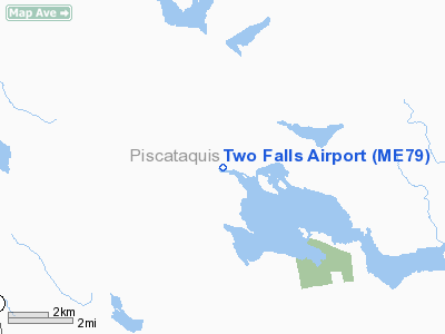
| Location: | Piscataquis County, ME |
| Magnetic Variation: | 19W (1985) |
Owner & Manager
| Ownership: | Privately owned |
| Owner: | H. Bayerdorffer
D/B/A TWO FALLS CAMPS. |
| Address: | 15350 Skyking Dr
Port St Lucie, FL 34987 |
| Phone number: | 772-486-1800 |
| Manager: | D. Bayerdorffer |
| Address: | 28 Airport Rd
Willimantic, ME 04443 |
| Phone number: | 207-997-3625 |
Airport Operations and Facilities
| Airport Use: | Private |
| Wind indicator: | Yes |
| Segmented Circle: | No |
| Control Tower: | No |
| Landing fee charge: | No |
| Sectional chart: | Montreal |
| Region: | ANE - New England |
| Boundary ARTCC: | ZBW - Boston |
| Tie-in FSS: | BGR - Bangor |
| FSS on Airport: | No |
| FSS Toll Free: | 1-800-WX-BRIEF |
Airport Communications
Runway Information
Runway 13/31
| Dimension: | 3200 x 45 ft / 975.4 x 13.7 m |
| Surface: | GRVL, |
| |
Runway 13 |
Runway 31 |
| Traffic Pattern: | Left | Left |
|
Runway 13W/31W
| Dimension: | 5000 x 500 ft / 1524.0 x 152.4 m |
| Surface: | WATER, |
| |
Runway 13W |
Runway 31W |
| Traffic Pattern: | Left | Left |
|
Radio Navigation Aids
| ID |
Type |
Name |
Ch |
Freq |
Var |
Dist |
| XQA | NDB | Squaw | | 236.00 | 18W | 19.0 nm |
| LRG | NDB | Lincoln | | 216.00 | 19W | 34.4 nm |
| OLD | NDB | Old Town | | 272.00 | 20W | 35.2 nm |
| BUP | NDB | Burnham | | 348.00 | 18W | 36.6 nm |
| LNT | NDB | Milnot | | 344.00 | 19W | 39.4 nm |
| MLT | VOR/DME | Millinocket | 126X | 117.90 | 20W | 38.9 nm |
| BGR | VORTAC | Bangor | 095X | 114.80 | 19W | 34.3 nm |
| BGR | VOT | Bangor | | 111.00 | | 37.8 nm |
Remarks
Images and information placed above are from
http://www.airport-data.com/airport/ME79/
We thank them for the data!
| General Info
|
| Country |
United States
|
| State |
MAINE
|
| FAA ID |
ME79
|
| Latitude |
45-18-20.181N
|
| Longitude |
069-20-48.173W
|
| Elevation |
366 feet
|
| Near City |
WILLIMANTIC
|
We don't guarantee the information is fresh and accurate. The data may
be wrong or outdated.
For more up-to-date information please refer to other sources.
|
|


