 |
|
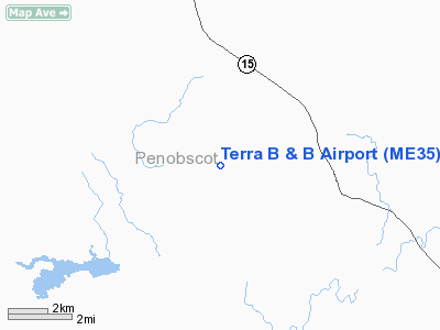
Location & QuickFacts
| FAA Information Effective: | 2008-09-25 |
| Airport Identifier: | ME35 |
| Airport Status: | Operational |
| Longitude/Latitude: | 069-00-26.1410W/44-55-53.2440N
-69.007261/44.931457 (Estimated) |
| Elevation: | 382 ft / 116.43 m (Surveyed) |
| Land: | 100 acres |
| From nearest city: | 4 nautical miles SE of Levant, ME |
| Location: | Penobscot County, ME |
| Magnetic Variation: | 19W (1985) |
Owner & Manager
| Ownership: | Privately owned |
| Owner: | William Terra |
| Address: | Brann Road, Box 1950
West Levant, ME 04456 |
| Phone number: | 207-884-8805 |
| Manager: | William Terra |
| Address: | Brann Road, Box 1950
West Levant, ME 04456 |
| Phone number: | 207-884-8805 |
Airport Operations and Facilities
| Airport Use: | Private |
| Wind indicator: | Yes |
| Segmented Circle: | No |
| Control Tower: | No |
| Landing fee charge: | No |
| Sectional chart: | Montreal |
| Region: | ANE - New England |
| Boundary ARTCC: | ZBW - Boston |
| Tie-in FSS: | BGR - Bangor |
| FSS on Airport: | No |
| FSS Toll Free: | 1-800-WX-BRIEF |
Airport Services
| Fuel available: | MOGAS |
| Airframe Repair: | NONE |
| Power Plant Repair: | NONE |
Runway Information
Runway 01/19
| Dimension: | 2600 x 100 ft / 792.5 x 30.5 m |
| Surface: | TURF, |
| |
Runway 01 |
Runway 19 |
| Traffic Pattern: | Left | Left |
| Obstruction: | | 40 ft , 50.0 ft from runway |
|
Radio Navigation Aids
| ID |
Type |
Name |
Ch |
Freq |
Var |
Dist |
| OLD | NDB | Old Town | | 272.00 | 20W | 16.5 nm |
| BUP | NDB | Burnham | | 348.00 | 18W | 20.5 nm |
| BST | NDB | Belfast | | 278.00 | 18W | 31.3 nm |
| LRG | NDB | Lincoln | | 216.00 | 19W | 32.4 nm |
| BH | NDB | Surry | | 330.00 | 19W | 38.1 nm |
| RL | NDB | Bracy | | 399.00 | 18W | 42.1 nm |
| XQA | NDB | Squaw | | 236.00 | 18W | 45.4 nm |
| LNT | NDB | Milnot | | 344.00 | 19W | 47.2 nm |
| MLT | VOR/DME | Millinocket | 126X | 117.90 | 20W | 44.5 nm |
| AUG | VOR/DME | Augusta | 051X | 111.40 | 18W | 49.9 nm |
| BGR | VORTAC | Bangor | 095X | 114.80 | 19W | 7.8 nm |
| BGR | VOT | Bangor | | 111.00 | | 11.4 nm |
Remarks
Images and information placed above are from
http://www.airport-data.com/airport/ME35/
We thank them for the data!
| General Info
|
| Country |
United States
|
| State |
MAINE
|
| FAA ID |
ME35
|
| Latitude |
44-55-53.244N
|
| Longitude |
069-00-26.141W
|
| Elevation |
382 feet
|
| Near City |
LEVANT
|
We don't guarantee the information is fresh and accurate. The data may
be wrong or outdated.
For more up-to-date information please refer to other sources.
|
|


