 |
|
Location & QuickFacts
| FAA Information Effective: | 2008-09-25 |
| Airport Identifier: | 29ME |
| Airport Status: | Operational |
| Longitude/Latitude: | 069-31-49.2000W/44-26-52.8000N
-69.530333/44.448000 (Estimated) |
| Elevation: | 194 ft / 59.13 m (Estimated) |
| Land: | 0 acres |
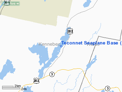
| From nearest city: | 2 nautical miles S of China, ME |
| Location: | Kennebec County, ME |
| Magnetic Variation: | () |
Owner & Manager
| Ownership: | Privately owned |
| Owner: | John P. Meade |
| Address: | 104 Barker Street
Pembroke, MA 02359 |
| Phone number: | 781-826-3902 |
| Manager: | John P. Meade |
| Address: | 104 Barker Street
Pembroke, MA 02359 |
| Phone number: | 781-826-3902 |
Airport Operations and Facilities
| Airport Use: | Private |
| Control Tower: | No |
| Sectional chart: | Montreal |
| Region: | ANE - New England |
| Boundary ARTCC: | ZBW - Boston |
| Tie-in FSS: | BGR - Bangor |
| FSS Toll Free: | 1-800-WX-BRIEF |
Runway Information
Runway 03W/21W
| Dimension: | 5000 x 200 ft / 1524.0 x 61.0 m |
| Surface: | WATER, |
| |
Runway 03W |
Runway 21W |
| Traffic Pattern: | Left | Left |
|
Radio Navigation Aids
| ID |
Type |
Name |
Ch |
Freq |
Var |
Dist |
| RL | NDB | Bracy | | 399.00 | 18W | 8.8 nm |
| BUP | NDB | Burnham | | 348.00 | 18W | 16.7 nm |
| BST | NDB | Belfast | | 278.00 | 18W | 22.4 nm |
| ISS | NDB | Wiscasset | | 407.00 | 18W | 28.4 nm |
| SUH | NDB | Sprucehead | | 356.00 | 18W | 30.1 nm |
| NHZ | TACAN | Brunswick | 099X | | 17W | 38.4 nm |
| AUG | VOR/DME | Augusta | 051X | 111.40 | 18W | 13.8 nm |
| BGR | VORTAC | Bangor | 095X | 114.80 | 19W | 36.7 nm |
| BGR | VOT | Bangor | | 111.00 | | 37.5 nm |
Remarks
Images and information placed above are from
http://www.airport-data.com/airport/29ME/
We thank them for the data!
We don't guarantee the information is fresh and accurate. The data may
be wrong or outdated.
For more up-to-date information please refer to other sources.
|
|


