 |
|
Stonington Municipal Airport |
| Stonington Municipal Airport |
| IATA: none – ICAO: none – FAA LID: 93B |
| Summary |
| Airport type |
Public |
| Operator |
Town of Stonington |
| Location |
Stonington, Maine |
| Elevation AMSL |
30 ft / 9.1 m |
| Coordinates |
44°10′24″N 68°40′49″W / 44.17333°N 68.68028°W / 44.17333; -68.68028Coordinates: 44°10′24″N 68°40′49″W / 44.17333°N 68.68028°W / 44.17333; -68.68028 |
| Runways |
| Direction |
Length |
Surface |
| ft |
m |
| 7/25 |
2,099 |
640 |
Asphalt |
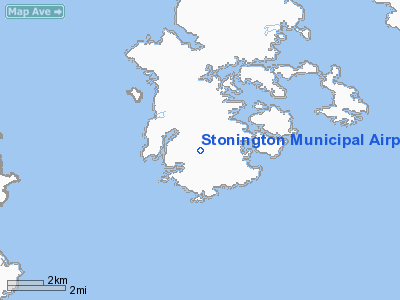
Stonington Municipal Airport (FAA LID: 93B) is a public airport located one mile (1.6 km) northwest of the central business district (CBD) of Stonington, a town in Hancock County, Maine, USA. The airport covers 12 acres and has one runway. It provides service to private and charter aircraft traffic only. Stonington is located on an island named Deer Isle which is only reachable by automobile via a long, narrow suspension bridge.
The above content comes from Wikipedia and is published under free licenses – click here to read more.
Location & QuickFacts
| FAA Information Effective: | 2008-09-25 |
| Airport Identifier: | 93B |
| Airport Status: | Operational |
| Longitude/Latitude: | 068-40-48.9000W/44-10-23.6000N
-68.680250/44.173222 (Estimated) |
| Elevation: | 30 ft / 9.14 m (Surveyed) |
| Land: | 12 acres |
| From nearest city: | 1 nautical miles NW of Stonington, ME |
| Location: | Hancock County, ME |
| Magnetic Variation: | 18W (1985) |
Owner & Manager
| Ownership: | Publicly owned |
| Owner: | Town Of Stonington |
| Address: | Po Box 9
Stonington, ME 04681 |
| Phone number: | 207-367-2351 |
| Manager: | Richard Avery |
| Address: | Po Box 9
Stonington, ME 04681 |
| Phone number: | 207-367-2351 |
Airport Operations and Facilities
| Airport Use: | Open to public |
| Wind indicator: | Yes |
| Segmented Circle: | No |
| Control Tower: | No |
| Landing fee charge: | No |
| Sectional chart: | Halifax |
| Region: | ANE - New England |
| Boundary ARTCC: | ZBW - Boston |
| Tie-in FSS: | BGR - Bangor |
| FSS on Airport: | No |
| FSS Toll Free: | 1-800-WX-BRIEF |
| NOTAMs Facility: | BGR (NOTAM-d service avaliable) |
| Federal Agreements: | N |
Airport Communications
Airport Services
| Airframe Repair: | NONE |
| Power Plant Repair: | NONE |
| Bottled Oxygen: | NONE |
| Bulk Oxygen: | NONE |
Runway Information
Runway 07/25
| Dimension: | 2099 x 60 ft / 639.8 x 18.3 m |
| Surface: | ASPH, Good Condition |
| |
Runway 07 |
Runway 25 |
| Longitude: | 068-41-00.0830W | 068-40-37.7094W |
| Latitude: | 44-10-17.0712N | 44-10-30.1153N |
| Elevation: | 32.00 ft | 25.00 ft |
| Traffic Pattern: | Left | Left |
| Markings: | Basic, Poor Condition
PAINTED NRS ARE FADED. | Basic, Poor Condition
PAINTED NRS ARE FADED. |
| Obstruction: | 28 ft trees, 200.0 ft from runway, 112 ft right of centerline
+6 FT LEDGE 10-20 FT FROM THLD70 FT LEFT OF CNTRLN. TREES 6-10 FEET, 187-200 FEET OUT, 30-112 FEET LEFT. | 55 ft trees, 695.0 ft from runway, 114 ft left of centerline, 8:1 slope to clear
+20 FT TREES & BRUSH 20-170 FT FM THLD BOTH SIDES OF CENTERLINE. |
|
Radio Navigation Aids
| ID |
Type |
Name |
Ch |
Freq |
Var |
Dist |
| SUH | NDB | Sprucehead | | 356.00 | 18W | 19.8 nm |
| BST | NDB | Belfast | | 278.00 | 18W | 20.2 nm |
| BH | NDB | Surry | | 330.00 | 19W | 27.2 nm |
| BUP | NDB | Burnham | | 348.00 | 18W | 42.9 nm |
| ISS | NDB | Wiscasset | | 407.00 | 18W | 43.0 nm |
| RL | NDB | Bracy | | 399.00 | 18W | 48.5 nm |
| AUG | VOR/DME | Augusta | 051X | 111.40 | 18W | 48.9 nm |
| BGR | VORTAC | Bangor | 095X | 114.80 | 19W | 41.0 nm |
| BGR | VOT | Bangor | | 111.00 | | 38.3 nm |
Remarks
- USE EXTREME CARE SEAGULLS ON & INVOF ARPT.
- DAYLIGHT USE ONLY - NO ELECTRICITY.
- EXISTED PRIOR TO 1959.
Images and information placed above are from
http://www.airport-data.com/airport/93B/
We thank them for the data!
| General Info
|
| Country |
United States
|
| State |
MAINE
|
| FAA ID |
93B
|
| Latitude |
44-10-23.600N
|
| Longitude |
068-40-48.900W
|
| Elevation |
30 feet
|
| Near City |
STONINGTON
|
We don't guarantee the information is fresh and accurate. The data may
be wrong or outdated.
For more up-to-date information please refer to other sources.
|
|


