 |
|
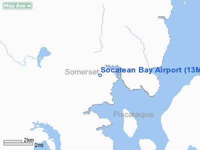
Location & QuickFacts
| FAA Information Effective: | 2008-09-25 |
| Airport Identifier: | 13ME |
| Airport Status: | Operational |
| Longitude/Latitude: | 069-48-33.6250W/45-46-34.9430N
-69.809340/45.776373 (Estimated) |
| Elevation: | 1179 ft / 359.36 m (Estimated) |
| Land: | 0 acres |
| From nearest city: | 16 nautical miles S of Rockwood, ME |
| Location: | Somerset County, ME |
| Magnetic Variation: | 18W (2005) |
Owner & Manager
| Ownership: | Privately owned |
| Owner: | Robert Greenhill |
| Address: | Riversville Aviation, 433 Riversville Rd
Greenwich, CT 10504 |
| Phone number: | 914-428-8000 |
| Manager: | Mike Telow, Chief Pilot |
| Address: | 92 Iron Works Rd
Clinton, CT 06413 |
| Phone number: | 914-428-8000 |
Airport Operations and Facilities
| Airport Use: | Private |
| Wind indicator: | Yes |
| Segmented Circle: | No |
| Control Tower: | No |
| Sectional chart: | Montreal |
| Region: | ANE - New England |
| Boundary ARTCC: | ZBW - Boston |
| Tie-in FSS: | BGR - Bangor |
| FSS Toll Free: | 1-800-WX-BRIEF |
Runway Information
Runway 09/27
| Dimension: | 2100 x 100 ft / 640.1 x 30.5 m |
| Surface: | ASPH, |
| |
Runway 09 |
Runway 27 |
| Longitude: | 069-48-48.0180W | 069-48-19.2340W |
| Latitude: | 45-46-32.5000N | 45-46-37.3910N |
| Elevation: | 1179.00 ft | 1159.00 ft |
| Traffic Pattern: | Left | Left |
|
Radio Navigation Aids
| ID |
Type |
Name |
Ch |
Freq |
Var |
Dist |
| XQA | NDB | Squaw | | 236.00 | 18W | 16.3 nm |
| VLV | VOR/DME | Beauce | 119X | 117.20 | 18W | 44.3 nm |
Remarks
- PRVDD INSTALL WIND INDICATOR, OPNS RESTRICTED TO SMALL ACFT ONLY, VFR OPNS, & ALL USERS ARE NOTIFIED & COMPLY.
Images and information placed above are from
http://www.airport-data.com/airport/13ME/
We thank them for the data!
We don't guarantee the information is fresh and accurate. The data may
be wrong or outdated.
For more up-to-date information please refer to other sources.
|
|


