 |
|
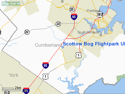
Scottow Bog Flightpark Ultralight |
Location & QuickFacts
| FAA Information Effective: | 2008-09-25 |
| Airport Identifier: | ME66 |
| Airport Status: | Operational |
| Longitude/Latitude: | 070-21-26.1790W/43-36-45.2960N
-70.357272/43.612582 (Estimated) |
| Elevation: | 30 ft / 9.14 m (Estimated) |
| Land: | 0 acres |
| From nearest city: | 2 nautical miles W of Scarborough, ME |
| Location: | Cumberland County, ME |
| Magnetic Variation: | 17W (1990) |
Owner & Manager
| Ownership: | Privately owned |
| Owner: | Charles H/elaine S Warren |
| Address: | 102 Fogg Rd
Scarborough, ME 04074 |
| Phone number: | 207-883-4538 |
| Manager: | Charles H/elaine S Warren |
| Address: | 102 Fogg Rd
Scarborough, ME 04074 |
| Phone number: | 207-883-4538 |
Airport Operations and Facilities
| Airport Use: | Private |
| Wind indicator: | Yes |
| Segmented Circle: | No |
| Control Tower: | No |
| Sectional chart: | New York |
| Region: | ANE - New England |
| Boundary ARTCC: | ZBW - Boston |
| Tie-in FSS: | BGR - Bangor |
| FSS on Airport: | No |
| FSS Toll Free: | 1-800-WX-BRIEF |
Runway Information
Runway 09/27
| Dimension: | 900 x 300 ft / 274.3 x 91.4 m |
| Surface: | TURF, |
| |
Runway 09 |
Runway 27 |
| Traffic Pattern: | Left | Left |
|
Runway 18/36
| Dimension: | 600 x 225 ft / 182.9 x 68.6 m |
| Surface: | TURF, |
| |
Runway 18 |
Runway 36 |
| Traffic Pattern: | Left | Left |
|
Radio Navigation Aids
| ID |
Type |
Name |
Ch |
Freq |
Var |
Dist |
| SZO | FAN MARKER | Grinn | | | 17W | 30.8 nm |
| LCI | FAN MARKER | Laconia | | | | 47.3 nm |
| PH | MARINE NDB | Portland Lhb-p | | 301.00 | 17W | 12.7 nm |
| SZO | NDB | Sebago | | 227.00 | 17W | 25.5 nm |
| ESG | NDB | Rollins | | 260.00 | 16W | 31.3 nm |
| ISS | NDB | Wiscasset | | 407.00 | 18W | 38.2 nm |
| NHZ | TACAN | Brunswick | 099X | | 17W | 24.6 nm |
| PSM | VOR/DME | Pease | 112X | 116.50 | 16W | 37.9 nm |
| AUG | VOR/DME | Augusta | 051X | 111.40 | 18W | 49.0 nm |
| ENE | VORTAC | Kennebunk | 118X | 117.10 | 17W | 15.8 nm |
| PWM | VOT | Portland Intl Jetport | | 111.00 | | 2.5 nm |
Remarks
- PROVIDED OPS ARE CONDUCTED IN DALGT VFR WEATHER CONDITIONS; APCHS TO RY ENDS ARE CLEARED OF TREES; AND THE N-S & E-W RYS ARE NOT UTILIZED CONCURRENTLY.
Images and information placed above are from
http://www.airport-data.com/airport/ME66/
We thank them for the data!
| General Info
|
| Country |
United States
|
| State |
MAINE
|
| FAA ID |
ME66
|
| Latitude |
43-36-45.296N
|
| Longitude |
070-21-26.179W
|
| Elevation |
30 feet
|
| Near City |
SCARBOROUGH
|
We don't guarantee the information is fresh and accurate. The data may
be wrong or outdated.
For more up-to-date information please refer to other sources.
|
|


