 |
|
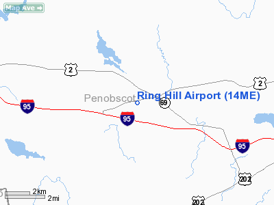
Location & QuickFacts
| FAA Information Effective: | 2008-09-25 |
| Airport Identifier: | 14ME |
| Airport Status: | Operational |
| Longitude/Latitude: | 069-04-13.1550W/44-47-33.2460N
-69.070321/44.792568 (Estimated) |
| Elevation: | 340 ft / 103.63 m (Surveyed) |
| Land: | 8 acres |
| From nearest city: | 1 nautical miles W of Carmel, ME |
| Location: | Penobscot County, ME |
| Magnetic Variation: | 19W (1985) |
Owner & Manager
| Ownership: | Privately owned |
| Owner: | Charles B. Nute Iii |
| Address: | 19 Ring Hill Lane
Carmel, ME 04419 |
| Phone number: | 207-848-7471 |
| Manager: | Charles B. Nute Iii |
| Address: | 19 Ring Hill Lane
Carmel, ME 04419 |
| Phone number: | 207-848-7471 |
Airport Operations and Facilities
| Airport Use: | Private |
| Wind indicator: | Yes |
| Segmented Circle: | No |
| Control Tower: | No |
| Landing fee charge: | No |
| Sectional chart: | Montreal |
| Region: | ANE - New England |
| Boundary ARTCC: | ZAB - Albuquerque |
| Tie-in FSS: | BGR - Bangor |
| FSS on Airport: | No |
| FSS Toll Free: | 1-800-WX-BRIEF |
Airport Services
| Airframe Repair: | NONE |
| Power Plant Repair: | NONE |
Runway Information
Runway 16/34
| Dimension: | 1100 x 60 ft / 335.3 x 18.3 m |
| Surface: | TURF, Good Condition |
| |
Runway 16 |
Runway 34 |
| Traffic Pattern: | Left | Left |
| Markings: | None, | None, |
| Obstruction: | 40 ft trees, 108.0 ft from runway, 108 ft right of centerline, 2:1 slope to clear | 40 ft trees, 300.0 ft from runway, 100 ft right of centerline, 7:1 slope to clear |
|
Radio Navigation Aids
| ID |
Type |
Name |
Ch |
Freq |
Var |
Dist |
| BUP | NDB | Burnham | | 348.00 | 18W | 13.5 nm |
| OLD | NDB | Old Town | | 272.00 | 20W | 22.6 nm |
| BST | NDB | Belfast | | 278.00 | 18W | 23.1 nm |
| RL | NDB | Bracy | | 399.00 | 18W | 34.7 nm |
| BH | NDB | Surry | | 330.00 | 19W | 36.0 nm |
| LRG | NDB | Lincoln | | 216.00 | 19W | 40.8 nm |
| SUH | NDB | Sprucehead | | 356.00 | 18W | 44.7 nm |
| AUG | VOR/DME | Augusta | 051X | 111.40 | 18W | 42.1 nm |
| BGR | VORTAC | Bangor | 095X | 114.80 | 19W | 8.9 nm |
| BGR | VOT | Bangor | | 111.00 | | 11.1 nm |
Images and information placed above are from
http://www.airport-data.com/airport/14ME/
We thank them for the data!
We don't guarantee the information is fresh and accurate. The data may
be wrong or outdated.
For more up-to-date information please refer to other sources.
|
|


