 |
|
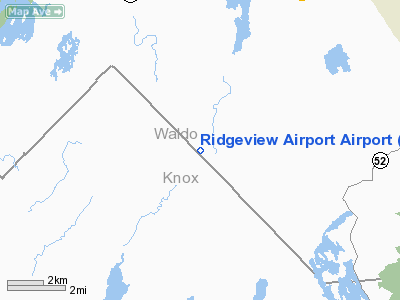
Location & QuickFacts
| FAA Information Effective: | 2008-09-25 |
| Airport Identifier: | 12ME |
| Airport Status: | Operational |
| Longitude/Latitude: | 069-12-26.1000W/44-19-20.3800N
-69.207250/44.322328 (Estimated) |
| Elevation: | 240 ft / 73.15 m (Estimated) |
| Land: | 0 acres |
| From nearest city: | 3 nautical miles SW of Searsmont, ME |
| Location: | Waldo County, ME |
| Magnetic Variation: | 18W (2000) |
Owner & Manager
| Ownership: | Privately owned |
| Owner: | Wayne Thomas |
| Address: | P.o. Box 6
Searsmont, ME 04973 |
| Phone number: | 207-342-5034 |
| Manager: | Wayne Thomas |
| Address: | P.o. Box 6
Searsmont, ME 04973 |
| Phone number: | 207-342-5034 |
Airport Operations and Facilities
| Airport Use: | Private |
| Segmented Circle: | No |
| Control Tower: | No |
| Sectional chart: | Montreal |
| Region: | ANE - New England |
| Boundary ARTCC: | ZBW - Boston |
| Tie-in FSS: | BGR - Bangor |
| FSS Toll Free: | 1-800-WX-BRIEF |
Runway Information
Runway 15/33
| Dimension: | 1500 x 50 ft / 457.2 x 15.2 m |
| Surface: | TURF, |
| |
Runway 15 |
Runway 33 |
| Traffic Pattern: | Left | Left |
|
Radio Navigation Aids
| ID |
Type |
Name |
Ch |
Freq |
Var |
Dist |
| BST | NDB | Belfast | | 278.00 | 18W | 10.0 nm |
| SUH | NDB | Sprucehead | | 356.00 | 18W | 16.9 nm |
| BUP | NDB | Burnham | | 348.00 | 18W | 23.4 nm |
| RL | NDB | Bracy | | 399.00 | 18W | 24.1 nm |
| ISS | NDB | Wiscasset | | 407.00 | 18W | 27.7 nm |
| BH | NDB | Surry | | 330.00 | 19W | 40.8 nm |
| OLD | NDB | Old Town | | 272.00 | 20W | 47.9 nm |
| NHZ | TACAN | Brunswick | 099X | | 17W | 41.0 nm |
| AUG | VOR/DME | Augusta | 051X | 111.40 | 18W | 25.3 nm |
| BGR | VORTAC | Bangor | 095X | 114.80 | 19W | 34.3 nm |
| BGR | VOT | Bangor | | 111.00 | | 33.6 nm |
Remarks
- PRVDD VFR DALGT ONLY, TKOF RY 15, LDNG RY 33, NOTIFY ALL USERS.
Images and information placed above are from
http://www.airport-data.com/airport/12ME/
We thank them for the data!
| General Info
|
| Country |
United States
|
| State |
MAINE
|
| FAA ID |
12ME
|
| Latitude |
44-19-20.380N
|
| Longitude |
069-12-26.100W
|
| Elevation |
240 feet
|
| Near City |
SEARSMONT
|
We don't guarantee the information is fresh and accurate. The data may
be wrong or outdated.
For more up-to-date information please refer to other sources.
|
|


