 |
|
Princeton Municipal Airport |
| Princeton Municipal Airport |
| IATA: PNN – ICAO: KPNN – FAA LID: PNN |
| Summary |
| Airport type |
Public |
| Owner |
Town of Princeton |
| Serves |
Princeton, Maine |
| Elevation AMSL |
266 ft / 81 m |
| Coordinates |
45°12′02″N 067°33′52″W / 45.20056°N 67.56444°W / 45.20056; -67.56444 |
| Runways |
| Direction |
Length |
Surface |
| ft |
m |
| 6/24 |
3,999 |
1,219 |
Asphalt |
| 15/33 |
4,004 |
1,220 |
Asphalt |
| Statistics (2007) |
| Aircraft operations |
2,250 |
| Based aircraft |
9 |
| Source: Federal Aviation Administration |
This article is about the airport in Maine.For other similarly named airports, see Princeton Municipal Airport.
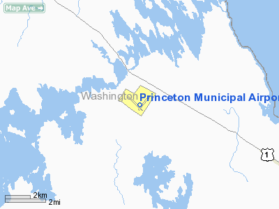
Princeton Municipal Airport (IATA: PNN, ICAO: KPNN, FAA LID: PNN) is a town-owned public-use airport located two nautical miles (3.7 km) south of the central business district of Princeton, a town in Washington County, Maine, United States.
Facilities and aircraft
Princeton Municipal Airport covers an area of 420 acres (170 ha) at an elevation of 266 feet (81 m) above mean sea level. It has two asphalt paved runways: 6/24 is 3,999 by 150 feet (1,219 x 46 m) and 15/33 is 4,004 by 100 feet (1,220 x 30 m).
For the 12-month period ending July 31, 2007, the airport had 2,250 aircraft operations, an average of 187 per month: 98% general aviation and 2% air taxi. At that time there were 9 aircraft based at this airport: 78% single-engine and 22% ultralight.
The above content comes from Wikipedia and is published under free licenses – click here to read more.
Location & QuickFacts
| FAA Information Effective: | 2008-09-25 |
| Airport Identifier: | PNN |
| Airport Status: | Operational |
| Longitude/Latitude: | 067-33-51.8000W/45-12-02.4000N
-67.564389/45.200667 (Estimated) |
| Elevation: | 266 ft / 81.08 m (Surveyed) |
| Land: | 420 acres |
| From nearest city: | 2 nautical miles S of Princeton, ME |
| Location: | Washington County, ME |
| Magnetic Variation: | 20W (1975) |
Owner & Manager
| Ownership: | Publicly owned |
| Owner: | Town Of Princeton |
| Address: | Town Offices
Princeton, ME 04668 |
| Phone number: | 207-796-2744 |
| Manager: | Greg Monk |
| Address: | P.o.box 346
Princeton, ME 04668 |
| Phone number: | 207-796-2847
AMGR EXT 4730. |
Airport Operations and Facilities
| Airport Use: | Open to public |
| Wind indicator: | Yes |
| Segmented Circle: | Yes |
| Control Tower: | No |
| Lighting Schedule: | DUSK-DAWN
ACTVT MIRL RY 15/33 & VASI RY 15 - CTAF. |
| Beacon Color: | Clear-Green (lighted land airport) |
| Landing fee charge: | No |
| Sectional chart: | Halifax |
| Region: | ANE - New England |
| Boundary ARTCC: | ZBW - Boston |
| Tie-in FSS: | BGR - Bangor |
| FSS on Airport: | No |
| FSS Toll Free: | 1-800-WX-BRIEF |
| NOTAMs Facility: | BGR (NOTAM-d service avaliable) |
| Federal Agreements: | NGY3 |
Airport Communications
| CTAF: | 122.800 |
| Unicom: | 122.800 |
Airport Services
| Fuel available: | 100LL
24 HOUR FUEL AVAILABLE WITH MAJOR CREDIT CARD. |
| Airframe Repair: | NONE |
| Power Plant Repair: | NONE |
| Bottled Oxygen: | NONE |
| Bulk Oxygen: | NONE |
Runway Information
Runway 06/24
| Dimension: | 3999 x 150 ft / 1218.9 x 45.7 m |
| Surface: | ASPH, Poor Condition |
| |
Runway 06 |
Runway 24 |
| Longitude: | 067-33-57.3740W | 067-33-22.5890W |
| Latitude: | 45-11-47.9400N | 45-12-18.8320N |
| Elevation: | 239.00 ft | 246.00 ft |
| Alignment: | 39 | 127 |
| Traffic Pattern: | Left | Left |
| Markings: | Numbers only, Poor Condition
06/24 MARKINGS FADED | Numbers only, Poor Condition |
| Displaced threshold: | 0.00 ft | 504.00 ft |
| Obstruction: | 40 ft trees, 800.0 ft from runway, 15:1 slope to clear
+4' BRUSH 50' FM EDGE OF PAVEMENT. | 10 ft trees, 210.0 ft from runway, 1:1 slope to clear
26:1 APCH SLOPE AT DSPLCD THR. 50 FT TREE 1300 FT OUT 75 FT R.
+6' BRUSH 50' FM EDGE OF PAVEMENT. |
|
Runway 15/33
| Dimension: | 4004 x 100 ft / 1220.4 x 30.5 m |
| Surface: | ASPH, Good Condition |
| Weight Limit: | Single wheel: 31000 lbs.
Dual wheel: 38000 lbs. |
| Edge Lights: | Non-standard lighting system
NSTD MIRL; LGTS 25 FT FM RY EDGES. |
| |
Runway 15 |
Runway 33 |
| Longitude: | 067-34-24.2660W | 067-33-43.0680W |
| Latitude: | 45-12-14.7430N | 45-11-48.0090N |
| Elevation: | 262.00 ft | 235.00 ft |
| Alignment: | 127 | 127 |
| Traffic Pattern: | Left | Left |
| Markings: | Non-precision instrument, Fair Condition | Non-precision instrument, Fair Condition |
| Crossing Height: | 51.00 ft | 0.00 ft |
| VASI: | 4-box on left side | |
| Visual Glide Angle: | 3.00° | 0.00° |
| Runway End Identifier: | No | No |
| Centerline Lights: | No | No |
| Touchdown Lights: | No | No |
| Obstruction: | 49 ft trees, 495.0 ft from runway, 260 ft right of centerline, 6:1 slope to clear | 23 ft trees, 200.0 ft from runway, 75 ft left of centerline
15 FT BRUSH 60 FT FM THLD BOTH SIDES OF CENTERLINE. |
|
Radio Navigation Aids
| ID |
Type |
Name |
Ch |
Freq |
Var |
Dist |
| EPM | NDB | Eastport | | 260.00 | 19W | 29.1 nm |
| MVM | NDB | Machias | | 251.00 | 19W | 30.0 nm |
| LRG | NDB | Lincoln | | 216.00 | 19W | 42.2 nm |
| OLD | NDB | Old Town | | 272.00 | 20W | 46.8 nm |
| LNT | NDB | Milnot | | 344.00 | 19W | 49.5 nm |
| PNN | VOR/DME | Princeton | 090X | 114.30 | 21W | 9.7 nm |
| MLT | VOR/DME | Millinocket | 126X | 117.90 | 20W | 46.4 nm |
Remarks
Images and information placed above are from
http://www.airport-data.com/airport/PNN/
We thank them for the data!
| General Info
|
| Country |
United States
|
| State |
MAINE
|
| FAA ID |
PNN
|
| Latitude |
45-12-02.400N
|
| Longitude |
067-33-51.800W
|
| Elevation |
266 feet
|
| Near City |
PRINCETON
|
We don't guarantee the information is fresh and accurate. The data may
be wrong or outdated.
For more up-to-date information please refer to other sources.
|
|


