 |
|
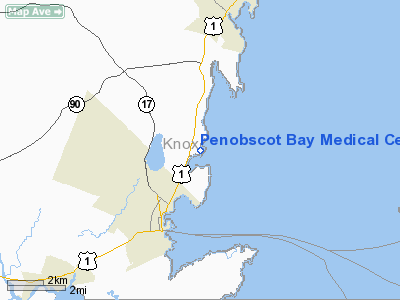
Penobscot Bay Medical Center Heliport |
Location & QuickFacts
| FAA Information Effective: | 2008-09-25 |
| Airport Identifier: | ME76 |
| Airport Status: | Operational |
| Longitude/Latitude: | 069-04-56.1400W/44-08-32.2870N
-69.082261/44.142302 (Estimated) |
| Elevation: | 60 ft / 18.29 m (Estimated) |
| Land: | 0 acres |
| From nearest city: | 0 nautical miles N of Rockland, ME |
| Location: | Knox County, ME |
| Magnetic Variation: | 18W (1985) |
Owner & Manager
| Ownership: | Privately owned |
| Owner: | Penobscot Bay Medical Center |
| Address: | 6 Glen Cove
Rockland, ME 04841 |
| Phone number: | 207-596-8610 |
| Manager: | Security & Maint Dept Or E.r. |
| Address: | 6 Glen Cove
Rockland, ME 04841 |
| Phone number: | 207-596-8600 |
Airport Operations and Facilities
| Airport Use: | Private
MEDICAL USE. |
| Wind indicator: | No |
| Segmented Circle: | No |
| Control Tower: | No |
| Landing fee charge: | No |
| Sectional chart: | Montreal |
| Region: | ANE - New England |
| Boundary ARTCC: | ZBW - Boston |
| Tie-in FSS: | BGR - Bangor |
| FSS on Airport: | No |
| FSS Toll Free: | 1-800-WX-BRIEF |
Runway Information
Helipad H1
| Dimension: | 70 x 70 ft / 21.3 x 21.3 m |
| Surface: | ASPH, |
| |
Runway H1 |
Runway |
| Traffic Pattern: | Left | Left |
|
Radio Navigation Aids
| ID |
Type |
Name |
Ch |
Freq |
Var |
Dist |
| SUH | NDB | Sprucehead | | 356.00 | 18W | 5.6 nm |
| BST | NDB | Belfast | | 278.00 | 18W | 16.4 nm |
| ISS | NDB | Wiscasset | | 407.00 | 18W | 25.9 nm |
| RL | NDB | Bracy | | 399.00 | 18W | 34.0 nm |
| BUP | NDB | Burnham | | 348.00 | 18W | 35.4 nm |
| BH | NDB | Surry | | 330.00 | 19W | 41.0 nm |
| NHZ | TACAN | Brunswick | 099X | | 17W | 39.7 nm |
| AUG | VOR/DME | Augusta | 051X | 111.40 | 18W | 32.6 nm |
| BGR | VORTAC | Bangor | 095X | 114.80 | 19W | 43.0 nm |
| BGR | VOT | Bangor | | 111.00 | | 41.5 nm |
Remarks
Images and information placed above are from
http://www.airport-data.com/airport/ME76/
We thank them for the data!
| General Info
|
| Country |
United States
|
| State |
MAINE
|
| FAA ID |
ME76
|
| Latitude |
44-08-32.287N
|
| Longitude |
069-04-56.140W
|
| Elevation |
60 feet
|
| Near City |
ROCKLAND
|
We don't guarantee the information is fresh and accurate. The data may
be wrong or outdated.
For more up-to-date information please refer to other sources.
|
|


