 |
|
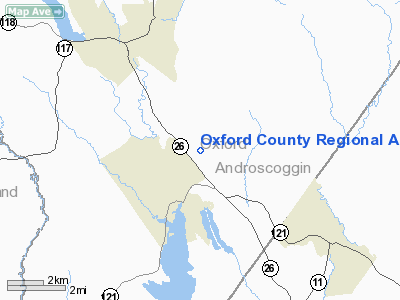
Oxford County Regional Airport |
Location & QuickFacts
| FAA Information Effective: | 2008-09-25 |
| Airport Identifier: | 81B |
| Airport Status: | Operational |
| Longitude/Latitude: | 070-28-52.6000W/44-09-26.8000N
-70.481278/44.157444 (Estimated) |
| Elevation: | 346 ft / 105.46 m (Estimated) |
| Land: | 70 acres |
| From nearest city: | 2 nautical miles E of Oxford, ME |
| Location: | Oxford County, ME |
| Magnetic Variation: | 17W (1995) |
Owner & Manager
| Ownership: | Publicly owned |
| Owner: | Oxford County |
| Address: | Oxford County Commissioners
South Paris, ME 04271 |
| Phone number: | 207-743-6359
EMERGENCY PHONE: 207-743-6336 (OXFORD COUNTY EMA). |
| Manager: | James L. Horowitz |
| Address: | 75 Number Six Rd Po Box 990
Oxford, ME 04270 |
| Phone number: | 207-539-4779 |
Airport Operations and Facilities
| Airport Use: | Open to public |
| Wind indicator: | Yes |
| Segmented Circle: | Yes |
| Control Tower: | No |
| Lighting Schedule: | DUSK-DAWN
ACTVT MIRL RY 15/33 - CTAF. |
| Beacon Color: | Clear-Green (lighted land airport) |
| Landing fee charge: | No |
| Sectional chart: | Montreal
ADDITIONAL SECTIONAL CHART NEW YORK. |
| Region: | ANE - New England |
| Boundary ARTCC: | ZBW - Boston |
| Tie-in FSS: | BGR - Bangor |
| FSS on Airport: | No |
| FSS Toll Free: | 1-800-WX-BRIEF |
| NOTAMs Facility: | BGR (NOTAM-d service avaliable) |
| Federal Agreements: | NGY |
Airport Communications
| CTAF: | 122.800 |
| Unicom: | 122.800 |
Airport Services
| Fuel available: | 100LLA
FOR FUEL OR MAINTENANCE CALL 207-539-4779. |
| Airframe Repair: | MAJOR |
| Power Plant Repair: | MAJOR |
| Bottled Oxygen: | NONE |
| Bulk Oxygen: | NONE |
Runway Information
Runway 15/33
| Dimension: | 2997 x 75 ft / 913.5 x 22.9 m |
| Surface: | ASPH, Good Condition |
| Weight Limit: | Single wheel: 25000 lbs. |
| Edge Lights: | Medium |
| |
Runway 15 |
Runway 33 |
| Longitude: | 070-29-08.0249W | 070-28-37.2376W |
| Latitude: | 44-09-36.5485N | 44-09-16.9417N |
| Elevation: | 345.00 ft | 337.00 ft |
| Alignment: | 127 | 127 |
| Traffic Pattern: | Left | Left |
| Markings: | Basic, Good Condition | Basic, Good Condition |
| Obstruction: | 12 ft trees, 201.0 ft from runway, 100 ft right of centerline
+10-15 FT TREES & BRUSH 50-200 FT FM THLD 125 FT RIGHT; +6 FT BRUSH 0-200 FT FM THLD 0B. | 37 ft tree, 201.0 ft from runway, 200 ft right of centerline
+30 FT TREES 0-200 FT FROM THLD 210 FT RIGHT. |
|
Radio Navigation Aids
| ID |
Type |
Name |
Ch |
Freq |
Var |
Dist |
| SZO | FAN MARKER | Grinn | | | 17W | 21.1 nm |
| HIE | FAN MARKER | Witey | | | 17W | 48.3 nm |
| PH | MARINE NDB | Portland Lhb-p | | 301.00 | 17W | 41.5 nm |
| SZO | NDB | Sebago | | 227.00 | 17W | 20.0 nm |
| RL | NDB | Bracy | | 399.00 | 18W | 36.9 nm |
| ISS | NDB | Wiscasset | | 407.00 | 18W | 37.8 nm |
| HXK | NDB | Hornebrook | | 281.00 | 17W | 39.2 nm |
| RQM | NDB | Rangeley | | 221.00 | 18W | 48.1 nm |
| NHZ | TACAN | Brunswick | 099X | | 17W | 29.6 nm |
| AUG | VOR/DME | Augusta | 051X | 111.40 | 18W | 31.1 nm |
| BML | VOR/DME | Berlin | 041X | 110.40 | 17W | 41.7 nm |
| ENE | VORTAC | Kennebunk | 118X | 117.10 | 17W | 44.4 nm |
| PWM | VOT | Portland Intl Jetport | | 111.00 | | 31.8 nm |
Remarks
Images and information placed above are from
http://www.airport-data.com/airport/81B/
We thank them for the data!
| General Info
|
| Country |
United States
|
| State |
MAINE
|
| FAA ID |
81B
|
| Latitude |
44-09-26.800N
|
| Longitude |
070-28-52.600W
|
| Elevation |
346 feet
|
| Near City |
OXFORD
|
We don't guarantee the information is fresh and accurate. The data may
be wrong or outdated.
For more up-to-date information please refer to other sources.
|
|


