 |
|
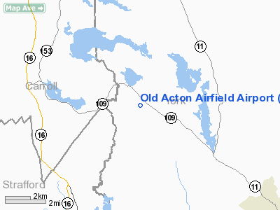
Old Acton Airfield Airport |
Location & QuickFacts
| FAA Information Effective: | 2008-09-25 |
| Airport Identifier: | 02ME |
| Airport Status: | Operational |
| Longitude/Latitude: | 070-55-45.7200W/43-32-14.2800N
-70.929367/43.537300 (Estimated) |
| Elevation: | 700 ft / 213.36 m (Estimated) |
| Land: | 0 acres |
| From nearest city: | 2 nautical miles SE of Acton, ME |
| Location: | York County, ME |
| Magnetic Variation: | 16W (1995) |
Owner & Manager
| Ownership: | Privately owned |
| Owner: | Old Acton Airfield |
| Address: | P.o. Box 901
Acton, ME 04001 |
| Phone number: | 978-251-1789 |
| Manager: | John R. Nadeau, President |
| Address: | P.o. Box 901
Acton, ME 04001 |
| Phone number: | 781-504-3143 |
Airport Operations and Facilities
| Airport Use: | Private |
| Segmented Circle: | No |
| Control Tower: | No |
| Sectional chart: | New York |
| Region: | ANE - New England |
| Boundary ARTCC: | ZBW - Boston |
| Tie-in FSS: | BGR - Bangor |
| FSS Toll Free: | 1-800-WX-BRIEF |
Runway Information
Runway 14/32
| Dimension: | 2400 x 60 ft / 731.5 x 18.3 m |
| Surface: | TURF, |
| |
Runway 14 |
Runway 32 |
| Traffic Pattern: | Left | Right |
| Obstruction: | 60 ft trees | 60 ft trees |
|
Radio Navigation Aids
| ID |
Type |
Name |
Ch |
Freq |
Var |
Dist |
| LCI | FAN MARKER | Laconia | | | | 22.4 nm |
| SZO | FAN MARKER | Grinn | | | 17W | 25.3 nm |
| PH | MARINE NDB | Portland Lhb-p | | 301.00 | 17W | 36.5 nm |
| ESG | NDB | Rollins | | 260.00 | 16W | 19.6 nm |
| SZO | NDB | Sebago | | 227.00 | 17W | 23.0 nm |
| LC | NDB | Blnap | | 328.00 | 16W | 26.5 nm |
| CO | NDB | Epsom | | 216.00 | 16W | 34.0 nm |
| DRY | NDB | Derry | | 338.00 | 16W | 45.0 nm |
| NHZ | TACAN | Brunswick | 099X | | 17W | 48.2 nm |
| PSM | VOR/DME | Pease | 112X | 116.50 | 16W | 27.6 nm |
| MHT | VOR/DME | Manchester | 091X | 114.40 | 15W | 44.6 nm |
| LWM | VOR/DME | Lawrence | 072X | 112.50 | 15W | 48.4 nm |
| ENE | VORTAC | Kennebunk | 118X | 117.10 | 17W | 15.3 nm |
| CON | VORTAC | Concord | 076X | 112.90 | 15W | 34.1 nm |
| PWM | VOT | Portland Intl Jetport | | 111.00 | | 27.4 nm |
Remarks
- ALL OPNS DAYLIGHT VFR ONLY; OPNS TO RY 32 RIGHT TRAFFIC; & NOTIFY USERS OF THESE TWO CONDITIONS.
Images and information placed above are from
http://www.airport-data.com/airport/02ME/
We thank them for the data!
| General Info
|
| Country |
United States
|
| State |
MAINE
|
| FAA ID |
02ME
|
| Latitude |
43-32-14.280N
|
| Longitude |
070-55-45.720W
|
| Elevation |
700 feet
|
| Near City |
ACTON
|
We don't guarantee the information is fresh and accurate. The data may
be wrong or outdated.
For more up-to-date information please refer to other sources.
|
|


