 |
|
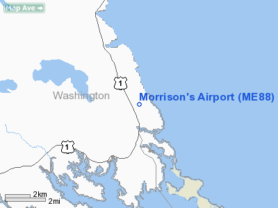
Location & QuickFacts
| FAA Information Effective: | 2008-09-25 |
| Airport Identifier: | ME88 |
| Airport Status: | Operational |
| Longitude/Latitude: | 067-04-27.9310W/44-59-30.2810N
-67.074425/44.991745 (Estimated) |
| Elevation: | 200 ft / 60.96 m (Estimated) |
| Land: | 7 acres |
| From nearest city: | 2 nautical miles NE of Perry, ME |
| Location: | Washington County, ME |
| Magnetic Variation: | 20W (1985) |
Owner & Manager
| Ownership: | Privately owned |
| Owner: | Maynard C. Morrison |
| Address: | Shore Road
Perry, ME 04667 |
| Phone number: | 207-853-6666 |
| Manager: | Maynard C. Morrison |
| Address: | Shore Road
Perry, ME 04667 |
| Phone number: | 207-853-6666 |
Airport Operations and Facilities
| Airport Use: | Private
PERSONAL USE. |
| Segmented Circle: | No |
| Control Tower: | No |
| Landing fee charge: | No |
| Sectional chart: | Montreal |
| Region: | ANE - New England |
| Boundary ARTCC: | ZBW - Boston |
| Tie-in FSS: | BGR - Bangor |
| FSS on Airport: | No |
| FSS Toll Free: | 1-800-WX-BRIEF |
Runway Information
Runway 09/27
| Dimension: | 2000 x 75 ft / 609.6 x 22.9 m |
| Surface: | TURF, |
| |
Runway 09 |
Runway 27 |
| Traffic Pattern: | Left | Left |
| Obstruction: | 50 ft trees, 500.0 ft from runway | 35 ft pline, 500.0 ft from runway |
|
Radio Navigation Aids
| ID |
Type |
Name |
Ch |
Freq |
Var |
Dist |
| EPM | NDB | Eastport | | 260.00 | 19W | 5.4 nm |
| MVM | NDB | Machias | | 251.00 | 19W | 24.4 nm |
| J | NDB | Juliett | | 397.00 | 20W | 49.4 nm |
| PNN | VOR/DME | Princeton | 090X | 114.30 | 21W | 33.5 nm |
Remarks
Images and information placed above are from
http://www.airport-data.com/airport/ME88/
We thank them for the data!
| General Info
|
| Country |
United States
|
| State |
MAINE
|
| FAA ID |
ME88
|
| Latitude |
44-59-30.281N
|
| Longitude |
067-04-27.931W
|
| Elevation |
200 feet
|
| Near City |
PERRY
|
We don't guarantee the information is fresh and accurate. The data may
be wrong or outdated.
For more up-to-date information please refer to other sources.
|
|


