 |
|
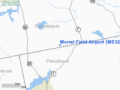
Location & QuickFacts
| FAA Information Effective: | 2008-09-25 |
| Airport Identifier: | ME32 |
| Airport Status: | Operational |
| Longitude/Latitude: | 069-15-31.1600W/45-05-25.2000N
-69.258656/45.090333 (Estimated) |
| Elevation: | 500 ft / 152.40 m (Estimated) |
| Land: | 0 acres |
| From nearest city: | 8 nautical miles SE of Sangerville, ME |
| Location: | Piscataquis County, ME |
| Magnetic Variation: | 18W (2000) |
Owner & Manager
| Ownership: | Privately owned |
| Owner: | Victor Ward Morrel |
| Address: | 1095 Silver Mills Rd.
Sangerville, ME 04479 |
| Phone number: | 207-876-3541 |
| Manager: | Victor Ward Morrel |
| Address: | 1095 Silver Mills Rd.
Sangerville, ME 04479 |
| Phone number: | 207-876-3541 |
Airport Operations and Facilities
| Airport Use: | Private |
| Wind indicator: | Yes |
| Segmented Circle: | No |
| Control Tower: | No |
| Sectional chart: | Montreal |
| Region: | ANE - New England |
| Boundary ARTCC: | ZBW - Boston |
| Tie-in FSS: | BGR - Bangor |
| FSS Toll Free: | 1-800-WX-BRIEF |
Runway Information
Runway 10/28
| Dimension: | 1900 x 75 ft / 579.1 x 22.9 m |
| Surface: | TURF, |
| |
Runway 10 |
Runway 28 |
| Traffic Pattern: | Left | Left |
|
Runway 13/31
| Dimension: | 1500 x 75 ft / 457.2 x 22.9 m |
| Surface: | TURF, |
| |
Runway 13 |
Runway 31 |
| Traffic Pattern: | Left | Left |
|
Radio Navigation Aids
| ID |
Type |
Name |
Ch |
Freq |
Var |
Dist |
| BUP | NDB | Burnham | | 348.00 | 18W | 24.0 nm |
| OLD | NDB | Old Town | | 272.00 | 20W | 27.0 nm |
| XQA | NDB | Squaw | | 236.00 | 18W | 31.3 nm |
| LRG | NDB | Lincoln | | 216.00 | 19W | 34.5 nm |
| BST | NDB | Belfast | | 278.00 | 18W | 42.2 nm |
| RL | NDB | Bracy | | 399.00 | 18W | 43.0 nm |
| LNT | NDB | Milnot | | 344.00 | 19W | 45.0 nm |
| MLT | VOR/DME | Millinocket | 126X | 117.90 | 20W | 43.3 nm |
| BGR | VORTAC | Bangor | 095X | 114.80 | 19W | 22.2 nm |
| BGR | VOT | Bangor | | 111.00 | | 25.7 nm |
Remarks
- STOL AIRCRAFT OPNS ONLY.
- PRVDD APCH END OF RY 31 CLEARED OF TREES; OPERATIONS ARE STOL AIRCRAFT ONLY, VFR, USERS OF THIS FACILITY ARE NOTIFIED AND COMPLY WITH THESE RESTRICTIONS.
Images and information placed above are from
http://www.airport-data.com/airport/ME32/
We thank them for the data!
We don't guarantee the information is fresh and accurate. The data may
be wrong or outdated.
For more up-to-date information please refer to other sources.
|
|


