 |
|
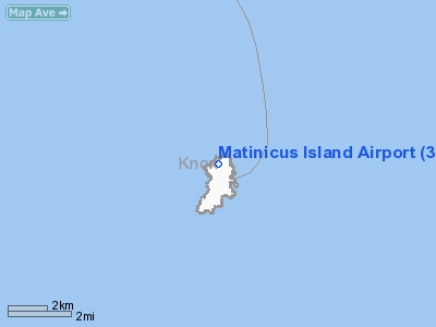
Location & QuickFacts
| FAA Information Effective: | 2008-09-25 |
| Airport Identifier: | 35ME |
| Airport Status: | Operational |
| Longitude/Latitude: | 068-53-36.0000W/43-52-16.0000N
-68.893333/43.871111 (Estimated) |
| Elevation: | 15 ft / 4.57 m (Estimated) |
| Land: | 0 acres |
| From nearest city: | 1 nautical miles NW of Matinicus Island, ME |
| Location: | Knox County, ME |
| Magnetic Variation: | () |
Owner & Manager
| Ownership: | Privately owned |
| Owner: | Telford Aviation |
| Address: | 19 Terminal Lane
Owl's Head, ME 04854 |
| Phone number: | 207-596-5557 |
| Manager: | Kevin Waters |
| Address: | 19 Terminal Lane
Owl's Head, ME 04854 |
| Phone number: | 207-596-5557 |
Airport Operations and Facilities
| Airport Use: | Private |
| Segmented Circle: | No |
| Control Tower: | No |
| Sectional chart: | New York |
| Region: | ANE - New England |
| Boundary ARTCC: | ZBW - Boston |
| Tie-in FSS: | BGR - Bangor |
| FSS Toll Free: | 1-800-WX-BRIEF |
Runway Information
Runway 18/36
| Dimension: | 1700 x 30 ft / 518.2 x 9.1 m |
| Surface: | DIRT, |
| |
Runway 18 |
Runway 36 |
| Traffic Pattern: | Left | Left |
|
Radio Navigation Aids
| ID |
Type |
Name |
Ch |
Freq |
Var |
Dist |
| SUH | NDB | Sprucehead | | 356.00 | 18W | 14.1 nm |
| BST | NDB | Belfast | | 278.00 | 18W | 32.8 nm |
| ISS | NDB | Wiscasset | | 407.00 | 18W | 33.0 nm |
| BH | NDB | Surry | | 330.00 | 19W | 47.4 nm |
| NHZ | TACAN | Brunswick | 099X | | 17W | 44.6 nm |
| AUG | VOR/DME | Augusta | 051X | 111.40 | 18W | 47.4 nm |
Remarks
- WIND INDICATION BE INSTALLED & MKD, OPNS SHOULD BE RESTRICTED TO SMALL ACFT ONLY, VFR, USERS OF THIS FACILITY ARE NOTIFIED & COMPLY WITH THESE RESTRICTIONS.
Images and information placed above are from
http://www.airport-data.com/airport/35ME/
We thank them for the data!
We don't guarantee the information is fresh and accurate. The data may
be wrong or outdated.
For more up-to-date information please refer to other sources.
|
|


