 |
|
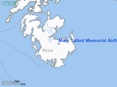
Mary Talbot Memorial Airfield Airport |
Location & QuickFacts
| FAA Information Effective: | 2008-09-25 |
| Airport Identifier: | ME55 |
| Airport Status: | Operational |
| Longitude/Latitude: | 068-49-08.1110W/44-04-25.2930N
-68.818920/44.073692 (Estimated) |
| Elevation: | 72 ft / 21.95 m (Surveyed) |
| Land: | 9 acres |
| From nearest city: | 1 nautical miles N of Vinalhaven, ME |
| Location: | Knox County, ME |
| Magnetic Variation: | 18W (1985) |
Owner & Manager
| Ownership: | Publicly owned |
| Owner: | Town Of Vinalhaven
AIRSTRIP IS LEASED TO "PENOBSCOT ISLAND AIR SERVICE" |
| Address: | Po Box 815
Vinalhaven, ME 04863 |
| Phone number: | 207-863-4471 |
| Manager: | Marjorie Stratton |
| Address: | Po Box 815
Vinalhaven, ME 04863 |
| Phone number: | 207-863-2042 |
Airport Operations and Facilities
| Airport Use: | Private |
| Wind indicator: | No |
| Segmented Circle: | No |
| Control Tower: | No |
| Landing fee charge: | No |
| Sectional chart: | Halifax |
| Region: | ANE - New England |
| Boundary ARTCC: | ZBW - Boston |
| Tie-in FSS: | BGR - Bangor |
| FSS on Airport: | No |
| FSS Toll Free: | 1-800-WX-BRIEF |
Airport Services
| Airframe Repair: | NONE |
| Power Plant Repair: | NONE |
Runway Information
Runway NE/SW
| Dimension: | 1510 x 100 ft / 460.2 x 30.5 m |
| Surface: | GRVL, |
| |
Runway NE |
Runway SW |
| Traffic Pattern: | Left | Left |
| Obstruction: | | 50 ft hill, 500.0 ft from runway |
|
Radio Navigation Aids
| ID |
Type |
Name |
Ch |
Freq |
Var |
Dist |
| SUH | NDB | Sprucehead | | 356.00 | 18W | 12.4 nm |
| BST | NDB | Belfast | | 278.00 | 18W | 21.9 nm |
| BH | NDB | Surry | | 330.00 | 19W | 35.6 nm |
| ISS | NDB | Wiscasset | | 407.00 | 18W | 35.9 nm |
| BUP | NDB | Burnham | | 348.00 | 18W | 44.1 nm |
| RL | NDB | Bracy | | 399.00 | 18W | 45.8 nm |
| NHZ | TACAN | Brunswick | 099X | | 17W | 49.2 nm |
| AUG | VOR/DME | Augusta | 051X | 111.40 | 18W | 44.7 nm |
| BGR | VORTAC | Bangor | 095X | 114.80 | 19W | 46.2 nm |
| BGR | VOT | Bangor | | 111.00 | | 43.9 nm |
Remarks
Images and information placed above are from
http://www.airport-data.com/airport/ME55/
We thank them for the data!
| General Info
|
| Country |
United States
|
| State |
MAINE
|
| FAA ID |
ME55
|
| Latitude |
44-04-25.293N
|
| Longitude |
068-49-08.111W
|
| Elevation |
72 feet
|
| Near City |
VINALHAVEN
|
We don't guarantee the information is fresh and accurate. The data may
be wrong or outdated.
For more up-to-date information please refer to other sources.
|
|


