 |
|
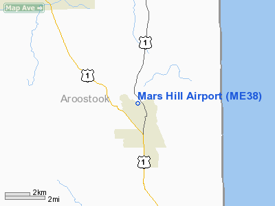
Location & QuickFacts
| FAA Information Effective: | 2008-09-25 |
| Airport Identifier: | ME38 |
| Airport Status: | Operational |
| Longitude/Latitude: | 067-52-28.0880W/46-31-40.1500N
-67.874469/46.527819 (Estimated) |
| Elevation: | 432 ft / 131.67 m (Surveyed) |
| Land: | 0 acres |
| From nearest city: | 1 nautical miles NW of Mars Hill, ME |
| Location: | Aroostook County, ME |
| Magnetic Variation: | 20W (1985) |
Owner & Manager
| Ownership: | Privately owned |
| Owner: | Mars Hill Flying Club |
| Address: |
Mars Hill, ME 04758 |
| Manager: | Harold Fulton |
| Address: | Box 113
Mars Hill, ME 04758 |
| Phone number: | 207-429-9793 |
Airport Operations and Facilities
| Airport Use: | Private |
| Wind indicator: | Yes |
| Segmented Circle: | No |
| Control Tower: | No |
| Landing fee charge: | No |
| Sectional chart: | Halifax |
| Region: | ANE - New England |
| Boundary ARTCC: | ZBW - Boston |
| Tie-in FSS: | BGR - Bangor |
| FSS on Airport: | No |
| FSS Toll Free: | 1-800-WX-BRIEF |
Runway Information
Runway 14/32
| Dimension: | 2000 x 150 ft / 609.6 x 45.7 m |
| Surface: | TURF, |
| |
Runway 14 |
Runway 32 |
| Traffic Pattern: | Left | Left |
|
Radio Navigation Aids
| ID |
Type |
Name |
Ch |
Freq |
Var |
Dist |
| LIF | NDB | Limestone | | 220.00 | 19W | 18.8 nm |
| YSL | NDB | St Leonard | | 404.00 | 22W | 40.9 nm |
| FVE | NDB | Frenchville | | 257.00 | 20W | 47.2 nm |
| PQI | VOR/DME | Presque Isle | 111X | 116.40 | 21W | 17.4 nm |
| HUL | VOR/DME | Houlton | 108X | 116.10 | 21W | 29.4 nm |
Remarks
- PVT USE; VFR WX CONDS ONLY.
Images and information placed above are from
http://www.airport-data.com/airport/ME38/
We thank them for the data!
| General Info
|
| Country |
United States
|
| State |
MAINE
|
| FAA ID |
ME38
|
| Latitude |
46-31-40.150N
|
| Longitude |
067-52-28.088W
|
| Elevation |
432 feet
|
| Near City |
MARS HILL
|
We don't guarantee the information is fresh and accurate. The data may
be wrong or outdated.
For more up-to-date information please refer to other sources.
|
|


