 |
|
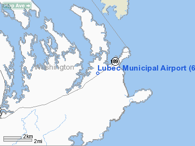
Location & QuickFacts
| FAA Information Effective: | 2008-09-25 |
| Airport Identifier: | 65B |
| Airport Status: | Operational |
| Longitude/Latitude: | 067-01-37.1000W/44-50-11.6000N
-67.026972/44.836556 (Estimated) |
| Elevation: | 85 ft / 25.91 m (Estimated) |
| Land: | 6 acres |
| From nearest city: | 2 nautical miles W of Lubec, ME |
| Location: | Washington County, ME |
| Magnetic Variation: | 20W (1985) |
Owner & Manager
| Ownership: | Publicly owned |
| Owner: | Town Of Lubec |
| Address: | Town Hall,, 40 School Street
Lubec, ME 04652 |
| Phone number: | 207-733-2341 |
| Manager: | Vernice Mains
TOWN MGR. |
| Address: | 40 Summer Street
Lubec, ME 04652 |
| Phone number: | 207-733-2341 |
Airport Operations and Facilities
| Airport Use: | Open to public |
| Wind indicator: | Yes |
| Segmented Circle: | No |
| Control Tower: | No |
| Lighting Schedule: | RDO-CTL
ACTVT LIRL RY 08/26 AND ROTG BCN - CTAF. |
| Beacon Color: | Clear-Green (lighted land airport) |
| Landing fee charge: | No |
| Sectional chart: | Halifax |
| Region: | ANE - New England |
| Boundary ARTCC: | ZBW - Boston |
| Tie-in FSS: | BGR - Bangor |
| FSS on Airport: | No |
| FSS Toll Free: | 1-800-WX-BRIEF |
| NOTAMs Facility: | BGR (NOTAM-d service avaliable) |
Airport Communications
| CTAF: | 122.800 |
| Unicom: | 122.800 |
Airport Services
| Airframe Repair: | NONE |
| Power Plant Repair: | NONE |
| Bottled Oxygen: | NONE |
| Bulk Oxygen: | NONE |
Runway Information
Runway 08/26
| Dimension: | 2024 x 100 ft / 616.9 x 30.5 m |
| Surface: | TURFRVL, Good Condition |
| Edge Lights: | Low |
| |
Runway 08 |
Runway 26 |
| Longitude: | 067-01-48.4561W | 067-01-25.6495W |
| Latitude: | 44-50-05.7778N | 44-50-17.4461N |
| Elevation: | 82.00 ft | 81.00 ft |
| Traffic Pattern: | Left | Left |
| Markings: | None, | None, |
| Runway End Identifier: | No | No |
| Centerline Lights: | No | No |
| Touchdown Lights: | No | No |
| Obstruction: | 35 ft trees, 35.0 ft from runway, 50 ft right of centerline, 1:1 slope to clear | 40 ft tree, 84.0 ft from runway, 55 ft right of centerline, 2:1 slope to clear |
|
Radio Navigation Aids
| ID |
Type |
Name |
Ch |
Freq |
Var |
Dist |
| EPM | NDB | Eastport | | 260.00 | 19W | 4.6 nm |
| MVM | NDB | Machias | | 251.00 | 19W | 20.8 nm |
| PNN | VOR/DME | Princeton | 090X | 114.30 | 21W | 41.3 nm |
Remarks
- 24 HOUR EMERGENCY CALLS TO FIRE STATION 733-4321.
- DEER ON & INVOF ARPT.
- CUSTOMS ON REQUEST 207-733-4331.
- NO LINE OF SIGHT BETWEEN RY ENDS.
- EXISTED PRIOR TO 1959.
Images and information placed above are from
http://www.airport-data.com/airport/65B/
We thank them for the data!
| General Info
|
| Country |
United States
|
| State |
MAINE
|
| FAA ID |
65B
|
| Latitude |
44-50-15.287N
|
| Longitude |
067-01-57.931W
|
| Elevation |
85 feet
|
| Near City |
LUBEC
|
We don't guarantee the information is fresh and accurate. The data may
be wrong or outdated.
For more up-to-date information please refer to other sources.
|
|


