 |
|
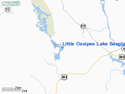
Little Ossipee Lake Seaplane Base |
Location & QuickFacts
| FAA Information Effective: | 2008-09-25 |
| Airport Identifier: | ME90 |
| Airport Status: | Operational |
| Longitude/Latitude: | 070-41-47.2070W/43-36-47.2870N
-70.696446/43.613135 (Estimated) |
| Elevation: | 311 ft / 94.79 m (Estimated) |
| Land: | 600 acres |
| From nearest city: | 2 nautical miles N of Waterboro Center, ME |
| Location: | York County, ME |
| Magnetic Variation: | 17W (1985) |
Owner & Manager
| Ownership: | Privately owned |
| Owner: | Edward R. Thompson, Jr. |
| Address: | Webber Road, Box 248
Waterboro, ME 04084 |
| Phone number: | 207-247-4427 |
| Manager: | Edward R. Thompson, Jr. |
| Address: | Webber Road, Box 248
Waterboro, ME 04084 |
| Phone number: | 207-247-4427 |
Airport Operations and Facilities
| Airport Use: | Private |
| Wind indicator: | Yes |
| Segmented Circle: | No |
| Control Tower: | No |
| Sectional chart: | New York |
| Region: | ANE - New England |
| Boundary ARTCC: | ZBW - Boston |
| Tie-in FSS: | BGR - Bangor |
| FSS Toll Free: | 1-800-WX-BRIEF |
Runway Information
Runway 14/32
| Dimension: | 8000 x 400 ft / 2438.4 x 121.9 m |
| Surface: | WATER, |
| |
Runway 14 |
Runway 32 |
| Traffic Pattern: | Left | Left |
|
Radio Navigation Aids
| ID |
Type |
Name |
Ch |
Freq |
Var |
Dist |
| SZO | FAN MARKER | Grinn | | | 17W | 22.2 nm |
| LCI | FAN MARKER | Laconia | | | | 32.5 nm |
| PH | MARINE NDB | Portland Lhb-p | | 301.00 | 17W | 26.9 nm |
| SZO | NDB | Sebago | | 227.00 | 17W | 17.9 nm |
| ESG | NDB | Rollins | | 260.00 | 16W | 24.3 nm |
| LC | NDB | Blnap | | 328.00 | 16W | 36.9 nm |
| CO | NDB | Epsom | | 216.00 | 16W | 44.4 nm |
| NHZ | TACAN | Brunswick | 099X | | 17W | 37.1 nm |
| PSM | VOR/DME | Pease | 112X | 116.50 | 16W | 32.3 nm |
| ENE | VORTAC | Kennebunk | 118X | 117.10 | 17W | 11.8 nm |
| CON | VORTAC | Concord | 076X | 112.90 | 15W | 45.1 nm |
| PWM | VOT | Portland Intl Jetport | | 111.00 | | 16.6 nm |
Remarks
Images and information placed above are from
http://www.airport-data.com/airport/ME90/
We thank them for the data!
| General Info
|
| Country |
United States
|
| State |
MAINE
|
| FAA ID |
ME90
|
| Latitude |
43-36-47.287N
|
| Longitude |
070-41-47.207W
|
| Elevation |
311 feet
|
| Near City |
WATERBORO CENTER
|
We don't guarantee the information is fresh and accurate. The data may
be wrong or outdated.
For more up-to-date information please refer to other sources.
|
|


