 |
|
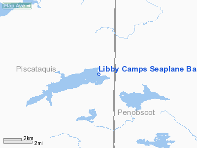
Libby Camps Seaplane Base |
Location & QuickFacts
| FAA Information Effective: | 2008-09-25 |
| Airport Identifier: | ME86 |
| Airport Status: | Operational |
| Longitude/Latitude: | 068-50-37.0000W/46-18-30.0000N
-68.843611/46.308333 (Estimated) |
| Elevation: | 754 ft / 229.82 m (Estimated) |
| Land: | 2700 acres |
| From nearest city: | 26 nautical miles SW of Ashland, ME |
| Location: | Piscataquis County, ME |
| Magnetic Variation: | 19W (1995) |
Owner & Manager
| Ownership: | Privately owned |
| Owner: | Matthew Libby |
| Address: | P.o.box 810
Ashland, ME 04732 |
| Phone number: | 207-435-8274 |
| Manager: | Matthew Libby |
| Address: | P.o. Box 810
Ashland, ME 04732 |
| Phone number: | 207-435-8274 |
Airport Operations and Facilities
| Airport Use: | Private |
| Wind indicator: | Yes |
| Segmented Circle: | No |
| Control Tower: | No |
| Sectional chart: | Halifax |
| Region: | ANE - New England |
| Boundary ARTCC: | ZBW - Boston |
| Tie-in FSS: | BGR - Bangor |
| FSS on Airport: | No |
| FSS Toll Free: | 1-800-WX-BRIEF |
Airport Services
| Fuel available: | 100LLMOGAS |
Runway Information
Runway 09/27
| Dimension: | 26000 x 3000 ft / 7924.8 x 914.4 m |
| Surface: | WATER, |
| |
Runway 09 |
Runway 27 |
| Traffic Pattern: | Left | Left |
|
Radio Navigation Aids
| ID |
Type |
Name |
Ch |
Freq |
Var |
Dist |
| LNT | NDB | Milnot | | 344.00 | 19W | 41.5 nm |
| PQI | VOR/DME | Presque Isle | 111X | 116.40 | 21W | 41.8 nm |
| HUL | VOR/DME | Houlton | 108X | 116.10 | 21W | 45.0 nm |
| MLT | VOR/DME | Millinocket | 126X | 117.90 | 20W | 45.5 nm |
Remarks
- SUBMERGED ROCKS 1000 FT S OF SPB.
- PRVDD VFR USE ONLY.
Images and information placed above are from
http://www.airport-data.com/airport/ME86/
We thank them for the data!
We don't guarantee the information is fresh and accurate. The data may
be wrong or outdated.
For more up-to-date information please refer to other sources.
|
|


