 |
|
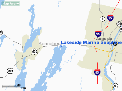
Lakeside Marina Seaplane Base |
Location & QuickFacts
| FAA Information Effective: | 2008-09-25 |
| Airport Identifier: | 03M |
| Airport Status: | Operational |
| Longitude/Latitude: | 069-53-22.1750W/44-19-15.2470N
-69.889493/44.320902 (Estimated) |
| Elevation: | 165 ft / 50.29 m (Estimated) |
| Land: | 0 acres |
| From nearest city: | 4 nautical miles E of East Winthrop, ME |
| Location: | Kennebec County, ME |
| Magnetic Variation: | 18W (1990) |
Owner & Manager
| Ownership: | Privately owned |
| Owner: | Lakeside Motel, Cabins & Marina
MR. ANDY WESS. |
| Address: | Po Box 236
East Winthrop, ME 04343 |
| Phone number: | 207-395-6741
TEL 800-532-6892. |
| Manager: | Anthony Wess |
| Address: | Po Box 236
East Winthrop, ME 04343 |
| Phone number: | 207-395-6741 |
Airport Operations and Facilities
| Airport Use: | Open to public |
| Wind indicator: | Yes
AT DOCK IN WELCH BAY ON TOP OF MOTEL. |
| Segmented Circle: | No |
| Control Tower: | No |
| Sectional chart: | Montreal |
| Region: | ANE - New England |
| Boundary ARTCC: | ZBW - Boston |
| Tie-in FSS: | BGR - Bangor |
| FSS on Airport: | No |
| FSS Toll Free: | 1-800-WX-BRIEF |
| NOTAMs Facility: | BGR (NOTAM-d service avaliable) |
Airport Communications
Airport Services
| Fuel available: | MOGAS
FOR FUEL CHECK AT MOTEL. |
Runway Information
Runway 02/20
| Dimension: | 3800 x 200 ft / 1158.2 x 61.0 m
RY 02 END EAST OF LIGHTHOUSE; RY 20 END EAST OF SOUTH TIP HERSEY ISLAND. |
| Surface: | WATER, |
| |
Runway 02 |
Runway 20 |
| Traffic Pattern: | Left | Left |
| Obstruction: | , 50:1 slope to clear | 130 ft trees, 3385.0 ft from runway, 400 ft right of centerline, 26:1 slope to clear |
|
Radio Navigation Aids
| ID |
Type |
Name |
Ch |
Freq |
Var |
Dist |
| SZO | FAN MARKER | Grinn | | | 17W | 48.1 nm |
| PH | MARINE NDB | Portland Lhb-p | | 301.00 | 17W | 48.5 nm |
| RL | NDB | Bracy | | 399.00 | 18W | 10.7 nm |
| ISS | NDB | Wiscasset | | 407.00 | 18W | 23.0 nm |
| BUP | NDB | Burnham | | 348.00 | 18W | 32.1 nm |
| SUH | NDB | Sprucehead | | 356.00 | 18W | 37.5 nm |
| BST | NDB | Belfast | | 278.00 | 18W | 38.1 nm |
| SZO | NDB | Sebago | | 227.00 | 17W | 46.0 nm |
| NHZ | TACAN | Brunswick | 099X | | 17W | 26.9 nm |
| AUG | VOR/DME | Augusta | 051X | 111.40 | 18W | 4.0 nm |
| PWM | VOT | Portland Intl Jetport | | 111.00 | | 44.8 nm |
Remarks
- DAYTIME USE ONLY.
- PRVDD VFR.
Images and information placed above are from
http://www.airport-data.com/airport/03M/
We thank them for the data!
| General Info
|
| Country |
United States
|
| State |
MAINE
|
| FAA ID |
03M
|
| Latitude |
44-19-15.247N
|
| Longitude |
069-53-22.175W
|
| Elevation |
165 feet
|
| Near City |
EAST WINTHROP
|
We don't guarantee the information is fresh and accurate. The data may
be wrong or outdated.
For more up-to-date information please refer to other sources.
|
|


